2021-08-28 47 7
| Sat 28 Aug 2021 in 47,7: 47.4640886, 7.3864027 geohashing.info google osm bing/os kml crox |
Location
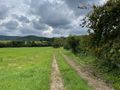
In a meadow in Lutter.
Participants
Plans
Baarde plans to go to Mulhouse by train, then cycle to the geohash. He expects to be there at 14:30.
Expedition
I cycled along the Rhône–Rhine Canal from Mulhouse to Illfurth. There I entered the Sundgau, a hilly region between the plain of Alsace and the foothills of the Jura.
I took a small detour on the way to the geohash to stop in Altkirch, the historical capital of the region. After eating a salad and a blueberry mousse, I cycled the remaining 30 km to the hashpoint, which was located in Lutter, in a meadow near the exit of the village.
I reached the coordinates at 14:22. Until now, the weather had been nice: lukewarm and slightly cloudy. But rain was on its way. After recording proof, I headed towards the nearest train station, in Saint-Louis, and arrived just in time to catch a train home.
Photos
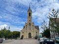
Visiting Altkirch
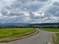
Cycling through the Sundgau
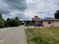
Arriving in Lutter
Exiting Litter
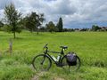
My bicycle near the geohash
Coordinates reached
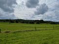
Surroundings (South-West)
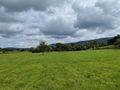
Surroundings (East)
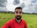
Stupid grin


Achievements
Baarde earned the Land geohash achievement
|
Baarde earned the Subdivision geohash achievement
|