2021-09-30 42 -78
| Thu 30 Sep 2021 in 42,-78: 42.0820736, -78.8370597 geohashing.info google osm bing/os kml crox |
Location
Allegany State Park, near Holts Run 'Road'
Participants
- Pedalpusher
- Simon the dog
- Myka the dog
Expedition
What to do on a random Thursday? Let's go Geohashing! The hash finally lands in Allegany State Park again after avoiding it for most of the year. However, I'll need to be careful as the sun sets a little before 19:00 now. I was able to get out of work a bit early so I could pack some stuff up along with some food for the dogs and we were on our way.
Looking at the map, it appears that Holts Run Road (a very old road that is now overgrown, but passable by hiking) goes near the hash and there's also some kind of building halfway there and off to the side on a branch of the road. Maybe I'll explore that if I have time on the way back. I skipped dinner thinking I could pick something up on the way but the Tim Horton's near Ellicottville had the dining area closed and only the drive thru open. I don't like the drive thru but because I wasn't that hungry yet, I continued on my way.
Getting to the Park Exit, I found where Holts Run hits the main road and was able to pull off to park. It was definitely overgrown with tall grass and wildflowers, but there was a trail down the middle after passing by the gate blocking vehicles. I was thinking this would be a piece of cake especially since it looked like the hash was NOT at the top of a hill or in a swamp. I found where the road turned and went uphill toward that building, but I needed to keep going as I didn't want to walk back in the dark.
It was at this point that I needed to reassess the ease of this expedition. It turns out that this was likely more of a very long driveway to that building and while there still appeared to be a road here at one time, this section has returned to nature. It was still passable though and I found it was easier to walk in the woods at times to the side, but then I came upon a large creek. There was the foundation of an old bridge on this side, but nothing on the other side besides a stream that had taken over the former roadbed.
I was able to cross the stream, but trying to continue to follow the road was no good. It was just too overgrown so I moved into the woods where it was more open and easier to move. Following my GPS toward the hash, we then navigated the open woods as we continued slightly uphill. There were a few thick spots, but we got around them and then found an ATV or old logging road that was heading the right way. I closed in on the hash at about 18:40 for a successful expedition. With only 20 minutes before sunset though, I now needed to get out of here. Near the hash, there was a creek which I assumed was the one I had crossed earlier so instead of fully retracing my steps, we kind of followed the creek back which turned out to be a bit easier.
Finally getting back to the walkable road, we still had a few minutes to check out that building and even if it did get dark at this point, it would be way easier to walk back on a path with a light. Turns out it was just a cinder block building with no windows and just a giant garage door in the front. There was a door on the side but it was pretty rusty (with no door handle) and it was also locked with a padlock so I couldn't really see inside. Curiosity satisfied, we continued our way back to the car and I fed the dogs in the last light of the day before we headed for home.
I tried again to go to another Tim Horton's in Springville, but that was closed by the time I got there so I ended up just eating carrots and hummus for a very late dinner when I got home.
Still early days, but I'm keeping an eye on this for a Last Man Standing.
Photos
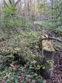
Ruins of the former bridge across the creek.
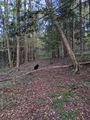
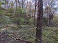
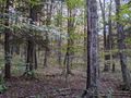
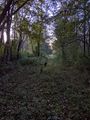
Almost to the hash, we found another clear path to walk on.
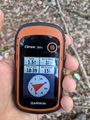
Made it!
Accuracy.
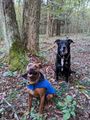
Hashdogs at the hash.
View West...ish, the direction we came from.
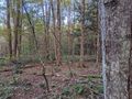
View Northish, toward the creek.
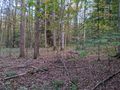
View East.
View South.
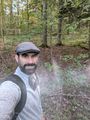
Standard Stupid Grin.
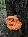
On the way back, I came across this huge fungus growing out of a Black Cherry tree.
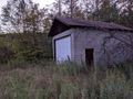
The building I saw on the map.
Almost back to the car, we are walking down Holts Run 'Road'

Dogs eating their dinner before we drive home as the sun has just set.
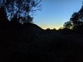
View of the Sunset.


Ribbons
This user earned the Land geohash achievement
|
Expeditions and Plans
| 2021-09-25 | ||
|---|---|---|
| Buffalo, New York | Pedalpusher | Next to Precision Scale & Balance in Lancaster |