2022-01-23 61 29
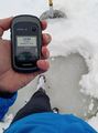
| Sun 23 Jan 2022 in 61,29: 61.6026188, 29.5517225 geohashing.info google osm bing/os kml crox |
Location
In lake Simpelejärvi, close to the shore near Savikumpu.
The point on a topographic map: [1]
Participants
- Kripakko
- Kripakko's father
Plans
We were visiting my grandparents who live somewhere in this area, and this point happened to be in an accessible location. I do not want to reveal their home location, so let us just say that the distance to the geohash was less than five kilometres.
Expedition 1
We went for a reconnaissance trip by car. We did not know whether the road would be clear of snow all the way to the shore, but we would find out. Apparently this place is used as a launching spot for boats and as a snowmobile route by the locals, so the road was well drivable. We parked the car at the shore and needed to walk only 30 metres to get to the geohash. I shovelled the spot of the hashpoint clear of snow to show that there was lake ice underneath. I took a few photos, and then we left.
Expedition 2
For fun and some physical exercise, after we returned to the grandparents' place, I grabbed a kicksled and rode the way to the hashpoint another time. I had no problem traversing the roads, but then I could not quite ride all the way to the hashpoint since there was too much snow. I had to push and nearly carry the kicksled for the last few metres. In retrospect, I could have shovelled a wide enough path in the snow, but it is too late now. Oh well, close enough. I took a few more photos and left again for good.
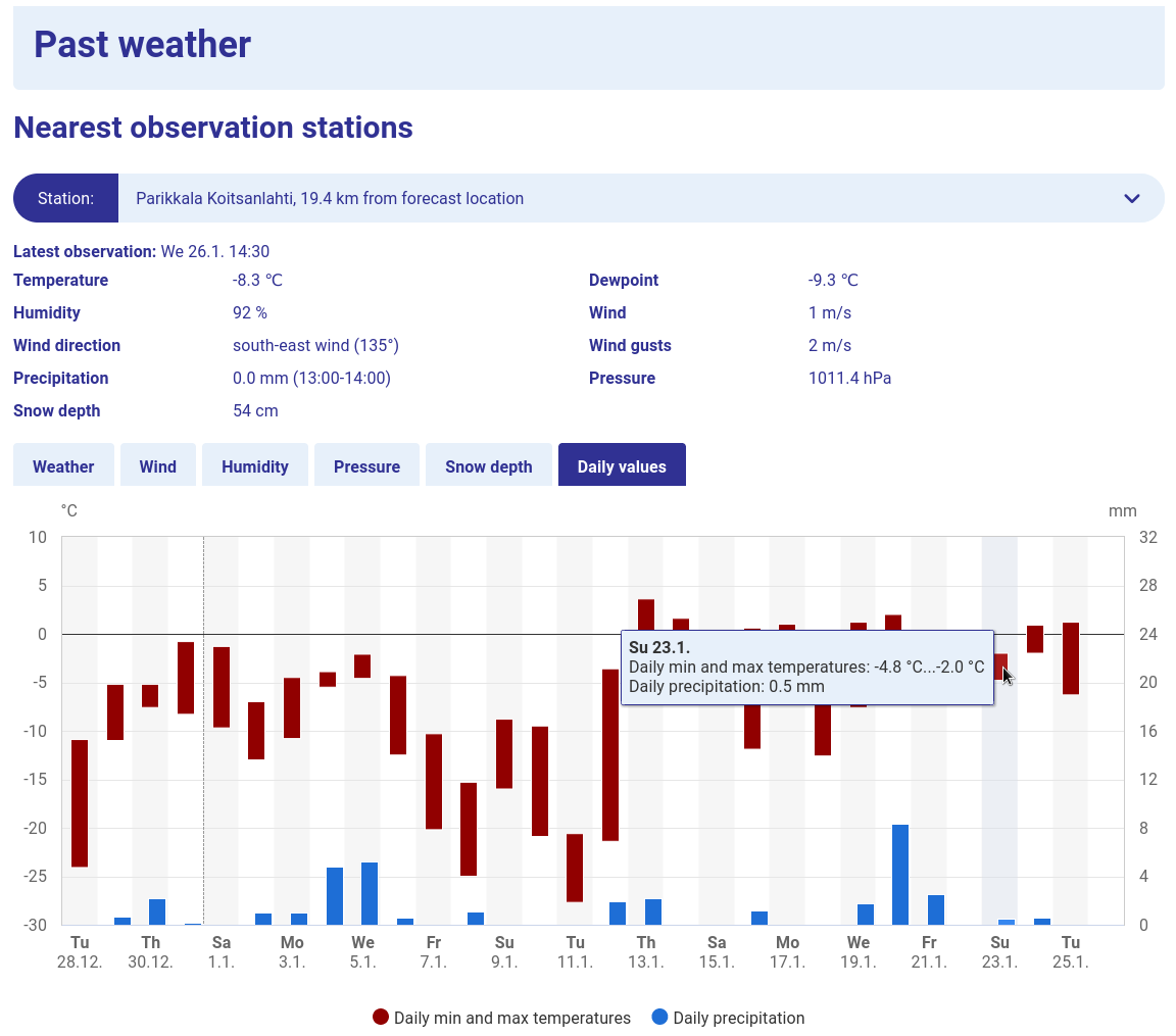
I did not record the temperature, but the Finnish Meteorological Institute [2] reports a daily high temperature of −2 °C in Koitsanlahti, Parikkala, so it was most definitely freezing. The data of each day disappear in four weeks, so I took a screenshot for permanent proof: Media:2022-01-23_61_29_08-temperature.png.
For some reason, OpenStreetMap shows that the hashpoint is on land. However, the topographic map and the aerial photo by the National Land Survey of Finland put it in the lake, as do Google Maps. To be sure, I showed the existence of lake ice. The water is admittedly very shallow there: the depth is a few tens of centimetres at most, and there may not have been any liquid water under the ice. Since I was standing on the ice, I argue that I was fully supported by it regardless of the depth and that I am eligible for the Water geohash achievement and the Walking on water geohash achievement.
Photos
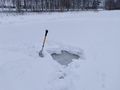
The hashpoint with the lake ice exposed.
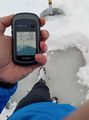
Proof of location.
Proof of date and time.
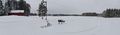
View from near the final intersection at Savikummuntie road.
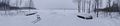
The lakeshore and the place where the road led to.
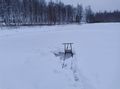
The kicksled at the hashpoint.
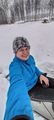
Selfie at the hashpoint, sitting on the kicksled.


Video
I filmed the journey from the location of the fourth photo to near the hashpoint with my mobile phone camera. The final view is towards the hashpoint. I am sorry for the vertical video and unstable picture, but this is the best that I could come up with with minimal equipment and effort.
YouTube link: [3]
Achievements
Kripakko earned the Water geohash achievement
|
Kripakko earned the Walking on water geohash achievement
|
Kripakko earned the Frozen Geohash Achievement
|