2022-03-06 40 -4
| Sun 6 Mar 2022 in 40,-4: 40.4424864, -4.6064815 geohashing.info google osm bing/os kml crox |
Location
On the steep slope of a hill, behind a barbwire fence, in an area with no mobile network coverage.
Participants
Plans
The geohash was close to the large reservoir Embalse del Borguillo, which has very nice beaches. The beaches in the Sun and the blue and green of the water have kind of a Caribbean touch. I had visited the reservoir a couple of times and I had passed by it on the way back from expedition 2021-06-06_40_-4, but I did not stop and take photos. So this time, the plan was to first reach the geohash, which seemed to be located only a few hundred meters from a road, and stop at the reservoir on the way back to take some photos there.
Expedition
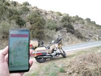
The weather was not particularly nice, with temperatures peaking at 12°C in the afternoon and mostly overcast skies. When I passed by the reservoir on the way to the geohash, I noticed that the water level was very low and with the overcast skies it did not really show its Caribbean side. Approaching the geohash, I could conveniently park the Goldwing by the side of the road near the point closest to the geohash. So far, so good.
But when I got out the mobile to have the final approach guided by the Droid, I got the message that I have no internet connection. Indeed, there was no mobile network coverage. This had never before happened to me in Spain. The Droid does only need GPS to get its position, but it needs internet access to get the location of today's geohash. In my navigation device mounted on the Goldwing, I had only entered the location on the road closest to the geohash, so I had no access to the geohash coordinates.
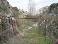
Anyway, I had a rough idea of the direction to the geohash. I had to go away from the road, roughly perpendicular. There was a steep hill in that direction and the hope was that if I can get up the hill I might get mobile network coverage. I first checked out a path leading to a gate. The gate was not seriously locked and I might have been able to open it, however, the path behind continued along the road, not away from it. As far as I could look behind the gate, there was no easy way to get up the hill.
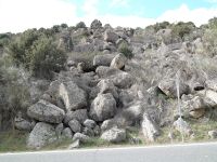
So I went the path back and looked along the road for possibilities to get up the hill. The terrain looked in fact quite intimidating. Nevertheless, I decided to give it a (careful) try, but first I put the photo case with the SLR camera back into the Goldwing's top case to avoid damaging it and for less hindered ascending.
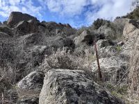
Just when I had reached a height of about ten meters above the road and started to reconsider if I really dared to pursue this, I arrived at a barbwire fence. At this point I had enough and decided to quit. I took a photo of the fence with my mobile and climbed carefully back down.
Thus, coordinates not reaches, because of a steep rocky hillside put in my way by mother nature, a barbwire posing a man made obstacle, and technical failure because of no internet connection. Okay, I could have worked around the internet problem by riding to some other place with coverage, getting the geohash coordinates, entering them in my navigation device, and then trying again to go for it. However, I rather felt like riding to the reservoir and taking some photos.
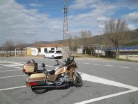
I parked the Goldwing on the parking place of a little bar directly at the reservoir where it is crossed by a bridge. When I had previously passed by this place, I had always been thinking I should have a drink there with a view to waters, but I never did it. Now the bar was closed and for sale.
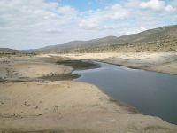
This is the smaller part of the reservoir North of the bridge. Usually, the water level is much higher. In the extreme, all the sandy beach is completely covered by water.
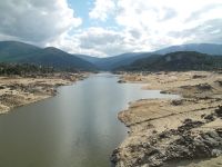
This is the much larger part South of the bridge. It extends very much beyond what can be seen from here.
The beaches are directly accessible by car and in summer many people bring their beach equipment and enjoy the waters. As I wrote in the beginning, with a bit more water in the reservoir and the usually cloudless skies, it has a pretty Caribbean touch.
Tracklog
This shows only the walk close to the first parking place where I tried to reach the geohash. Start and stop markers are at the Goldwing. The gate is at the tip of the branch going North. The barbwire fence that finally stopped me is at the tip of the branch going Northwest.
