2023-06-11 45 -122

| Sun 11 Jun 2023 in 45,-122: 45.6806087, -122.2968555 geohashing.info google osm bing/os kml crox |
"Let's hope they're not shooting at us"
Location
In a forest between Camas an Washougal, there are dirt bike trails snaking all throughout the area and a clearcut bit just a little ways from the hash. We'll access the hash via the Jones Creek Trailhead nearby.
Participants
- Hamblingreen
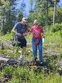
- My parents! They were going to take a mattress up to my grandparents' cabin on Mt. Hood but decided to go on as expedition with me instead.
Plans
We'll drive out to the geohash up I5 then on 500 E and finally turning down a few paved road before arriving at the dirt road that leads to the Jones Creek trailhead. We'll hike a trail and then into the trees about 150 feet to the hash.
Expedition
The drive was beautiful! There were clear views of the mountains and the forests were amazing. The roads were windy and hilly and paved pretty well for the most part. There was no service most of the way which was fine by me. I brought M&Ms and Mambas as a snack, and my dad brought a staple gun to hang the poster. The double yellow sine disappeared from the road at some point as we drove through thicker trees, and we crossed a little bridge over Jones Creek. Shortly thereafter the road turned to gravel as we approached the trailhead.
We arrived at the trailhead and saw people walking their dogs, a good omen! A sign said we needed a Washington state forest pass, but we opted to risk it. We didn't get run over by any dirt bikers, and walked down a 2 mile gravel road in the sun. In hindsight we could've driven that part, but oh well! We arrived at the clear-cut and it turned out to have more elevation then we expected. The ground up to the tree line was covered in sticks and thistle and was very difficult to walk through. People were firing shotguns around us, which is where the quote from today's expedition comes from. Once we got to the tree line, things got a whole lot harder. It was almost not passable, but we hacked our way through trees and the wilderness. We saw a bobcat which we unfortunately didn't get pictures of, and came to a steep decline that we decided would be unsafe to try and get to. The phone GPS said we were within 100 feet of the hash, so we picked a tree and called it a day.
This was easily the most difficult geohash I've ever reached, and though we might not have been right on the hash I'm calling it a success due to the work it took to get there and how close we got. I had a super fun time blazing trail in the blazing sun, and can't wait for my next geohashing expedition!
Distractions and Detours
By the time we finished the hash, it was right around 5 pm and we decided for one final adventure for the day. Bobs Mountain had a 2 mile trail spiraling to the top that we decided to hike, and it was about a half hour away from the hashpoint in Washougal. The hike was peaceful, one of my new favorite hikes. The trees were just thin enough for it to be bright, but not too bright so the sun wasn't in your eyes. There was a beautiful image of Mt. Hood framed by trees and foothills that I got, a real treat. Also, on the way to this second hike we saw a branch fall out of a tree and into the road, causing an oncoming truck to swerve. In all, I'm glad we opted to embark on that second leg of our journey, it was a lot of fun and we scored the first salmon berries of the season.
Photos
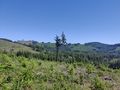
View from top of hash hill before plunging into trees
The base of Bobs hill
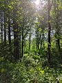
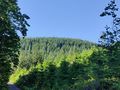
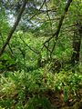
Beautiful forest along Bobs hill path
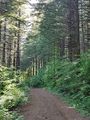
Bobs hill path
Bobs Hill summit is right up there
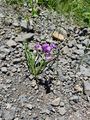
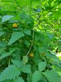
Camas flower along hashpoint trail
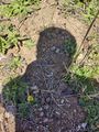
Deer scat along hashpoint hill
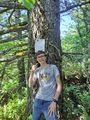
I might look disheveled, but I made it
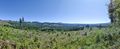
Pano from atop hash hill
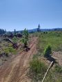
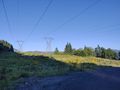
Gravel road turns to dirt bike path
We made it!
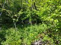
Hashpoint surroundings
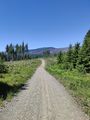
Gravel road on the way to the hashpoint
View from outside of hashpoint forest
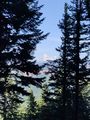
Mt Hood from Bobs Hill path
Parents descending hashpoint hill
First salmon berries of the season from Bobs Hill path
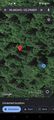
So close! Screenshot of our location
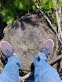
Cool stump, why not?
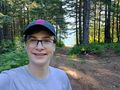
Selfie atop Bobs Hill
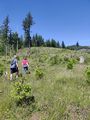
Parents climbing hashpoint hill
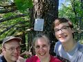
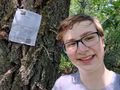
Selfie with the parents in front of hashpoint, Stupid Grin (TM) included


