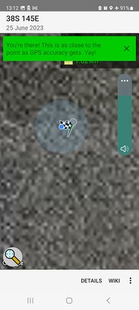
2023-06-25 -38 145

| Sun 25 Jun 2023 in -38,145: -38.2399723, 145.3094706 geohashing.info google osm bing/os kml crox |
Location
In Rutherford Inlet, about 20m from shore, near Warneet.
Participants
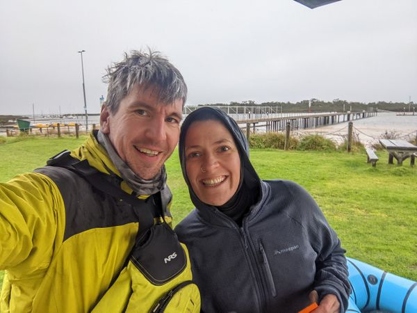
Expedition (by Steve)
The plannings
Three of my favourite things to look for in a geohashing point are:
1. Somewhere I've never been. 2. Somewhere I didn't even know about. 3. Somewhere I'd be glad to have been to.
This little inlet into Western Port Bay, barely an hour's drive away, ticked all three boxes! And I've been wanting to do an aquatic geohash for a long time, but never quite had the guts to swim hundreds of metres into Port Phillip Bay or wade into a dam in the middle of winter.
This location looked just perfect: close enough to shore to feel safe, yet far enough to be unquestionably aquatic. Near enough to the Warneet boat ramp to be achievable, yet far enough to be worth the drive. I messaged KT, "Hey are you up for a boating geohash tomorrow?" Response "um yes".
We didn't have any boats though.
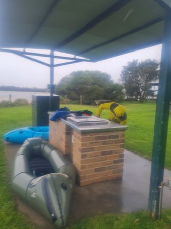
Felix offered two kayaks. But they're the rigid plastic type, and neither KT's mighty Yaris nor my clunky Ford Falcon sedan were likely contenders to transport them.
Tom offered a stand-up paddleboard, which he thought might conceivably transport two humans, but with no life jackets and only one paddle. We took it as a backup.
Kate came through with the goods: two excellent inflatable packrafts, with life jackets, paddles, the works. Game on.
The goings
After a bit of confusion about whose place we were meeting at, we made it to Kate's house to collect the gear, being very impressed by Kate's meticulously well organised gear shed, with boats and gear belonging to several people, all labelled and in its place.
The drive down was mostly uneventful, other than my meddling with the planned route to select an alternative route that was both slower and had more tolls.
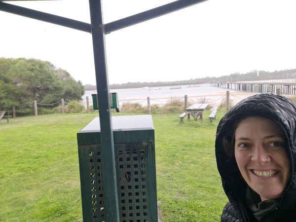
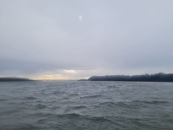
But soon, Warneet! Where the skies are grey, the winds bracing, the outlook dismal, the water choppy, and the rain dampening. The wind was a steady 30-40kph down the inlet out to sea, while the low tide was turning, bringing a current back inwards.
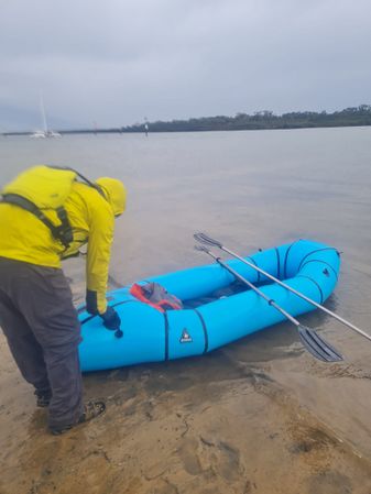
I immediately had an attack of the softs and needed some convincing to proceed with the plan. We inflated the kayaks, whereupon I belatedly re-remembered that one of Kate's kayaks is a two-person affair. Two people in one boat seemed like a much better plan - one main paddler, and one backup paddler/navigator/geohash-finder/photographer.
My stomach suddenly demanded to be fed, so we immediately wolfed down almost all of our planned on-board snacks: savoury shapes, bananas, chocolate, dried plums. And still I was hungry but tried to be brave.
We relucantly changed out of our nice warm clothes into a soon-to-be-sodden seawear. KT had failed to bring a rainjacket, or to think of asking me for one, so prepared for a thorough soaking. She decided that socks would be adequate footwear, leaving runners in the car. The weather was slowly changing from grey to grim to gross, and we weren't sure what came next, but suspected it wasn't going to be great.
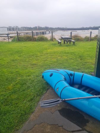
We gingerly walked down the slippery boat ramp and prepared to launch. Which mostly just consisted of blowing a few extra lungfuls of air into the boat and expressing last minute regrets. Mostly I was worried about whether we'd ever be able to paddle back home, into the strong wind.
Pre-adventure enthusiasm
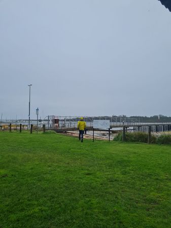
Steve goes to check just how grim it is.
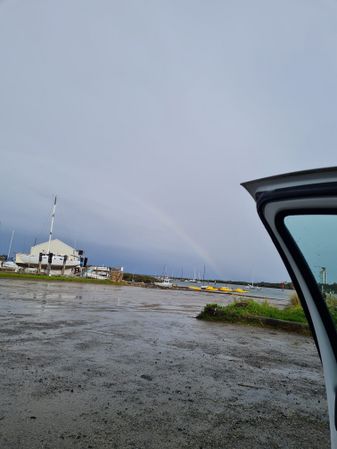
Nothing can ever be completely grim when there is a rainbow.
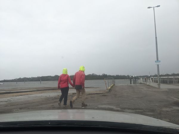
Other geohashers?
One boat more than needed.
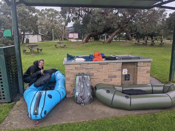
Steve's pack, cleverly placed on the rainy side of the shelter.
KT has no doubts whatsoever.
Inflated
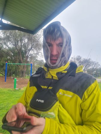
Steve is ready for the misgivings to begin.


The boatings
We did a quick paddle around to check whether we thought we could paddle back into the wind, and decided we could. We pondered the chances of being able to walk back along the shore, but with dense mangroves and mud, it looked iffy, especially as the tide came in.
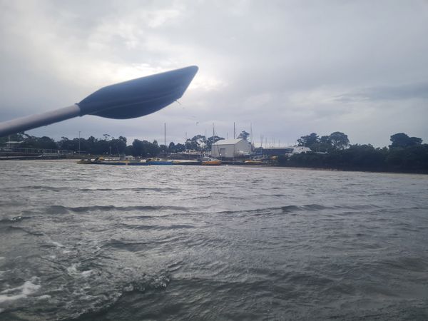
As soon as we began to push out from shore, the wind really picked up and took us alarmingly close to a line of mooring posts to which an array of boats were moored. Waves from behind shoved us strangely around, unsettlingly heaving the boat up and pushing us off line.
"Left!" I yelled, desperately wanting to be closer to the shore all of 20 metres away. "Whee!" replied KT, paddling right. "This is fun!"
We were not yet a smooth, well-oiled machine of clockwork paddling efficiently making progress down the inlet. There was much clashing of paddles, confusion about which way we were going or how deep we wanted to be. Each time our photographer put down her paddle for a photo opportunity, the waves would suddenly swing the boat to one side, tipping us alarmingly. Well, at least I was alarmed. KT was having a great time.
The same thing happened when our navigator put down her paddle to check on our progress to the hash. We started at about 1.2km but were soon at 750m. If it wasn't for the alarming spinning to either side, you could say it was pretty easy. We mostly hugged the bank, staying just deep enough for the paddles to not actually scrape on the bottom.
As we passed the last of the moored boats, KT had to give up her pastime of calling out the names of the ones that made her giggle.
400m and I was starting to appreciate the bird life. Plenty of cormorants, including what looked like a juvenile, disappearing into the water. Lots of gulls, and possibly a sea eagle.
Soon we had to try to hit the actual point. Because of the strong drift, the best plan seemed to be to aim upriver of the point and drift down to it. But by the time we thought of that plan and put it in action, we'd already drifted past it. We frantically paddled back upstream while KT fiddled about with her phone, struggling with the waterproof case. Finally we had a good reading, and mercifully the dance was short - 20m, 10m, 0.5m!
I took the chance for a photo or two of my own, and immediately we were drifting out to sea. But I was starting to feel much better about this whole outing. Would we make it back home though?
Ready for launch.
Onboard, one of us is having a great time.
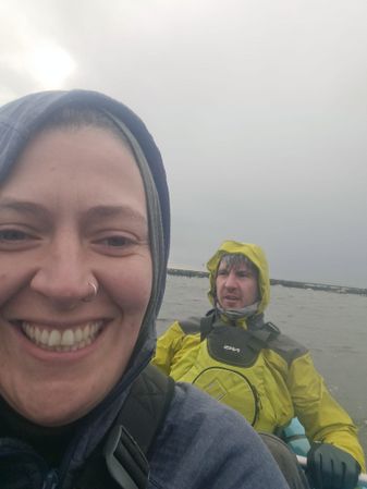
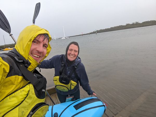
Success!
The geohash point! (Well, maybe. It looked something like this.)
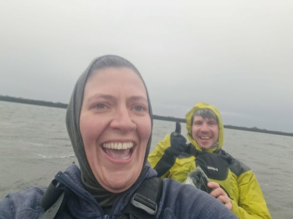
Success!
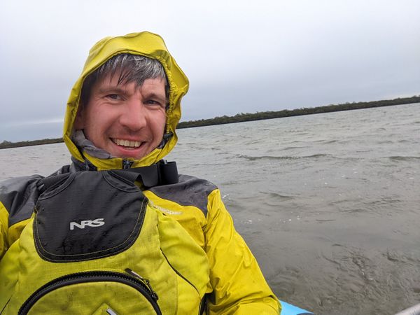
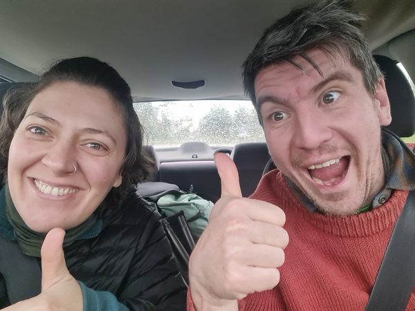
Steve experiences success.
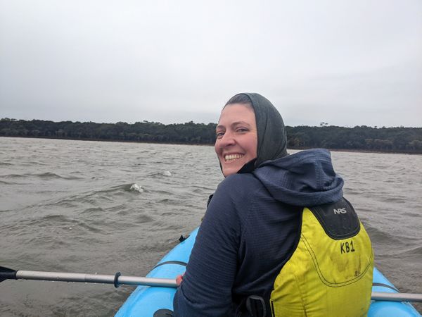
KT experiences success.
A tiny glimmer of sunshine.


The returnings
I often notice that the return from a geohash point is a much more straightforward affair. Relieved of all the anxious ponderings about whether or not it's a good idea to persevere, one is left with just the simple mission of getting back to civilisation as quickly as possible. Head down, we paddled into the wind.
At this point, I discovered my good fortune in being at the back - KT copped the brunt of the weather while I was actually pretty comfortable. We finally found a good rhythm. Hitting the waves head on didn't seem to cause the spinny problems from earlier, so we just motored along slowly, but consistently.
We pondered the name "Chinaman Island" given to the landform next to us, considering that it didn't seem to be an island, and wondered just how racist a name that was.
We tested whether I could keep making progress while KT took photos, and discovered that no - although I was just able to stop the boat drifting backwards.
We met up with our old friends the moored boats once again, and gave them a respectful distance.
Soon we were back on dry land, although making it wetter, and doing the same to the car. And turning our attention to a late lunch.
Warneet's General Store looked insufficiently inviting, so after a brief excursion to admire a viewpoint over the mangroves, we headed for Tooradin's fish-and-chippy named "New Cod on the Block". However, our loyalty to the cause was brief, and having discovered an older fish-and-chippy fractionally closer we went there instead, quietly making snide remarks about the sign that insisted that customers weren't entitled to refunds on their food simply on the basis that they didn't like it.
Then to a book shop having a closing down sale ($4 spent), and a disappointing ice cream from an extremely unbusy ice cream shop, then it was time for home.
Back on dryish land.
We made it!
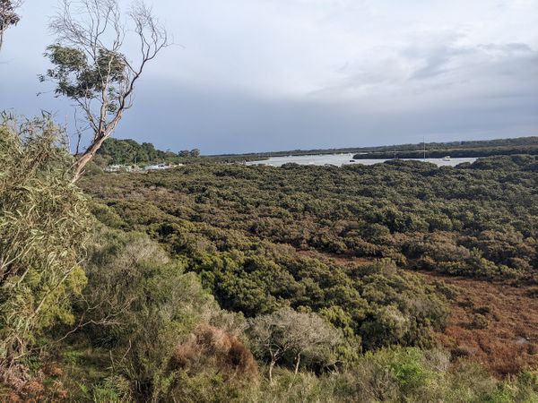
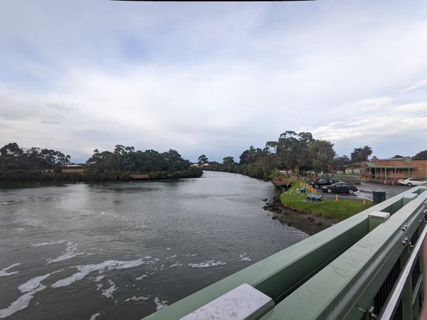
Mangrove viewpoint.
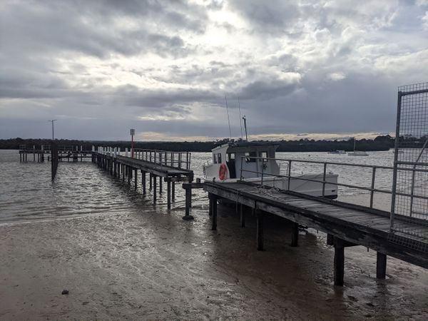
A challenging jetty.
Tooradin is quite pretty


Achievements
Stevage and KT earned the Water geohash achievement
|