2023-07-19 53 9

| Wed 19 Jul 2023 in 53,9: 53.7032615, 9.5889059 geohashing.info google osm bing/os kml crox |
Location
In the middle of a crop field in Seester, Schleswig-Holstein.
Participants
Plans
Rsge
Originally, I wanted to do a few more Retrohashes before doing "real" ones, but this one would be well reachable by bike, so I at least considered going if the weather would be ok. The hash would be in the middle of a field with a cluster of agrarian buildings near it with a road through them, so maybe I could use the road to get near. I hoped the field wouldn't currently be in use and the owner ok with me being there, if they saw me.
Expedition
Rsge
According to the weather forecast it would probably rain the whole day - but as the afternoon came it still hadn't rained more than a few drops. So, as due to summer holidays my usual activities were canceled, I thought a little bit of exercise wouldn't be the worst thing - and when my mother wanted a few packages brought to the packet shops in the main city, which was already a bit of the way to the hash, I thought I'd combine the useful with the practical and would do that, going for the hash afterwards. So I packed my drone and my usual bag with a water bottle and stuff and went on my way.
I went to the packet shops at the center of Tornesch, posted the packages and went on my way to Seester through Uetersen. On my way I rode past a seemingly burned down house at the outskirts of Uetersen; the orange sheet on the wall was a notice by criminal police to not enter the property under any circumstances. Then there was a long stretch of "nothing", just fields of grain and meadows with cows and sheep grazing. These flat and "empty" landscapes are a thing I like about Schleswig-Holstein - they are so nice to go through by bike and you can see for miles. I took a panorama photo on a particularly nice stretch of road. A few hundred meters further there was a construction site, seemingly for a kind of pipeline. I forgot to take a photo of that.
As I arrived at the last stretch of road I realized the road was part of the property and while nothing was fenced in, I felt weird going down the road and turned around to park my bike at the main street instead. Just as I did, someone, probably the owner I thought, drove past me in a car and away from the property. Feeling a bit more secure but still not wanting to walk "over their front porch", I used the meadow next to and behind the houses to get to the field. I walked along the field as long as I could and then "hid" behind a small assortment of trees to unpack my drone. Then I went to the proper hashpoint. I had to jump over a ditch to get there, but it was dry and not that wide.
At the point, I took the first few photos flying low and went back behind the bushes to change the battery of my drone, which I didn't charge beforehand. I stayed there and took a few more photos flying higher with the second charge and then packed away my drone.
Only then I got the idea of the marker, so I went back to the hashpoint, laid the marker and this time went straight across the field to get back to my bike.
When I arrived back at my bike I sat down to plan my further route and take a sip from my bottle. I realized I could make this a Tron achievement, at least for my bike ride (hope that's enough to qualify) and most of the way to the hash, with the detour back being caused by the empty battery I didn't want to change on the open field. So I planned my route accordingly.
While I was sitting on the bench, the (probable) owner of the property came back and, seeing as I've been there already when he left, he asked me if I needed any help. But I didn't understand that at first as I was wearing my earphones, so I just said "Moin" (The typical North-German greeting), he answered the same and didn't ask any further.
After he went again, I took a photo with my phone and, as I hate taking "selfies", unpacked my drone again to take another picture with me on it. I packed the drone again and started riding home, taking the path I planned to not cross my previous one.
When I finally arrived at home I was pretty exhausted, as I'm not used to going these distances by bike (but also didn't hold back in speed), but happy I did it. Then my mother asked me to bring the parts of two beds from the garage up to our attic....
Photos
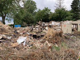
A broken down house on the way to the hash.
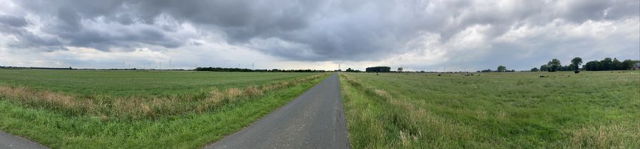
An empty street on the way to the hash - I love SH's landscape.
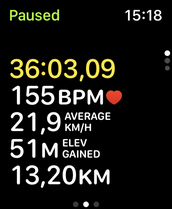
Bike ride activity on Rsge's watch after reaching near the hash.
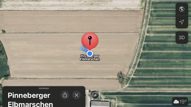
GPS evidence of reaching the hash.
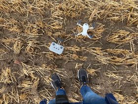
Rsge's feet (and drone) at the hash.
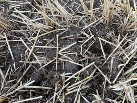
A small marker Rsge made out of straws at the hash.
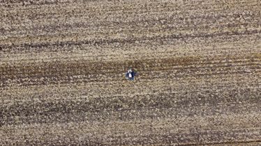
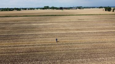
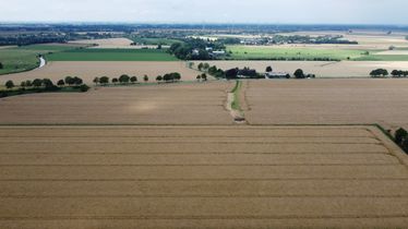
The hash from a bird's eye view, straight down.
The south of the hash via drone, flying low.
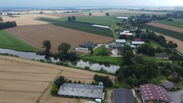
The north of the hash via drone, flying low.
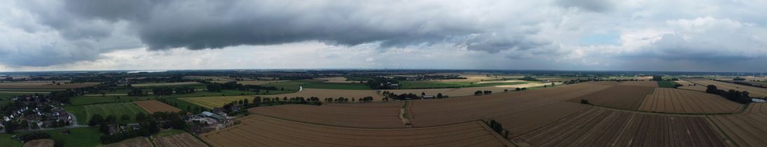
A panorama of the south of the hash via drone, flying high.
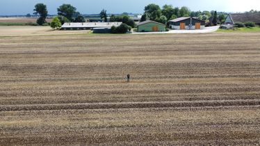
The south of the hash via drone, flying high.
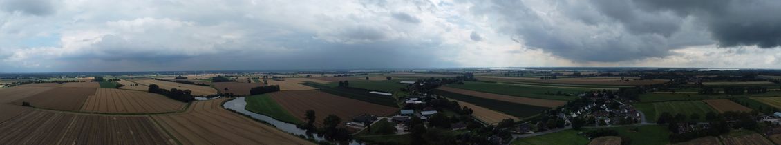
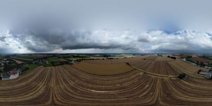
A panorama of the north of the hash via drone, flying high.
The north of the hash via drone, flying high.
A 360 ° photo at the hash. Special viewer needed.
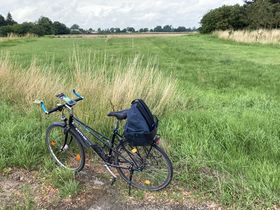
Rsge's bike before leaving, looking in hash direction.
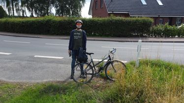
Rsge at his bike before leaving.
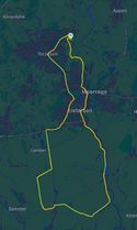
Rsge's bike ride path.


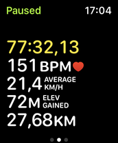
Bike ride activity total after getting home.
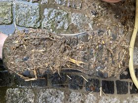
Rsge's dirty soles after getting home.


Achievements
Rsge earned the Two to the N achievement
|
Rsge earned the Two to the N achievement
|
Rsge earned the Land geohash achievement
|
Rsge earned the Bicycle geohash achievement
|
Rsge earned the Tron achievement
|