2023-10-01 50 8
| Sun 1 Oct 2023 in Frankfurt am Main: 50.3851093, 8.6657209 geohashing.info google osm bing/os kml crox |
Location
In a field between Ober-Mörlen, Fauerbach vor der Höhe and Ostheim
Participants
Plans
A sunny Sunday on a long weekend and the hashpoint in a direction I had not explored much. Nice preconditions for a good expedition. Again I would ride the train in a direction I had not before, again on a single tracked non-electrified train line through the hilly landscape (see 2023-09-23 50 8 as reference).
Expedition
To the hash point
I got onto the train with my bike in my hometown, though this time a more classically powered diesel-electric train. The train ride to Friedberg was comparably short, taking only 19 minutes. Still, it was pretty nice, going though hilly fields and stopping at tiny stations.
From Friedberg's main station, I rode my bike following a path near the river Usa, and I would stay close to this river for most of the way. The river let me through Bad Nauheim next, where I rode alongside some pretty nice parks, especially the main Kurpark. It is forbidden to ride your bike directly on the paths of that park, so I had to stay alongside them looking in from the road. But that was actually a good thing since even though the park itself was really nice, on this sunny Sunday on a long weekend, it was so full of people that riding a bike or even just relaxing there seemed like a challenge to me.
After some quiet residential streets of Bad Nauheim, I rode on a very nice dirt path right next to the river. Next, the path let me around Ober-Mörlen through some more fields and there were a lot of horses out on pastures. After some soccer fields and tennis courts, I finally left the vicinity of the river Usa to climb the final few meters to the hashpoint.
On the final approach I was worried, since some of the fields besides the path still had a lot of leafy greens planted on them, and if the hashpoint fell in one of those fields I would not have been able to get to it since that would mean trampling a bunch of crops. But thankfully, the hashpoint lied in an already harvested fallow field with nothing on it, so it was super easy to get to the hashpoint.
At the hash point
The hashpoint was about 107 meters away from the path, so I left my bike at the edge of the field and walked the final meters over the fallow field. I reached the hashpoint at 15:33, early again due to train schedules.
After taking all the prerequisite pictures I did not stay any longer, since there was no shade anywhere closeby and I did not bring any food anyway. So I just got back on my bike pretty much immediately and started my way back to Friedberg main station.
Way back
On my way back I chose not to ride the dirt path right next to the river again because, while beatuiful, I had just been there and it would be much faster and a smoother ride on the asphalt-path next to the road.
Looking at the train schedules on the way I found that I had about 10 min extra, so I decided to get an ice cream on the way. While there were several cafes in the Kurpark of Bad Nauheim, again everything was so crowded that I didn't dare go anywhere near those. Instead, I chose to go up the namesake Friedberg and found a nice ice cream shop on their main shopping street. For some reason their main shopping street is still open to a lot of car traffic, so I got my ice cream to go and enjoyed it while walking most of the way to the main station.
Then it was just an easy 19 minute train ride and I was back home.
Photos
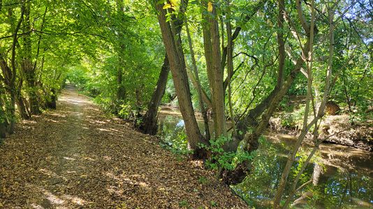
Dirt path next to the Usa
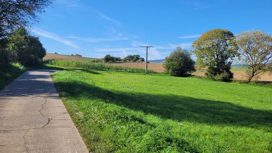
Final approach
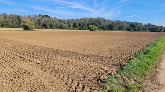
View towards the hashpoint
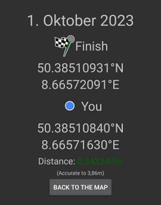
Proof
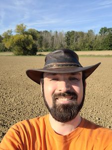
Stupid Grin™
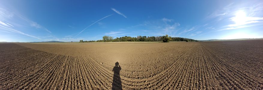
Panorama at the hashpoint
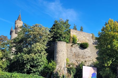
Burg Friedberg


Tracklog