2024-08-17 55 -1
| Sat 17 Aug 2024 in Blyth: 55.5406249, -1.8599137 geohashing.info google osm bing/os kml crox |
On July 31, 2012, the swimmer Michael Phelps won his 18th and 19th Olympic medals at the XXXth Summer Olympiad in London to tie, and then break, Larisa Latynina's 48-year-old record.
Among the millions not watching on TV was the geohasher Jand, who was busy unlocking the Camborne graticule while on holiday in Cornwall. As of that date in 2012, three locked graticules remained in England:
The Scilly Isles (stop it), a tiny archipelago 2¾ hours from Penzance by ferry, where cars are exempt from MOTs because there's nothing to crash into.
Lizard (I'll turn this car round and there'll be no geohash for anyone), a peninsula so far off the beaten track that the Great Western Railway skipped the usual process of building the line, shutting it down and replacing it with a bus, and went straight to the bus.
And Blyth, population c.500,000, high ratio of sheepy fells to croppy fields, very well connected thanks to the A1 and East Coast Main Line, perfect geohash country in every way except for two-thirds of it having disappeared into the sea since Paleolithic times. Damn Paleolithics with their heavy industry and SUVs.
Then, nothing happened for 12 years.
Contents
[hide]Location
A patch of barren moorland upside a fell criss-crossed by footpaths, halfway between the Coldstream road and the A1, a couple miles out from Chillingham and its castle. Beautiful!
Participants
Expedition
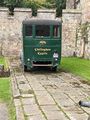
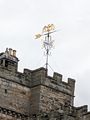
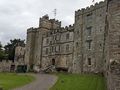
Chillingham Castle is notable as the most haunted castle in England, or if you don't believe in ghosts, as the joint-least haunted. Britain's Most Haunted has been there, and the local radio station used to offer prizes for spending the night. I left my wife and baby daughter there to soak up the ambiance. Are those gunshots I can hear in the distance? Ah, that's a complication I hadn't reckoned with: it's the first weekend day after the Twelfth of August. I have to try hard not to look like a red grouse today.

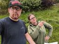
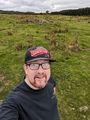
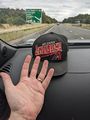
So as not to keep you in suspense, I can reveal that the person in this photo is me. I don't support the Arizona Diamondbacks, but I found this cap in a cap shop and remembered that I'd been trying to collect sightings of all 30 MLB teams' caps and was only missing the D'backs and the Rays. I paid a local urchin sixpence to put it on his head and play a round of Hide 'n' Seek with me, and he was good enough to give me it back. The t-shirt is from Tenaya Lodge in Yosemite, and the back says I Survived Geocaching At Tenaya Lodge, which I did (what, you thought this beard belonged to someone who had never stood in a field and done the GPS Tracker Hokey-Cokey before?)
Yep, we were at Chillingham Castle alright.
They are leaning into the spooky vibe or they are big Valencia fans.
Obviously most of the torture implements can't be out in the courtyard because of the screaming.
Foreboding level: orange.
This dog, instead of eyes it had marbles...
...and instead of a leg, it had Patrick Duffy.


Starting from Chillingham Castle (lower left) meant following the red dots on this map. As you can see, there is more than one set of dots on this map, and if you suspect that this is foreshadowing some Mild Peril you would be correct.

In the Chillingham estate is a wild cattle park with a full-time ranger and several full-time cattle. The ranger was delighted to have received a visitor, and was most understanding when I said I was from the internet, and told me I wasn't allowed on the red dots and would have to go all the way round via Chatton. Private road for forestry vehicles, innit.
And we don't trespass on private roads while geohashing, because that is wrong and against the rules, as per No trespassing consolation prize: "Trespassing beyond the posted sign invalidates the geohash itself and is against the spirit of the sport." And as per the Posted achievement: "If a geohashers chooses to enter private property despite the presence of fences or signs indicating that they are not welcome, that geohash does not count towards this achievement (or any others), as it is against one of the earliest rules of geohashing." So there you go.
They couldn't give me a date when the unicorn breeding effort was expected to bear fruit.
Good advice if someone is throwing eggs at your head.
Nope.


New plan, follow the purple dots.
A cool lifehack I discovered while following the purple dots is that when you see a sign saying Public Footpath with a place name and a distance, it's a good idea to not follow that sign unless the place name is somewhere you want to go. "But it's pointing in the right direction" - nope, footpaths twist and turn like a twisty turny thing.
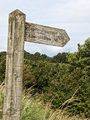
Amersidelaw ½. The perfect sign to not follow if you don't want to be in Amersidelaw.
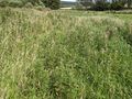
Especially when this is the alleged footpath.
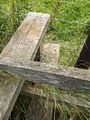
The lower plank had fallen over, so I fixed it, which was useful when I realised I was going the wrong way and turned back.


Having lost half an hour doing that, I'm now a little conscious of time. Next decision, keep to the B road (pink dots) or follow the Trout Fishery road (cyan dots)? I chose wrong again and stuck to the B road, because it looked like the other one merged with the private road that I'd been told not to walk on.
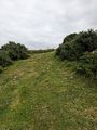
B roads are Boring roads, so here's where I left the B road to follow another alleged footpath for the last 1.2km.
The yellow circles mean it's a public footpath. I am taking the public footpath thing seriously.
My camera is vertical here, that's just the gradient of the ground.
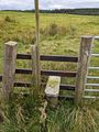
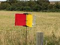
There was a "don't get shot, make yourself visible" sign on this fence. Having never had to make myself visible before, I declined to enter this field.


I made my final bad decision when I chose the green dots rather than the white dots, in the hope of crossing the burn once rather than twice. Lifehack #2: The shades of green on OpenStreetMap apparently mean something, and the lighter ones are better.
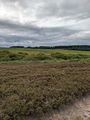
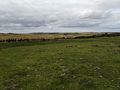
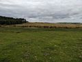
The hashpoint is in the light green bit on the other side of the heather, bracken, trees and water.
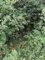
The footpath goes... into here?
And over here?
Still a public footpath, hurrah!


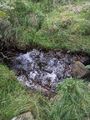
Exactly at the hashpoint I found a white stone that didn't belong. Glacial erratic, or left there on purpose by a ninja geohasher? It didn't have any secret messages on it. I arranged some grass to say XKCD, except that I'd just gotten back from Cyprus in the week (bad for geohashing, too long and thin, most of them land in the water) and the curved C and D of XKCD are hard to make with grass, so instead it said ΞΚΧΔ - Xi Kappa Chi Delta.
If you found this in a Pokemon game you'd assume it was for evolving your Lutefisk into a Garderobe.

That's a bingo! Is that how you say that?
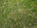
Xi Kappa Chi Delta, if you look closely.


Evidence
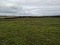
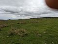
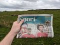
Since this was a graticule unlock and not everyone believes that I exist it was necessary to gather some extra evidence. Here's me, the ΞΚΧΔ sigil, the mysterious rock, the Chatton transmitter about a kilometer ESE of the hashpoint, and the Spon section of the Times from 17 August - you can tell I haven't manipulated the date because the headline is Manchester United's win over Fulham on the 16th. Also photos in all directions from the hashpoint - there isn't much in the way of landmarks but you can match them with the edges of some forests if you want.
NNE
ENE
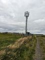
ESE - looking directly at the transmitter
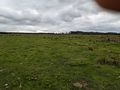
SSE
SSW
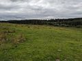
WSW
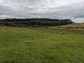
WNW
NNW
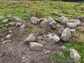
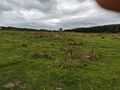
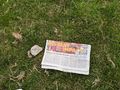
The other thing in this field was a clump of rocks, soooo I took a photo of that
Me and a clump of rocks

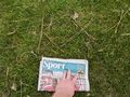
The Spon section with the date visible
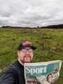
Me and paper
ΞΚΧΔ and paper
Transmitter and paper
Rock and paper (paper won)
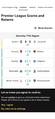
You may check the metadata on this BBC Sport screenshot from about 1528 on 2024-08-17 is the same as the rest of the batch.


Escape
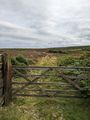
So on the other side of the field there was a gate leading to a gravel track. Yeah, if I'd followed the cyan and white dots, I could have literally driven the car to the edge of the field where the hashpoint was. It turns out the private road has a break in it where it overlaps with the Trout Fishery road, which at some point seems to have been extended to the east (fresher whiter gravel) to access a 4G mast. Ah well.
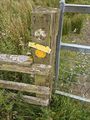
This is a Crop Gard. I don't know what it does.
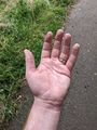
A case of Puffy Hand from walking too long.
Hand has returned to normal. Here's a sign for Blyth, because I realised I could have been in a totally different graticule all this time.


Bottomley Potts earned the Graticule Unlocked Achievement
|
After unlocking the graticule I was able to prise it open. It contained a seated bronze statue of Harry Kane, every Top Of The Pops episode from the 1970s, a working Nokia 3310, George R R Martin's script for Season 8, Elon Musk's "Mars Colony 2025" blueprints, an unopened jar of optimism, and Katie Hopkins.