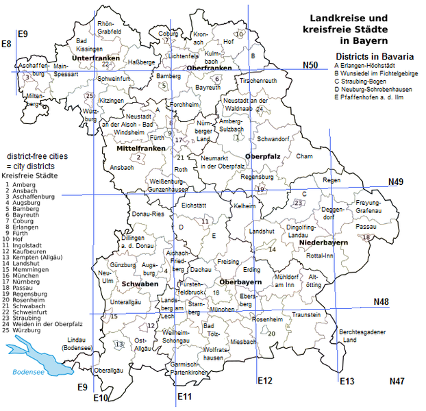
File:Districts EU-DE-BY.png
From Geohashing

Size of this preview: 622 × 600 pixels. Other resolutions: 249 × 240 pixels | 643 × 620 pixels.
Original file (643 × 620 pixels, file size: 148 KB, MIME type: image/png)
Map of the German state Bayern (Bavaria, EU-DE-BY) with Regierungsbezirke (administrative regions, medium-sized borders) and districts (small borders). Can be used for the Regional geohashing achievement or the Reverse regional achievement. (I personally tick off the districts I have visited by coloring them with MS Paint)
File history
Click on a date/time to view the file as it appeared at that time.
| Date/Time | Thumbnail | Dimensions | User | Comment | |
|---|---|---|---|---|---|
| current | 16:11, 30 January 2020 | | 643 × 620 (148 KB) | Maintenance script (talk | contribs) |
- You cannot overwrite this file.
File usage
There are no pages that link to this file.