Implementations/Online
Contents
[hide]Eupeodes's geohashing map
| This implementation IS FULLY 30W-compliant. |
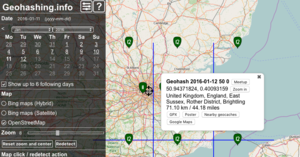
An implementation using openlayers. Gives 3 x 3 hashes, with option to download as GPX. Uses geo.crox as data source. This implementation works very well on both desktop and mobile.
See the help on the site for url parameters.
Small Hash Inquiry Tool
| This implementation IS FULLY 30W-compliant. |
Small Hash Inquiry Tool is an online tool Ekorren built to his own needs but later rebuilt to be globally usable.
Compared to the nifty tools like those for the iPhone, this one looks ugly to the end. Which was intended as it should be stripped from all colourful overhead, featuring just basic compressed information, all on one page and from everywhere.
Features:
- lists up to nine nearby hashpoints per day, today and upcoming (no retro)
- may be called from a bookmark without needing further input
- calculates approximate distance and direction
- shows the location on configurable maps on request
- includes the globalhash
- does it all at once, and
- is so basic that it works from virtually every phone which isn't entirely incapable of browsing.
Usage information is available from its own page.
Geohashing Poster Tool
| This implementation IS FULLY 30W-compliant. |
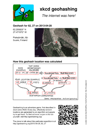
This tool produces a PDF document that can be printed out, similar to the ones that were available from Active Geohasher.
Posters are available from the following URL:
http://geo.crox.net/poster/[date]_[lat]_[lon]
Minimal globalhash support is also available:
http://geo.crox.net/poster/[date]_global
From an expedition page, you can link to the poster like this:
[http://geo.crox.net/poster/{{FULLPAGENAME}} Poster for this expedition]
For more information, credits and feedback, see User:Crox/Poster.
QDGN is an online tool written by Kripakko. It shows the client's location, as well as the nearest Geohash and its location, both as text and on a map.
Shotgun
| This implementation IS FULLY 30W-compliant. |
Shotgun Retro search tool. Multiple locations can be shown on the same map, using custom filters.
(Updated on 12th September 2015 to fix a 30W issue.)
Features:
- Option to limit the search to an area of interest, for example an island you live on, an area close to you, or just a favourite area.
- Search instances of a specific day of the year within the area, for example your birthday or anniversary.
- Show all matching results on a single map using Google Maps markers.
Example uses:
- View all 2015 location on La Gomera. [1]
- Search for 21st May locations on the Isle of Wight since 2008. [2]
- Prove that the last location on land in the Lizard Point was September 22nd, 2019. [3]
Future plans include creating a graphical selector for the graticule, and area of interest.
Note: This tool uses a private data source that needs to be manually updated, so it may be missing the last week or so of recent hashpoints.
Written by Zamzara
KML Tool
| This implementation IS FULLY 30W-compliant. |
Please double check the output - it has been tested but ...
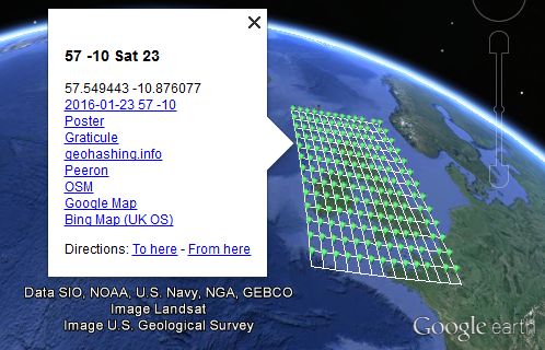
Sourcerer has made a geohash KML calculator. The source code is available on GitHub.
- This makes KML data which loads for viewing into Google Earth Desktop or similar applications like Marble. This might download as text if Google Earth Desktop is not installed.
- Why?
- Well there's no point having a dog and barking yourself.
- Google Earth Desktop has powerful functionality and there's not much point re-inventing these features.
Usage instructions, bug reporting and feature requests are on the Sourcerer/KML tool page.


