2024-06-19 49 8
| Wed 19 Jun 2024 in 49,8: 49.9437743, 8.6765648 geohashing.info google osm bing/os kml crox |
Location
The hash lay in the forest of Darmstadt.
Participants
Plans
Travel to Egelsbach, walking to the hash and some more walk.
Expedition
The day started wet and rainy. Some moments were dry and I hoped for a somewhat dry walk in the woods. I left the citybus at Egelsbach and it started to rain again. That would be no problem as I thought of an easy and direct way into the forest and around the forest. I started to walk and then, the bridge across the motorway was blocked. There were two alternate ways and the western one looked shorter. I took the western one. But it didn't lead me to the road but ended in a thicket of blackcurrants. I looked around and saw a parked car in the distance and it seemed to me, there would be a way out. Between me and the way out was a field with some unknown and wet wed, knee deep. But I didn't want to walk around for some more time and took the direct way. Then I took the state road, some more field ways, had a look to the blocked bridge from the other side, walked through a wet and fog forest, found the hash and went further to the station of Erzhausen.
Two villages later I made another walk around.
Tracklog
Photos

arrived
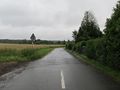
start to walk
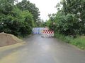
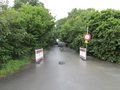
blocked bridge
there I wanted to go
this was the way
blocked bridge from the other side
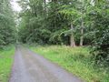
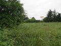
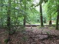
hash area

proof
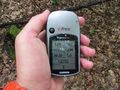
proof
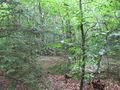
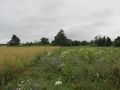
looking north
east
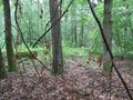
south

west
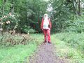
the geohasher


