Difference between revisions of "2009-02-16 33 -84"
imported>Woodveil |
imported>FippeBot m (Location) |
||
| (2 intermediate revisions by one other user not shown) | |||
| Line 14: | Line 14: | ||
== Expedition == | == Expedition == | ||
| − | [[Image:2009-02-16 powerlines.jpg|thumb|left| | + | [[Image:2009-02-16 powerlines.jpg|thumb|left| Big blue sky, a world of open possibilities.]][[user:Woodveil|We]] found the time around 12:30 to make a run at this hash, which looked particularly good as it would be our [[Consecutive Geohash|fourth straight day]] of reaching hashes. Interestingly enough, we got lost on the drive down, basically missing our turn and way overshooting. But we had Nick's iPhone, so we looked up new directions and changed our course back towards the point. We reached it around 1:30. |
I, gps in hand, ran to the hash and declared it to be a tree. We even got another picture of our gps showing 0.00 feet to go! Of course, about thirty seconds later it showed 28 feet to go, without having been moved. I suppose that's why the accuracy required is a ten meter circle. Well, we had found the point, Nick had wedged his camera in between some trees to take a picture (We need to just buy a damn tripod), and we ate some Pringles. Now to get back to class, and hope for a good hash tomorrow. | I, gps in hand, ran to the hash and declared it to be a tree. We even got another picture of our gps showing 0.00 feet to go! Of course, about thirty seconds later it showed 28 feet to go, without having been moved. I suppose that's why the accuracy required is a ten meter circle. Well, we had found the point, Nick had wedged his camera in between some trees to take a picture (We need to just buy a damn tripod), and we ate some Pringles. Now to get back to class, and hope for a good hash tomorrow. | ||
| Line 20: | Line 20: | ||
== Gallery == | == Gallery == | ||
| − | Pictures to | + | <gallery caption="Pretty Pictures" widths="200px" heights="200px" perrow="3"> |
| + | Image:2009-02-16 road.jpg| Another damn road. | ||
| + | Image:2009-02-16 lost.jpg| "Where the hell are we!?!" | ||
| + | Image:2009-02-16 iphone.jpg| Nick finding the way. | ||
| + | Image:2009-02-16 hash tree.jpg| There's the hashpoint. | ||
| + | Image:2009-02-16 c tree.jpg| Chris by the hash tree. | ||
| + | Image:2009-02-16 cc tree.jpg| Drinking a Sprite. | ||
| + | Image:2009-02-16 both.jpg| [[user:Woodveil|Woodveil]] | ||
| + | Image:2009-02-16 gps.jpg| We again got the gps exactly there. | ||
| + | Image:2009-02-16 road lines.jpg| Some powerlines. | ||
| + | Image:2009-02-16 powerlines 2.jpg| So we pulled over to take a picture. | ||
| + | </gallery> | ||
== Achievements == | == Achievements == | ||
| Line 31: | Line 42: | ||
[[Category:Expeditions with photos]] | [[Category:Expeditions with photos]] | ||
[[Category:Coordinates reached]] | [[Category:Coordinates reached]] | ||
| + | {{location|US|GA|FU}} | ||
Latest revision as of 01:54, 8 August 2019
| Mon 16 Feb 2009 in Atlanta: 33.6379620, -84.5620304 geohashing.info google osm bing/os kml crox |
Contents
About
Yes, we'd scouted this hash out on the way back to the previous day's hash. It was on the side of a road, west of the Airport.
Expedition

We found the time around 12:30 to make a run at this hash, which looked particularly good as it would be our fourth straight day of reaching hashes. Interestingly enough, we got lost on the drive down, basically missing our turn and way overshooting. But we had Nick's iPhone, so we looked up new directions and changed our course back towards the point. We reached it around 1:30.
I, gps in hand, ran to the hash and declared it to be a tree. We even got another picture of our gps showing 0.00 feet to go! Of course, about thirty seconds later it showed 28 feet to go, without having been moved. I suppose that's why the accuracy required is a ten meter circle. Well, we had found the point, Nick had wedged his camera in between some trees to take a picture (We need to just buy a damn tripod), and we ate some Pringles. Now to get back to class, and hope for a good hash tomorrow.
Gallery
- Pretty Pictures
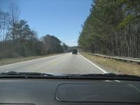
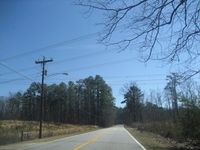
Another damn road.
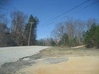
"Where the hell are we!?!"
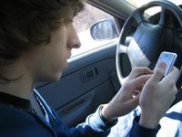
Nick finding the way.

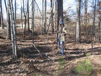
There's the hashpoint.
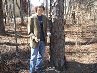
Chris by the hash tree.
Drinking a Sprite.
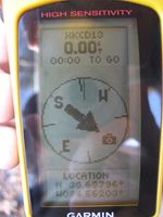
We again got the gps exactly there.
Some powerlines.
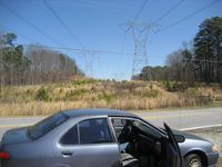
So we pulled over to take a picture.


Achievements
This user earned the Land geohash achievement
|
This user earned the Consecutive geohash achievement
|