Difference between revisions of "Prineville, Oregon"
From Geohashing
imported>Michael5000 m |
imported>Michael5000 |
||
| Line 1: | Line 1: | ||
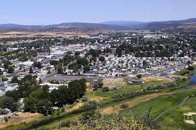
| − | [[File:Prineville.jpg | + | [[File:Prineville.jpg|400 px|Prineville, Oregon is the only major town in the graticule that bears its name.]] |
{{graticule | {{graticule | ||
| Line 14: | Line 14: | ||
| se = [[Hines, Oregon|Hines]] | | se = [[Hines, Oregon|Hines]] | ||
}} | }} | ||
| − | + | ||
| + | Rugged terrain cut by steep canyons makes much of this graticule hard to reach. The Ochoco Mountains are the main geographical feature, and nearly a third of the area falls inside the Ochoco National Rorest. Prineville, to the west, is by far the largest town, although the little seat of Wheeler County, Fossil, lies on the northern edge. The even smaller village of Mitchell is on U.S. Highway 26, which runs east to west across the graticule's middle. | ||
== Expedition History == | == Expedition History == | ||
Revision as of 02:12, 16 July 2011
| The Dalles | Goldendale, Washington | Hermiston |
| Bend | Prineville | Kimberly |
| La Pine | Hampton | Hines |
|
Today's location: not yet announced | ||
Rugged terrain cut by steep canyons makes much of this graticule hard to reach. The Ochoco Mountains are the main geographical feature, and nearly a third of the area falls inside the Ochoco National Rorest. Prineville, to the west, is by far the largest town, although the little seat of Wheeler County, Fossil, lies on the northern edge. The even smaller village of Mitchell is on U.S. Highway 26, which runs east to west across the graticule's middle.
Expedition History
2011-07-15_44_-120
Michael5000 and Mrs.5000 pay a visit to Twickenham Road.
2010-01-30 44 -120
Nn2s2u deflowered this graticule
2009-09-16 44 -120
Nn2s2u is thwarted by private property signs.
