Difference between revisions of "2009-04-15 51 12"
imported>Reinhard (New page: {{meetup graticule | map=<map lat="51" lon="12" date="2009-04-15" /> | lat=51 | lon=12 | date=2009-04-15 }} Manu and Reinhard have been there. Detailed rep...) |
imported>FippeBot m (Location) |
||
| (5 intermediate revisions by 2 users not shown) | |||
| Line 5: | Line 5: | ||
| date=2009-04-15 | | date=2009-04-15 | ||
}} | }} | ||
| + | == Participants == | ||
| + | * [[user:Manu|Manu]] | ||
| + | * [[user:Reinhard|Reinhard]] | ||
| + | |||
| + | == Expedition == | ||
| + | Starting from the [[2009-04-14_51_12|previous hashpoint]] at 12:25 am, [[User:Manu|Manu]] and I headed for the Autobahn A14 to reach the new day's hashpoint in Baalsdorf, to the west of Leipzig, as fast as possible ... which wasn't too fast because there's a speed limit of 80 km/h in part. Nevertheless we got there at 12:49 am after further 23.6 km and parked the car less than 200 m away from the destination at the end of a dead-end street. | ||
| + | |||
| + | The field looked quite similar to the one we visited the day (or an hour) before and we just took the shortest way through the wet, low cereal plants that made our feet finally swimming in their shoes. Compared to the longish walk before, this one was really relaxing. After taking some photos we quickly got back to the car and drove home, which we arrived at 01:14 am ... knowing that we'd have to get up at 07:15 am in the morning ... *YAWN* | ||
| − | |||
---[[User:Reinhard|Reinhard]] | ---[[User:Reinhard|Reinhard]] | ||
| + | |||
| + | <gallery caption="Photo Gallery" widths="200px" heights="200px" perrow="2"> | ||
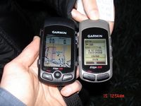
| + | Image:20090415-51N12E-01.jpg|GPS devices at geo hash. | ||
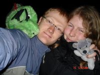
| + | Image:20090415-51N12E-02.jpg|Tired geohashers. | ||
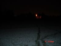
| + | Image:20090415-51N12E-03.jpg|Crop circle trail. | ||
| + | Image:20090415-51N12E-04.jpg|Arriving back home at 1:14 am after 47 km. | ||
| + | </gallery> | ||
| + | |||
| + | === Awards === | ||
| + | {{consecutive geohash | count=6 | latitude=50 | longitude=10 | date=2009-04-10 | name=Manu }} | ||
| + | {{consecutive geohash | count=5 | latitude=50 | longitude=10 | date=2009-04-11 | name=Reinhard }} | ||
[[Category:Expeditions]] | [[Category:Expeditions]] | ||
[[Category:Coordinates reached]] | [[Category:Coordinates reached]] | ||
| + | {{location|DE|SN|L|city=true}} | ||
Latest revision as of 02:50, 8 August 2019
| Wed 15 Apr 2009 in 51,12: 51.3262469, 12.4843262 geohashing.info google osm bing/os kml crox |
Participants
Expedition
Starting from the previous hashpoint at 12:25 am, Manu and I headed for the Autobahn A14 to reach the new day's hashpoint in Baalsdorf, to the west of Leipzig, as fast as possible ... which wasn't too fast because there's a speed limit of 80 km/h in part. Nevertheless we got there at 12:49 am after further 23.6 km and parked the car less than 200 m away from the destination at the end of a dead-end street.
The field looked quite similar to the one we visited the day (or an hour) before and we just took the shortest way through the wet, low cereal plants that made our feet finally swimming in their shoes. Compared to the longish walk before, this one was really relaxing. After taking some photos we quickly got back to the car and drove home, which we arrived at 01:14 am ... knowing that we'd have to get up at 07:15 am in the morning ... *YAWN*
---Reinhard
- Photo Gallery
Awards
Manu earned the Consecutive geohash achievement
|
Reinhard earned the Consecutive geohash achievement
|


