Difference between revisions of "2009-04-25 48 8"
From Geohashing
(New page: *hashpoint was reached by both of us and a drag-along-ee we met on the way. --koepfel ~~~~~) |
imported>Ekorren (Gallery with ekorren's photos) |
||
| Line 1: | Line 1: | ||
| − | + | {{meetup graticule | |
| + | | lat=48 | ||
| + | | lon=8 | ||
| + | | date=2009-04-25 | ||
| + | | graticule_name=Pforzheim | ||
| + | | graticule_link=Pforzheim, Germany | ||
| + | }} | ||
| + | == Location == | ||
| + | |||
| + | The hash in the Black Forest, somewhere in the middle of nowhere on a mountain near Baiersbronn. | ||
| + | |||
| + | It's actually the first expedition that goes into the Black Forest, all earlier ones in this area were somewhere outside or at the very margin of the mountains. | ||
| + | |||
| + | == Participants == | ||
| + | |||
| + | * [[User:Ekorren|Ekorren]] | ||
| + | * [[User:Koepfel|Koepfel]] | ||
| + | * Anonymous Drag-along | ||
| + | |||
| + | == Expedition == | ||
| + | |||
| + | |||
| + | == Gallery == | ||
| + | |||
| + | <gallery> | ||
| + | Image:2009-04-25_48_8_RS1_Horb.jpg|Train from Tübingen to Horb | ||
| + | Image:2009-04-25_48_8_AVG-FDS.jpg|Both of the trains we arrived with at Freudenstadt Stadtbahnhof | ||
| + | Image:2009-04-25_48_8_FDS_Church.jpg|Main church of Freudenstadt | ||
| + | Image:2009-04-25_48_8_FDS-market.jpg|Old town hall | ||
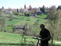
| + | Image:2009-04-25_48_8_FDS-valley.jpg|We had to cross this valley | ||
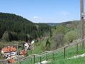
| + | Image:2009-04-25_48_8_FDS_View.jpg|A view back on Freudenstadt | ||
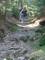
| + | Image:2009-04-25_48_8_Trail_1.jpg|Not a decent cycle trail, but a shortcut. | ||
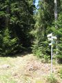
| + | Image:2009-04-25_48_8_Trail_2.jpg | ||
| + | Image:2009-04-25_48_8_Snowman.jpg|There was snow! | ||
| + | Image:2009-04-25_48_8_GPS.jpg|Coordinates reached | ||
| + | Image:2009-04-25_48_8_Hash_path.jpg|Hash path. We took the hard way, anyway. | ||
| + | Image:2009-04-25_48_8_Hash_stone.jpg|The hash point is stone(d). | ||
| + | Image:2009-04-25_48_8_Old_marker.jpg|Just an old marker on the way | ||
| + | Image:2009-04-25_48_8_Sankenbachfall.1.jpg|Sankenbach waterfall | ||
| + | Image:2009-04-25_48_8_Sankenbachsee.1.jpg|Sankenbach lake | ||
| + | Image:2009-04-25_48_8_Sankenbachsee.2.jpg|Sankenbach lake | ||
| + | </gallery> | ||
| + | |||
| + | |||
| + | [[Category:Expeditions]] | ||
| + | [[Category:Expeditions with photos]] | ||
| + | [[Category:Coordinates reached]] | ||
Revision as of 09:31, 26 April 2009
| Sat 25 Apr 2009 in Pforzheim: 48.4809778, 8.3527699 geohashing.info google osm bing/os kml crox |
Contents
Location
The hash in the Black Forest, somewhere in the middle of nowhere on a mountain near Baiersbronn.
It's actually the first expedition that goes into the Black Forest, all earlier ones in this area were somewhere outside or at the very margin of the mountains.
Participants
Expedition
Gallery
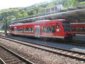
Train from Tübingen to Horb
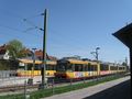
Both of the trains we arrived with at Freudenstadt Stadtbahnhof
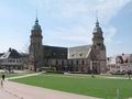
Main church of Freudenstadt
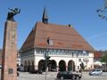
Old town hall
We had to cross this valley
A view back on Freudenstadt
Not a decent cycle trail, but a shortcut.
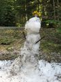
There was snow!
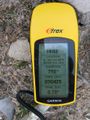
Coordinates reached
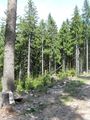
Hash path. We took the hard way, anyway.
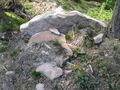
The hash point is stone(d).
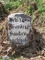
Just an old marker on the way
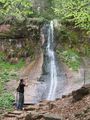
Sankenbach waterfall
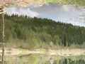
Sankenbach lake
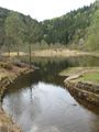
Sankenbach lake


