Difference between revisions of "2009-05-11 39 -88"
imported>Excellentdude m (Track log...kind of...) |
imported>Excellentdude m (A few more photos. Still need a writeup. Getting closer.) |
||
| Line 22: | Line 22: | ||
== Photos == | == Photos == | ||
| + | === The Beginning of the Journey === | ||
| + | <gallery perrow="4"> | ||
| + | Image:2009-05-11 39 -88 Road Construction.jpg|Short delay, but yea stimulus package! | ||
| + | Image:2009-05-11 39 -88 House First.jpg|The house of the friendly man | ||
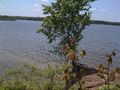
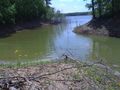
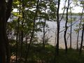
| + | Image:2009-05-11 39 -88 At the Lake.jpg|The lake just beneath the bridge | ||
| + | Image:2009-05-11 39 -88 Hiking Shoreline Difficult.jpg|OK, hiking right along the shore won't work | ||
| + | Image:2009-05-11 39 -88 Restart.jpg|Let's try again here | ||
| + | Image:2009-05-11 39 -88 Fellow Traveler.jpg|Hello fellow traveler! | ||
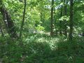
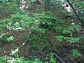
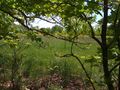
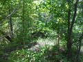
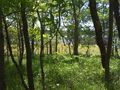
| + | Image:2009-05-11 39 -88 Getting More Dense.jpg|The forest becomes more dense | ||
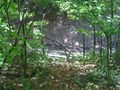
| + | Image:2009-05-11 39 -88 Two-Inch Waterfall.jpg|Small waterfall, bigger sound | ||
| + | Image:2009-05-11 39 -88 Typical Slope.jpg|Typical steep slope I repeatedly faced | ||
| + | Image:2009-05-11 39 -88 Surprising Bridge.jpg|Wasn't expecting to find a bridge! | ||
| + | Image:2009-05-11 39 -88 Another Surprising Bridge.jpg|Much less two! | ||
| + | Image:2009-05-11 39 -88 Still Hugging Shoreline.jpg|Still hiking near shore as planned | ||
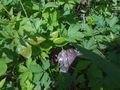
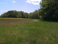
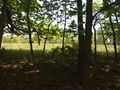
| + | Image:2009-05-11 39 -88 Field of Weeds.jpg|Wow, that looks easier to hike through | ||
| + | Image:2009-05-11 39 -88 Much Easier.jpg|And it is! | ||
| + | Image:2009-05-11 39 -88 Back in the Bush.jpg|But then I had to return to the forest | ||
| + | Image:2009-05-11 39 -88 Getting Close.jpg|I'm getting close to the hash | ||
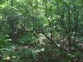
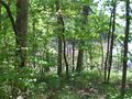
| + | Image:2009-05-11 39 -88 Densest Just Before Hash.jpg|The bush is always densest just before the hash | ||
| + | Image:2009-05-11 39 -88 I Made It.jpg|I made it! | ||
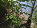
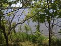
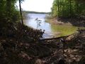
| + | Image:2009-05-11 39 -88 No I Did Not.jpg|No, I didn't, but a nice view nonetheless | ||
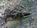
| + | Image:2009-05-11 39 -88 Unmapped Inlet.jpg|This unmapped inlet caused my error | ||
| + | Image:2009-05-11 39 -88 Around Inlet.jpg|Made it around the inlet | ||
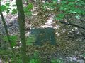
| + | Image:2009-05-11 39 -88 Buoy.jpg|I don't think this goes here | ||
| + | Image:2009-05-11 39 -88 Buoy Far Inland.jpg|Taken from the buoy | ||
| + | Image:2009-05-11 39 -88 Another Field Sigh.jpg|Could I have been hiking through fields this whole time? | ||
| + | Image:2009-05-11 39 -88 Still Near Shore.jpg|Sticking to the original plan near the shore | ||
| + | Image:2009-05-11 39 -88 The Real Thing.jpg|The hash is in this clearing! For real! | ||
| + | </gallery> | ||
=== My Best Imitation of a Track Log === | === My Best Imitation of a Track Log === | ||
<gallery perrow="4"> | <gallery perrow="4"> | ||
Revision as of 16:21, 20 May 2009
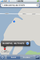
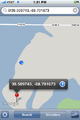
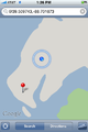
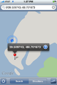
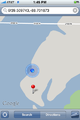
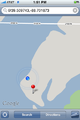
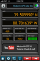
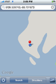
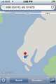
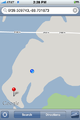
| Mon 11 May 2009 in Decatur: 39.5097432, -88.7016731 geohashing.info google osm bing/os kml crox |
Contents
About
Expedition
excellentdude: Although this was my twentieth geohashing expedition, this was clearly my baptism in geohashing, far surpassing my most difficult previous expedition which was probably 2009-03-09 38 -91. Extensive photos and details to come.
Achievements
excellentdude earned the Land geohash achievement
|
Photos
The Beginning of the Journey
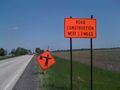
Short delay, but yea stimulus package!
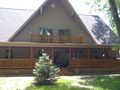
The house of the friendly man
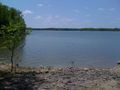
The lake just beneath the bridge
OK, hiking right along the shore won't work
Let's try again here
Hello fellow traveler!
The forest becomes more dense
Small waterfall, bigger sound
Typical steep slope I repeatedly faced
Wasn't expecting to find a bridge!
Much less two!
Still hiking near shore as planned
Wow, that looks easier to hike through
And it is!
But then I had to return to the forest
I'm getting close to the hash
The bush is always densest just before the hash
I made it!
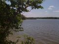
No, I didn't, but a nice view nonetheless
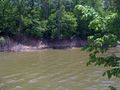
This unmapped inlet caused my error
Made it around the inlet
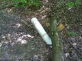
I don't think this goes here
Taken from the buoy
Could I have been hiking through fields this whole time?
Sticking to the original plan near the shore
The hash is in this clearing! For real!


My Best Imitation of a Track Log
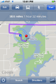
Google directions take you to the nearest road to the hash...
...which isn't always where you want to go
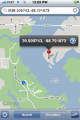
I made it around the inlet! The rest should be easy!
Slowly progressing near the shoreline
Wait a minute!
OK, that makes more sense
Getting closer...
...and closer...
I think I made it
Things aren't matching, but I think I made it
Zoomed out for similar perspective to others
On the way back, trying to find a better path inland


