Difference between revisions of "2009-05-18 42 -84"
imported>Excellentdude m (Blank template. More later. :-)) |
imported>FippeBot m (Location) |
||
| (2 intermediate revisions by one other user not shown) | |||
| Line 8: | Line 8: | ||
== About == | == About == | ||
| + | For the second consecutive day, this graticule's coordinates fell on a Michigan State University farm. | ||
== Expedition == | == Expedition == | ||
| + | [[User:excellentdude|excellentdude]]: Yesterday this graticule's coordinates fell so close to both my home and my office that I decided to [[2009-05-17 42 -84|walk there]]. I was so excited when I saw those coordinates because it was a beautiful day, and it might be a long time before the coordinates fell so close to me on such a day when I was available again. It was a very long time. Twenty-four whole hours. When today's coordinates came out, I was somewhat in shock. They were very near my home again, only about 50% farther from my apartment. This time, though, the map seemed to indicate that the farm containing the point was not on MSU's campus like yesterday. The point was near a road, however, so off I went on another geohashing walk with another great day all around me. | ||
| + | |||
| + | As with yesterday, I don't have track logs. So I took several pictures along my walk to verify the route. Along the way, I passed within meters of the previous day's hash. I got another picture, but it really seems too soon to tag the pics with the [[Revisited|revisited]] category. Shortly after passing the old hash, the road I was walking on left town, narrowed drastically, gained an increased speed limit, and became much more rural. Fortunately the traffic was light enough that it wasn't too dangerous to walk along. | ||
| + | |||
| + | As I walked, I passed several more MSU farms. Unlike the previous day where all the farms were crop farms, these farms all had animals for various purposes. I also some some less fortunate animals along the way: a small tribe of road kill. Only one of the three was very identifiable, at least to me. I then turned at the last paved road intersection along my route. To the north, I kept seeing signs for various MSU farms. Today's hash point laid to the south, though. As I approached the point, I began seeing more animals (sheep, donkeys, horses) on the south side of the road. I was happy to find that the hash point was, in fact, on yet another MSU farm. As I began walking down the gravel farm road toward the hash point, I encountered a sign marking the area as restricted. I decided to see if anyone who I could ask permission of was in the large barn nearby. When I walked in, there was music playing and cattle in several stalls. There was a long corridor down the middle of the building, though, and eventually the barn stalls gave way to offices and other rooms. I entered an office and found a man painting in an adjacent room. He couldn't help me, but said someone who could would be back soon. I waited in the office for about ten minutes, getting to know the friendly dog and cat there. The person in question soon returned and quickly granted me permission to access the hash point. | ||
| + | |||
| + | I then proceeded down the restricted road to the hash. There was a pretty orchard across the road from the hash, but I couldn't tell what kind of orchard. When I finally got to the hash, it ended up being a couple meters inside the fenced field. I hopped a nearby gate, got my GPS reading and some photos, and happily went on my way. On the way home, I found that the sheep I had seen earlier had large green numbers on them. I don't know if they were tatooed on or not, but it looked unusual to a sheep-novice like me. I tried to get some pictures of this, but they didn't turn out too well. Farther along on the way home, I got a picture of one of the welcome signs to MSU. I figured it was a fitting way to end this two-day tour through MSU's campus and farms. | ||
== Achievements == | == Achievements == | ||
| Line 17: | Line 25: | ||
| date = 2009-05-18 | | date = 2009-05-18 | ||
| name = excellentdude | | name = excellentdude | ||
| + | }}{{Walk geohash | ||
| + | | latitude = 42 | ||
| + | | longitude = -84 | ||
| + | | date = 2009-05-18 | ||
| + | | name = excellentdude | ||
| + | | distance = 14.49 km | ||
| + | }}{{consecutive geohash | ||
| + | | count = 2 | ||
| + | | latitude = 42 | ||
| + | | longitude = -84 | ||
| + | | date = 2009-05-17 | ||
| + | | name = excellentdude | ||
| + | }}{{Ambassador geohash | ||
| + | | latitude = 42 | ||
| + | | longitude = -84 | ||
| + | | date = 2009-05-18 | ||
| + | | name = excellentdude | ||
}} | }} | ||
== Photos == | == Photos == | ||
| − | <gallery perrow=" | + | <gallery perrow="5"> |
| + | Image:2009-05-18 42 -84 Starting Out.jpg|My journey begins again! | ||
| + | Image:2009-05-18 42 -84 Hagadorn And Grand River.jpg|Walk Documentation | ||
| + | Image:2009-05-18 42 -84 Barrier Closeup.jpg|The barrier keeps bikers from crossing tracks without looking | ||
| + | Image:2009-05-18 42 -84 Hagadorn And Mt Hope.jpg|Where I turned to hash yesterday | ||
| + | Image:2009-05-18 42 -84 Yesterdays Hash.jpg|Yesterday's hash | ||
| + | Image:2009-05-18 42 -84 Becoming Rural.jpg|Heading out of town... | ||
| + | Image:2009-05-18 42 -84 Smaller Road.jpg|...the road becomes smaller... | ||
| + | Image:2009-05-18 42 -84 Higher Speed Limit.jpg|...and the speed limit goes up. | ||
| + | Image:2009-05-18 42 -84 Horses.jpg|Horses, the first of many farm animals | ||
| + | Image:2009-05-18 42 -84 Sirens Again.jpg|Cops yesterday along walk, ambulance today | ||
| + | Image:2009-05-18 42 -84 Veterinary Research Farm.jpg|Animal farms are south of crop farms | ||
| + | Image:2009-05-18 42 -84 Rural And Scenic.jpg|Scenic, though no sidewalk or even shoulder | ||
| + | Image:2009-05-18 42 -84 Road Kill Alpha.jpg|An unfortunate squirrel? | ||
| + | Image:2009-05-18 42 -84 Road Kill Beta.jpg|An unfortunate raccoon? | ||
| + | Image:2009-05-18 42 -84 Bennett And Hagadorn.jpg|The last intersection before the hash | ||
| + | Image:2009-05-18 42 -84 Bennett Farm.jpg|Bennett Farm on Bennett Road. Makes sense. | ||
| + | Image:2009-05-18 42 -84 Donkey And Sheep.jpg|More animals: Donkey and sheep | ||
| + | Image:2009-05-18 42 -84 Doh.jpg|Going to need permission here | ||
| + | Image:2009-05-18 42 -84 Farm Office.jpg|Sitting in the farm office... | ||
| + | Image:2009-05-18 42 -84 Farm Dog.jpg|...with the farm dog... | ||
| + | Image:2009-05-18 42 -84 Farm Cat.jpg|...and the farm cat. | ||
| + | Image:2009-05-18 42 -84 Interesting Farm Name.jpg|Hash is on this farm | ||
| + | Image:2009-05-18 42 -84 Barn And Office.jpg|The barn/office I was in | ||
| + | Image:2009-05-18 42 -84 Road To Hash.jpg|Walking down the road to the hash | ||
| + | Image:2009-05-18 42 -84 GPS.png|I made it! | ||
| + | Image:2009-05-18 42 -84 Goofy Grin.jpg|Obligatory goofy grin | ||
| + | Image:2009-05-18 42 -84 Hash.jpg|The hash itself | ||
| + | Image:2009-05-18 42 -84 Farm From Hash.jpg|Looking back at barn from hash | ||
| + | Image:2009-05-18 42 -84 Hash To Road.jpg|The last road I was on from the hash | ||
| + | Image:2009-05-18 42 -84 Hash From Road.jpg|View of hash inside fence as I left | ||
| + | Image:2009-05-18 42 -84 Orchard.jpg|The ___ orchard across the road from the hash | ||
| + | Image:2009-05-18 42 -84 Cattle Guard.jpg|Cattle guard | ||
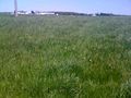
| + | Image:2009-05-18 42 -84 Distant Cows.jpg|These cows were in the same field as me, but far away | ||
| + | Image:2009-05-18 42 -84 Numbered Sheep.jpg|Sheep with big green numbers | ||
| + | Image:2009-05-18 42 -84 Road Kill Gamma.jpg|An unfortunate skunk | ||
| + | Image:2009-05-18 42 -84 Heading Home.jpg|Time to head back | ||
| + | Image:2009-05-18 42 -84 Not A Toll Road.jpg|Glad I don't live on this street | ||
| + | Image:2009-05-18 42 -84 MSU Tour.jpg|An appropriate picture for this two-day MSU tour | ||
| + | Image:2009-05-18 42 -84 Back Home.jpg|Back home! | ||
| + | Image:2009-05-18 42 -84 Walk.png|A recreation of my walk | ||
</gallery> | </gallery> | ||
| Line 28: | Line 93: | ||
[[Category:Meetup on 2009-05-18]] | [[Category:Meetup on 2009-05-18]] | ||
[[Category:Meetup in 42 -84]] | [[Category:Meetup in 42 -84]] | ||
| + | {{location|US|MI|IH}} | ||
Latest revision as of 03:24, 8 August 2019
| Mon 18 May 2009 in Lansing: 42.6902729, -84.4716312 geohashing.info google osm bing/os kml crox |
Contents
About
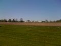
For the second consecutive day, this graticule's coordinates fell on a Michigan State University farm.
Expedition
excellentdude: Yesterday this graticule's coordinates fell so close to both my home and my office that I decided to walk there. I was so excited when I saw those coordinates because it was a beautiful day, and it might be a long time before the coordinates fell so close to me on such a day when I was available again. It was a very long time. Twenty-four whole hours. When today's coordinates came out, I was somewhat in shock. They were very near my home again, only about 50% farther from my apartment. This time, though, the map seemed to indicate that the farm containing the point was not on MSU's campus like yesterday. The point was near a road, however, so off I went on another geohashing walk with another great day all around me.
As with yesterday, I don't have track logs. So I took several pictures along my walk to verify the route. Along the way, I passed within meters of the previous day's hash. I got another picture, but it really seems too soon to tag the pics with the revisited category. Shortly after passing the old hash, the road I was walking on left town, narrowed drastically, gained an increased speed limit, and became much more rural. Fortunately the traffic was light enough that it wasn't too dangerous to walk along.
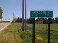
As I walked, I passed several more MSU farms. Unlike the previous day where all the farms were crop farms, these farms all had animals for various purposes. I also some some less fortunate animals along the way: a small tribe of road kill. Only one of the three was very identifiable, at least to me. I then turned at the last paved road intersection along my route. To the north, I kept seeing signs for various MSU farms. Today's hash point laid to the south, though. As I approached the point, I began seeing more animals (sheep, donkeys, horses) on the south side of the road. I was happy to find that the hash point was, in fact, on yet another MSU farm. As I began walking down the gravel farm road toward the hash point, I encountered a sign marking the area as restricted. I decided to see if anyone who I could ask permission of was in the large barn nearby. When I walked in, there was music playing and cattle in several stalls. There was a long corridor down the middle of the building, though, and eventually the barn stalls gave way to offices and other rooms. I entered an office and found a man painting in an adjacent room. He couldn't help me, but said someone who could would be back soon. I waited in the office for about ten minutes, getting to know the friendly dog and cat there. The person in question soon returned and quickly granted me permission to access the hash point.
I then proceeded down the restricted road to the hash. There was a pretty orchard across the road from the hash, but I couldn't tell what kind of orchard. When I finally got to the hash, it ended up being a couple meters inside the fenced field. I hopped a nearby gate, got my GPS reading and some photos, and happily went on my way. On the way home, I found that the sheep I had seen earlier had large green numbers on them. I don't know if they were tatooed on or not, but it looked unusual to a sheep-novice like me. I tried to get some pictures of this, but they didn't turn out too well. Farther along on the way home, I got a picture of one of the welcome signs to MSU. I figured it was a fitting way to end this two-day tour through MSU's campus and farms.
Achievements
excellentdude earned the Land geohash achievement
|
excellentdude earned the Walk geohash Achievement
|
excellentdude earned the Consecutive geohash achievement
|
excellentdude earned the Ambassador achievement
|
Photos
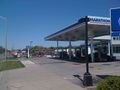
My journey begins again!
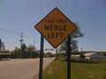
Walk Documentation
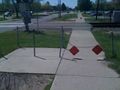
The barrier keeps bikers from crossing tracks without looking
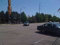
Where I turned to hash yesterday
Yesterday's hash
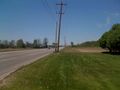
Heading out of town...
...the road becomes smaller...
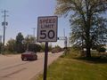
...and the speed limit goes up.
Horses, the first of many farm animals
Cops yesterday along walk, ambulance today
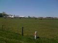
Animal farms are south of crop farms

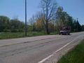
Scenic, though no sidewalk or even shoulder

An unfortunate squirrel?

An unfortunate raccoon?
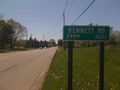
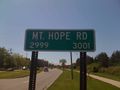
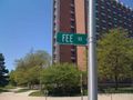
The last intersection before the hash
Bennett Farm on Bennett Road. Makes sense.
More animals: Donkey and sheep
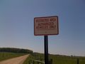
Going to need permission here
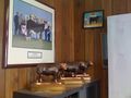
Sitting in the farm office...
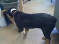
...with the farm dog...

...and the farm cat.
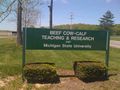
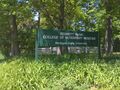
Hash is on this farm
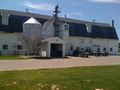
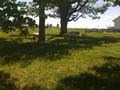
The barn/office I was in
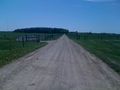
Walking down the road to the hash
I made it!

Obligatory goofy grin
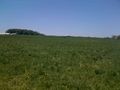
The hash itself

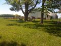
Looking back at barn from hash

The last road I was on from the hash

View of hash inside fence as I left
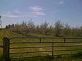
The ___ orchard across the road from the hash
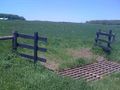
Cattle guard
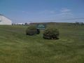
These cows were in the same field as me, but far away
Sheep with big green numbers
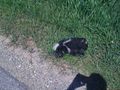
An unfortunate skunk
Time to head back
Glad I don't live on this street

An appropriate picture for this two-day MSU tour
Back home!
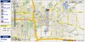
A recreation of my walk


