Difference between revisions of "2009-08-01 49 1"
imported>Paintedhell (report and photos.) |
imported>Paintedhell |
||
| Line 18: | Line 18: | ||
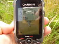
Image:Geo_20090801_49_1_2.jpg|Edgie showing the point. | Image:Geo_20090801_49_1_2.jpg|Edgie showing the point. | ||
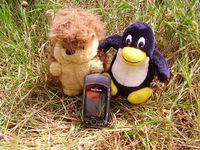
Image:Geo_20090801_49_1_3.jpg|Karl and Tux showing the Edgie. | Image:Geo_20090801_49_1_3.jpg|Karl and Tux showing the Edgie. | ||
| − | |||
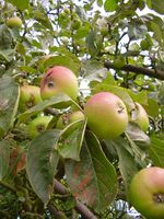
Image:Geo_20090801_49_1_5.jpg|The green strange things on the satellite picture were rows of cider apple trees in reality. | Image:Geo_20090801_49_1_5.jpg|The green strange things on the satellite picture were rows of cider apple trees in reality. | ||
</gallery> | </gallery> | ||
Revision as of 09:44, 14 November 2013
| Sat 1 Aug 2009 in 49,1: 49.8330528, 1.1372207 geohashing.info google osm bing/os kml crox |
Today Juja and J. were returning from their holiday - and the way home provided a chance on a multihash, which they happily took.
One evening before we were lucky enough to get a French waiter to tell us that there was free wi-fi at the bar (elemental knowledge for German tourists: French people don't seem to know what that strange "WLAN" is, it's "wi-fi" or nothing), so I could have a look on the weekend hashpoints and voilà: two of them (and maybe more) were right on our way back home!
We decided to try both points in Rouen and Amiens graticule, they seemed to be easy enough and this time I even had the satellite pictures to make sure they weren't in the middle of a wood or something. The first one was near Le Bois-Robert, a rather small village, but at a bigger street, so that was no problem. This hash was as easy as could be - we found the village, parked our car, the point was an a meadow which was full of thicket but at least didn't hurt to walk through, and on the point itself there was a circle of about one meter where the grass was absolutely short or bent down - obviously some crop circle aliens were geohashing on that day before...
So we took some photos and off we went to number two.
- Photo Gallery


