Difference between revisions of "1981-09-04 49 9"
imported>Danatar (New page: ''work in progress'' ...in a field with small corn plants, directly next to the road between Orendelsall and Hohensall. The next bigger town is Öhringen. This is part of a doublehash/d...) |
imported>FippeBot m (Location) |
||
| (2 intermediate revisions by one other user not shown) | |||
| Line 1: | Line 1: | ||
| − | + | {{meetup graticule | |
| + | | retro=1 | ||
| + | | lat=49 | ||
| + | | lon=9 | ||
| + | | date=1981-09-04 | ||
| + | | graticule_name=Würzburg | ||
| + | | graticule_link=Würzburg, Germany | ||
| + | }}__NOTOC__ | ||
| + | == Location == | ||
| − | + | [[User:Danatar|Danatar's]] [[Displaced origin geohash achievement|displaced origin]] location for the Würzburg graticule is in a field with small corn plants, directly next to the road between Orendelsall and Hohensall. The next bigger town is Öhringen. | |
| Line 10: | Line 18: | ||
*[[2009-10-17 49 8]] | *[[2009-10-17 49 8]] | ||
| + | == Retro expedition on 2009-10-17== | ||
| + | ===[[User:Danatar|Danatar]]=== | ||
| + | After today's hashpoint I continued along country roads towards my displaced origin location, not very far away. A light rain started again, but stopped before I reached the hashpoint. From Orendelsall on I used a narrow road which passed directly next to the hashpoint. I got out and stood at the edge of the hashfield. The GPS showed 0.00004° distance (3 metres) and I didn't want to trample the small plants, so I said "near enough" and drove onwards, to my real origin location. | ||
| − | + | ||
| + | {{displaced origin geohash | latitude = 49 | longitude = 9 | date = 1981-09-04 | on = 2009-10-17 | name = Danatar | gender = his | image = 1981-09-04_49_9_hp.jpg }} | ||
| + | <gallery> | ||
| + | Image:1981-09-04_49_9_steil.jpg|Steep street in Orendelsall | ||
| + | Image:1981-09-04_49_9_orendelsall.jpg|Orendelsall town sign | ||
| + | Image:1981-09-04_49_9_bach.jpg|Creek near the hashpoint | ||
| + | Image:1981-09-04_49_9_gps.jpg|GPS | ||
| + | Image:1981-09-04_49_9_hp.jpg|Retro coordinates reached! | ||
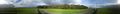
| + | Image:1981-09-04_49_9_panorama.jpg|Panorama | ||
| + | </gallery> | ||
| + | |||
| + | [[Category:Expeditions with photos]] | ||
| + | [[Category:Retro coordinates reached]] | ||
| + | [[Category:Danatar]] | ||
| + | {{location|DE|BW|ÖHR}} | ||
Latest revision as of 03:51, 7 August 2019
| Fri 4 Sep 1981 in Würzburg: 49.2553915, 9.5558053 geohashing.info google osm bing/os kml crox |
Location
Danatar's displaced origin location for the Würzburg graticule is in a field with small corn plants, directly next to the road between Orendelsall and Hohensall. The next bigger town is Öhringen.
This is part of a doublehash/doubleretrohash expedition:
- 2009-10-17 49 9
- 1981-09-04 49 9 (displaced origin)
- 1981-09-04 49 8 (the real origin)
- 2009-10-17 49 8
Retro expedition on 2009-10-17
Danatar
After today's hashpoint I continued along country roads towards my displaced origin location, not very far away. A light rain started again, but stopped before I reached the hashpoint. From Orendelsall on I used a narrow road which passed directly next to the hashpoint. I got out and stood at the edge of the hashfield. The GPS showed 0.00004° distance (3 metres) and I didn't want to trample the small plants, so I said "near enough" and drove onwards, to my real origin location.
Danatar earned the Displaced origin geohash achievement
|
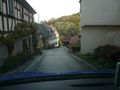
Steep street in Orendelsall
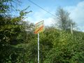
Orendelsall town sign
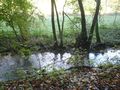
Creek near the hashpoint

GPS
Retro coordinates reached!
Panorama


