Difference between revisions of "2009-11-06 39 -86"
imported>ErWenn (Photos) |
imported>FippeBot m (Location) |
||
| (4 intermediate revisions by 2 users not shown) | |||
| Line 18: | Line 18: | ||
== Expedition == | == Expedition == | ||
| − | The hash looked accessible, about a hundred feet off of Moores Creek Road, so we went for it. If I (Erik) had looked at a map instead of just the satellite photos, I would have realized that it was practically sitting in Moore Creek. (Notice how the creek is just "Moore Creek", but the road is "Moore<strong>s</strong> Creek"? Ah, naming conventions.) Duncan was a little wary about the leaves covering the ground, but eventually he warmed up to it and became his usual straining-at-the-end-of-his-leash-if-you-pause-for-more-than-five-seconds self. The creek was so shallow, that I thought it might be a good candidate for the [[Walking on | + | The hash looked accessible, about a hundred feet off of Moores Creek Road, so we went for it. If I (Erik) had looked at a map instead of just the satellite photos, I would have realized that it was practically sitting in Moore Creek. (Notice how the creek is just "Moore Creek", but the road is "Moore<strong>s</strong> Creek"? Ah, naming conventions.) Duncan was a little wary about the leaves covering the ground, but eventually he warmed up to it and became his usual straining-at-the-end-of-his-leash-if-you-pause-for-more-than-five-seconds self. The creek was so shallow, that I thought it might be a good candidate for the [[Walking on water geohash achievement]]. I'll post to the talk pages there to see if it counts as enough water. I mean it is a body of water that shows up on maps (if only as a thin blue line)... Within the margin of error of my GPS receiver, there were spots that were probably ankle-deep, parts that were completely dry, and parts that were about half a centimeter deep (which is where I'm standing in the picture below). |
We also attempted a nearby (0.9 miles) [[Hash collision achievement|geocache]], but it got too dark, so we had to give up. | We also attempted a nearby (0.9 miles) [[Hash collision achievement|geocache]], but it got too dark, so we had to give up. | ||
| Line 27: | Line 27: | ||
<gallery perrow="4"> | <gallery perrow="4"> | ||
| − | Image:2009- | + | Image:2009-09-06 39 -86 proof.jpg | Proof! |
| − | Image:2009- | + | Image:2009-09-06 39 -86 Duncan.jpg | Duncan attempts the Walking on Water achievement |
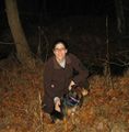
| − | Image:2009- | + | Image:2009-09-06 39 -86 Kira.jpg | Kira and Duncan near the hash |
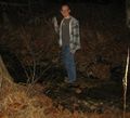
| − | Image:2009- | + | Image:2009-09-06 39 -86 Erik.jpg | Erik attempts the Walking on Water achievement |
</gallery> | </gallery> | ||
| Line 43: | Line 43: | ||
[[Category:Meetup in 39 -86]] | [[Category:Meetup in 39 -86]] | ||
[[Category:Expeditions with dogs]] | [[Category:Expeditions with dogs]] | ||
| − | + | {{location|US|IN|MR}} | |
| − | |||
Latest revision as of 06:41, 8 August 2019
| Fri 6 Nov 2009 in 39,-86: 39.1107714, -86.4648176 geohashing.info google osm bing/os kml crox |
Location
About a mile north of Lake Monroe near Moore Creek.
Participants
Erik, Kira, and Duncan.
Expedition
The hash looked accessible, about a hundred feet off of Moores Creek Road, so we went for it. If I (Erik) had looked at a map instead of just the satellite photos, I would have realized that it was practically sitting in Moore Creek. (Notice how the creek is just "Moore Creek", but the road is "Moores Creek"? Ah, naming conventions.) Duncan was a little wary about the leaves covering the ground, but eventually he warmed up to it and became his usual straining-at-the-end-of-his-leash-if-you-pause-for-more-than-five-seconds self. The creek was so shallow, that I thought it might be a good candidate for the Walking on water geohash achievement. I'll post to the talk pages there to see if it counts as enough water. I mean it is a body of water that shows up on maps (if only as a thin blue line)... Within the margin of error of my GPS receiver, there were spots that were probably ankle-deep, parts that were completely dry, and parts that were about half a centimeter deep (which is where I'm standing in the picture below).
We also attempted a nearby (0.9 miles) geocache, but it got too dark, so we had to give up.


