Difference between revisions of "2010-04-25 59 10"
imported>Relet (a live expedition message sent via geohashdroid for android.) |
imported>Relet (+photos) |
||
| Line 1: | Line 1: | ||
| − | |||
<!-- If you did not specify these parameters in the template, please substitute appropriate things for IMAGE, LAT, LON, and DATE (YYYY-MM-DD format) | <!-- If you did not specify these parameters in the template, please substitute appropriate things for IMAGE, LAT, LON, and DATE (YYYY-MM-DD format) | ||
| Line 44: | Line 43: | ||
*I made it home, apparently. -- [[User:relet|relet]] 20:07, 25 April 2010 (MESZ) | *I made it home, apparently. -- [[User:relet|relet]] 20:07, 25 April 2010 (MESZ) | ||
| − | |||
| − | <!-- | + | == Photos == |
| − | [ | + | |
| − | --> | + | <gallery> |
| + | File:2010-04-25-59-10-P1050960.JPG | Everyone should have a fjord. Even Africa! The weather is a bit rainy though. | ||
| + | File:2010-04-25-59-10-P1050962.JPG | Reached Vikersund. They have boats. | ||
| + | File:2010-04-25-59-10-P1050963.JPG | This could be a scenic holiday location, if it wasn't situated next to the main bridge. | ||
| + | File:2010-04-25-59-10-P1050965.JPG | There is an old "church road" apparently. | ||
| + | File:2010-04-25-59-10-P1050966.JPG | The track I chose up the mountain changed from "patches of snow" to this. | ||
| + | File:2010-04-25-59-10-P1050967.JPG | I was following someone's footsteps most of the time. At least I knew where I would be about to break in. | ||
| + | File:2010-04-25-59-10-P1050968.JPG | And then, a road! | ||
| + | Image:2010-04-25_59_10_15-16-23-515.jpg | They're taunting me! Or is tempting the right word? [http://www.openstreetmap.org/?lat=59.899986&lon=9.909779&zoom=16&layers=B000FTF @59.9000,9.9098] | ||
| + | File:2010-04-25-59-10-P1050969.JPG | It didn't even look very locked. | ||
| + | File:2010-04-25-59-10-P1050970.JPG | I has a view. | ||
| + | File:2010-04-25-59-10-P1050971.JPG | And some [http://kart.statkart.no|excellent maps]] on my android. If only the skidoo drivers would stick to the unmarked paths hidden under the snow. | ||
| + | File:2010-04-25-59-10-P1050972.JPG | The ants were rather busy already. | ||
| + | File:2010-04-25-59-10-P1050973.JPG | According to my map, this is a lake/swamp. | ||
| + | File:2010-04-25-59-10-P1050974.JPG | The best snowshoes money can buy. Truuuuust me. (But frankly, the wide soles did not fare so bad.) | ||
| + | File:2010-04-25-59-10-P1050975.JPG | More antsy goodness. | ||
| + | File:2010-04-25-59-10-P1050976.JPG | A geohut! That was unexpected! | ||
| + | File:2010-04-25-59-10-P1050977.JPG | You can tell it wants to become a lake again. | ||
| + | File:2010-04-25-59-10-P1050980.JPG | Coordinates reached! | ||
| + | File:2010-04-25-59-10-P1050981.JPG | RMaps agrees. | ||
| + | File:2010-04-25-59-10-P1050982.JPG | Happy tired geohasher. | ||
| + | Image:2010-04-25_59_10_09-10-43-976.jpg | Not a good idea. | ||
| + | File:2010-04-25-59-10-P1050983.JPG | On the way back - a canyon. | ||
| + | File:2010-04-25-59-10-P1050984.JPG | I like this tree stump. | ||
| + | File:2010-04-25-59-10-P1050985.JPG | I has more view. | ||
| + | File:2010-04-25-59-10-P1050986.JPG | I came out pretty close to the old church. | ||
| + | File:2010-04-25-59-10-P1050988.JPG | More history. | ||
| + | File:2010-04-25-59-10-P1050989.JPG | More history. | ||
| + | </gallery> | ||
| − | |||
[[Category:Expeditions]] | [[Category:Expeditions]] | ||
| − | |||
[[Category:Expeditions with photos]] | [[Category:Expeditions with photos]] | ||
| − | |||
| − | |||
| − | |||
| − | |||
| − | |||
[[Category:Coordinates reached]] | [[Category:Coordinates reached]] | ||
| − | |||
| − | |||
| − | |||
| − | |||
| − | |||
| − | |||
| − | |||
| − | |||
| − | |||
| − | |||
| − | |||
| − | |||
| − | |||
Revision as of 07:44, 26 April 2010
| Sun 25 Apr 2010 in 59,10: 59.9440030, 10.0453958 geohashing.info google osm bing/os kml crox |
Location
Participants
Plans
Expedition
- I don't know if I will get far, but here we go, Trusty and me. -- relet @60.1485,10.2685 10:47, 25 April 2010 (MESZ)
- With the fruit trees and the church bells ringing, I feel like in my grandma's village. -- relet @60.1485,10.2685 10:58, 25 April 2010 (MESZ)
- Until here, this was all just a detour, to avoid the highway bridge, which is closed for cyclists. -- relet @60.1485,10.2685 11:16, 25 April 2010 (MESZ)
- I could cycle alongside fjords all day long. In fact, that's what I am going to do. Yay! -- relet @60.1485,10.2685 11:30, 25 April 2010 (MESZ)
- Reached Vikersund and started walking. The rule of the game today is obviously to keep dry shoes. And don't talk about geohashing! -- relet @59.9506,10.0151 13:59, 25 April 2010 (MESZ)
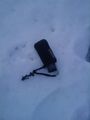
- Coordinates reached. No reception at hashpoint. Lost and found my camera. Broke both rules. Ducking tired. Time to think about the return trip. -- relet @59.9371,10.0369 16:30, 25 April 2010 (MESZ)
- As usual, the return path is so much less complicated. And this canyon is amazing. -- relet @59.9415,10.0078 17:04, 25 April 2010 (MESZ)
- According to recent statistics, there are only slightly fewer trees than elk droppings. -- relet @59.9415,10.0078 17:09, 25 April 2010 (MESZ)
- I made it home, apparently. -- relet 20:07, 25 April 2010 (MESZ)
Photos
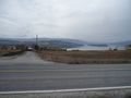
Everyone should have a fjord. Even Africa! The weather is a bit rainy though.
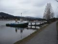
Reached Vikersund. They have boats.
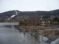
This could be a scenic holiday location, if it wasn't situated next to the main bridge.
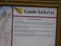
There is an old "church road" apparently.
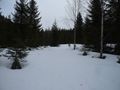
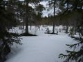
The track I chose up the mountain changed from "patches of snow" to this.
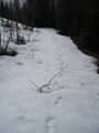
I was following someone's footsteps most of the time. At least I knew where I would be about to break in.
And then, a road!
They're taunting me! Or is tempting the right word? @59.9000,9.9098
It didn't even look very locked.
I has a view.
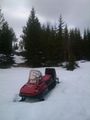
And some maps] on my android. If only the skidoo drivers would stick to the unmarked paths hidden under the snow.
The ants were rather busy already.
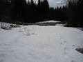
According to my map, this is a lake/swamp.
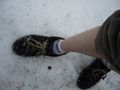
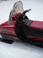
The best snowshoes money can buy. Truuuuust me. (But frankly, the wide soles did not fare so bad.)
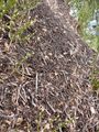
More antsy goodness.
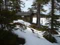
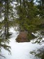
A geohut! That was unexpected!
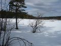
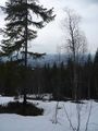
You can tell it wants to become a lake again.

Coordinates reached!
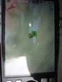
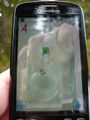
RMaps agrees.

Happy tired geohasher.
Not a good idea.
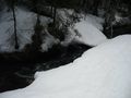
On the way back - a canyon.
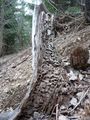
I like this tree stump.
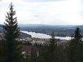
I has more view.
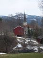
I came out pretty close to the old church.
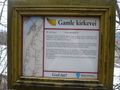
More history.
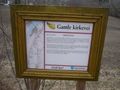
More history.


