Difference between revisions of "2010-05-13 52 13"
From Geohashing
imported>Davidc (must write this up soon) |
imported>Davidc (+photos) |
||
| Line 30: | Line 30: | ||
--> | --> | ||
<gallery perrow="5"> | <gallery perrow="5"> | ||
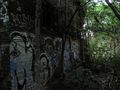
| + | File:2010-05-13_52_13_IMG_2193.JPG|Hashpoint and boarded up house hiding in the trees. | ||
| + | File:2010-05-13_52_13_IMG_0230.PNG|iPhone GPS proof. | ||
| + | File:2010-05-13_52_13_IMG_0234.PNG|iPhone map proof. | ||
| + | File:2010-05-13_52_13_IMG_2182.JPG|Boarded up hashhouse. | ||
| + | File:2010-05-13_52_13_IMG_2186.JPG|This place is giving us the willies. | ||
| + | File:2010-05-13_52_13_IMG_2191.JPG|Hashhouse side wall. | ||
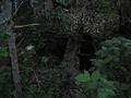
| + | File:2010-05-13_52_13_IMG_2181.JPG|Hashcellar | ||
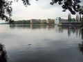
| + | File:2010-05-13_52_13_IMG_2196.JPG|Looking across the Rummelsberger See. | ||
| + | File:2010-05-13_52_13_IMG_2197.JPG|View down the Rummelsburger See from safety. | ||
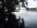
| + | File:2010-05-13_52_13_IMG_2199.JPG|View from the other side of the lake. Just because. | ||
</gallery> | </gallery> | ||
Revision as of 18:29, 21 May 2010
| Thu 13 May 2010 in 52,13: 52.5004698, 13.4701942 geohashing.info google osm bing/os kml crox |
Location
Waterfront by S-bahn Ostkreuz.
Participants
Plans
- If the weather's nice, I might spend the afternoon geocaching nearby, so I'm easy regarding the time. --davidc 17:06, 12 May 2010 (UTC)
Expedition
I made it. Writeup to follow.
Tracklog
Photos
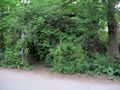
Hashpoint and boarded up house hiding in the trees.
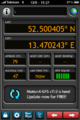
iPhone GPS proof.
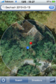
iPhone map proof.
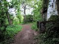
Boarded up hashhouse.

This place is giving us the willies.
Hashhouse side wall.
Hashcellar
Looking across the Rummelsberger See.
View down the Rummelsburger See from safety.

View from the other side of the lake. Just because.


