Difference between revisions of "2010-07-25 45 -122"
imported>Jiml (Expand Template) |
imported>FippeBot m (Location) |
||
| (17 intermediate revisions by 3 users not shown) | |||
| Line 1: | Line 1: | ||
| + | [[File:2010-07-25 45 -122 Landscape.JPG|The area around the hashpoint.|thumb|left]] | ||
| − | |||
| − | |||
| − | |||
| − | |||
| − | |||
| − | |||
| − | |||
| − | |||
| − | |||
{{meetup graticule | {{meetup graticule | ||
| lat=45 | | lat=45 | ||
| Line 15: | Line 7: | ||
}} | }} | ||
| − | |||
__NOTOC__ | __NOTOC__ | ||
== Location == | == Location == | ||
| − | + | Near the center of Lone Fir Cemetery, in Southeast Portland. | |
== Participants == | == Participants == | ||
| − | + | ||
| + | |||
| + | |||
| + | Expedition 5000 | ||
| + | * [[User:Michael5000|Michael5000]] | ||
| + | * [[User:Mrs.5000|Mrs.5000]] | ||
| + | Expedition two | ||
| + | * [[User:Jiml|Jim]] | ||
| + | Expedition drei | ||
| + | * [[User:Elegant Forkbomb|Forkbomb]] | ||
== Plans == | == Plans == | ||
| − | + | ||
| + | Jim's thought about it, but couldn't think of anything to make it really interesting, so he | ||
| + | just went. | ||
| + | |||
| + | APR can't make it. | ||
| + | |||
== Expedition == | == Expedition == | ||
| − | |||
| − | == | + | ===Expedition5000=== |
| − | + | ||
| + | Michael5000 woke up and checked the hashpoint. "Holy cats!" he exclaimed to Mrs.5000. "We're going geohashing!" And they walked down the street to the hashpoint in nearby Lone Fir Cemetery. | ||
| + | |||
| + | {{Walk geohash | ||
| + | | latitude = 45 | ||
| + | | longitude = -122 | ||
| + | | date = 2010-07-25 | ||
| + | | name = [[User:Michael5000|Michael5000]] and [[User:Mrs.5000|Mrs.5000]] | ||
| + | | distance = a mile and a half, round trip. | ||
| + | }} | ||
| + | |||
| + | ===Expedition Two=== | ||
| + | |||
| + | Jim finished up the chores he had to do and headed out. He first went in | ||
| + | search of blueberries, but took a wrong turn on the back roads he was taking and | ||
| + | ended up going the long way around. However, around one turn he ran | ||
| + | into a graveyard. Since he was still in Washington County, I guess that means that | ||
| + | this expedition qualifies for his "Graveyards of Washington County" series. | ||
| + | He also got to take a picture of Mount Hood since it was being quite visible. | ||
| + | |||
| + | He got some more blueberries, and then put them way in the back of the car so he | ||
| + | couldn't snack on them on the way, resulting in a loss of 20-30% of the original | ||
| + | amount. He then headed for Portland, but was struck by how heavy the traffic was. | ||
| + | |||
| + | However, it thinned out, and he eventually made it to SE Portland. He didn't find | ||
| + | Stark Street, but finally decided to just follow the GPS direction arrow and see | ||
| + | what happened. I eventually found myself at Lone Fir, which seems to be a Pioneer | ||
| + | Cemetery, whatever that is. (I noticed an article in the paper a few days later about | ||
| + | the fact that funds to maintain these cemeteries has become scare.) | ||
| + | |||
| + | I wandered around for a while looking a grave markers, then let the GPS | ||
| + | lead me to the hashpoint. There was a pioneer rose garden at the "zero" distance | ||
| + | point, so I stuck to the outer edge at 10 feet or so. There actually were a number | ||
| + | of graves close in, so a number of folks may have a Coffin Potato. | ||
| + | |||
| + | I took some pictures, wandered a little more, and headed home. | ||
| + | |||
| + | ===Expedition Drei=== | ||
| + | |||
| + | Forkbomb was poking around on his phone to avoid making eye contact on the train, and discovered that not only was the hashpoint just across the river, it was in a cemetery. Forkbomb likes cemeteries. | ||
| + | |||
| + | As near as I could tell with all the multipath interference, credit for the coffin potato achievement goes to the the Hill family. They [http://www.familysearch.org/eng/search/Census/household_record.asp?HOUSEHOLD_CODE=1880US_4477716&HOUSEHOLD_SUB=1&frompage=99| look] to have been woodworkers from Illinois, though their web presence is sadly lacking. | ||
== Photos == | == Photos == | ||
| − | < | + | |
| − | Image: | + | <gallery perrow="5"> |
| − | --> | + | Image:2010-07-25 45 -122 Landscape.JPG|The area around the hashpoint. |
| + | Image:2010-07-25 45 -122 M5K.JPG|Michael5000 | ||
| + | Image:2010-07-25 45 -122 Mrs5K.JPG|Mrs.5000, looking ghostly | ||
| + | Image:2010-07-25 45 -122 Bear5K.JPG|A hashcot, oblivious of cemetery etiquette. He meant no disrespect. | ||
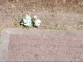
| + | Image:2010-07-25 45 -122 Nearest.JPG|The nearest posthumous geohasher. | ||
| + | </gallery> | ||
| + | |||
| + | <gallery perrow="5"> | ||
| + | Image:2010-07-25_45_-122-trip-start.jpg | A Wheaty start | ||
| + | Image:2010-07-25_45_-122-blooming-gate.jpg | A Graveyard of Washington County | ||
| + | Image:2010-07-25_45_-122-blooming-view.jpg | View of the much of it | ||
| + | Image:2010-07-25_45_-122-hood.jpg | Mount Hood peeking over the horizon | ||
| + | Image:2010-07-25_45_-122-sign.jpg | Pioneer Graveyards of Multnomah County | ||
| + | Image:2010-07-25_45_-122-roses1.jpg | The hashpoint is among the pioneer roses | ||
| + | Image:2010-07-25_45_-122-roses2.jpg | The roses themselves | ||
| + | Image:2010-07-25_45_-122-fir-decoration.jpg | Some graves have little decorations | ||
| + | Image:2010-07-25_45_-122-fir-maus.jpg | Some are more stately | ||
| + | Image:2010-07-25_45_-122-gps.jpg | The GPS got close | ||
| + | |||
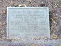
| + | Image:2010-07-25_45_-122-marker3.jpg | Another nearby coffin potato? | ||
| + | Image:2010-07-25_45_-122-squirrel.jpg | One of our other geohashers would approve of this greeter | ||
| + | |||
| + | |||
| + | </gallery> | ||
| + | |||
| + | |||
<gallery perrow="5"> | <gallery perrow="5"> | ||
| + | Image:2010-07-25 13.38.22.jpg | | ||
| + | Image:2010-07-25 13.22.59 Portland Oregon US.jpg | | ||
</gallery> | </gallery> | ||
| − | == Achievements == | + | ==Achievements == |
{{#vardefine:ribbonwidth|800px}} | {{#vardefine:ribbonwidth|800px}} | ||
<!-- Add any achievement ribbons you earned below, or remove this section --> | <!-- Add any achievement ribbons you earned below, or remove this section --> | ||
| + | * Land Geohash | ||
| + | * Coffin Potato | ||
| − | |||
| − | |||
| − | |||
| − | |||
| − | |||
| − | |||
| − | |||
| − | |||
| − | |||
[[Category:Expeditions]] | [[Category:Expeditions]] | ||
| − | |||
[[Category:Expeditions with photos]] | [[Category:Expeditions with photos]] | ||
| − | |||
| − | |||
| − | |||
| − | |||
[[Category:Coordinates reached]] | [[Category:Coordinates reached]] | ||
| − | + | {{location|US|OR|MU}} | |
| − | |||
| − | |||
| − | |||
| − | |||
| − | |||
| − | |||
| − | |||
| − | |||
| − | |||
Latest revision as of 02:58, 9 August 2019

| Sun 25 Jul 2010 in 45,-122: 45.5182129, -122.6414956 geohashing.info google osm bing/os kml crox |
Location
Near the center of Lone Fir Cemetery, in Southeast Portland.
Participants
Expedition 5000
Expedition two
Expedition drei
Plans
Jim's thought about it, but couldn't think of anything to make it really interesting, so he just went.
APR can't make it.
Expedition
Expedition5000
Michael5000 woke up and checked the hashpoint. "Holy cats!" he exclaimed to Mrs.5000. "We're going geohashing!" And they walked down the street to the hashpoint in nearby Lone Fir Cemetery.
Michael5000 and Mrs.5000 earned the Walk geohash Achievement
|
Expedition Two
Jim finished up the chores he had to do and headed out. He first went in search of blueberries, but took a wrong turn on the back roads he was taking and ended up going the long way around. However, around one turn he ran into a graveyard. Since he was still in Washington County, I guess that means that this expedition qualifies for his "Graveyards of Washington County" series. He also got to take a picture of Mount Hood since it was being quite visible.
He got some more blueberries, and then put them way in the back of the car so he couldn't snack on them on the way, resulting in a loss of 20-30% of the original amount. He then headed for Portland, but was struck by how heavy the traffic was.
However, it thinned out, and he eventually made it to SE Portland. He didn't find Stark Street, but finally decided to just follow the GPS direction arrow and see what happened. I eventually found myself at Lone Fir, which seems to be a Pioneer Cemetery, whatever that is. (I noticed an article in the paper a few days later about the fact that funds to maintain these cemeteries has become scare.)
I wandered around for a while looking a grave markers, then let the GPS lead me to the hashpoint. There was a pioneer rose garden at the "zero" distance point, so I stuck to the outer edge at 10 feet or so. There actually were a number of graves close in, so a number of folks may have a Coffin Potato.
I took some pictures, wandered a little more, and headed home.
Expedition Drei
Forkbomb was poking around on his phone to avoid making eye contact on the train, and discovered that not only was the hashpoint just across the river, it was in a cemetery. Forkbomb likes cemeteries.
As near as I could tell with all the multipath interference, credit for the coffin potato achievement goes to the the Hill family. They look to have been woodworkers from Illinois, though their web presence is sadly lacking.
Photos
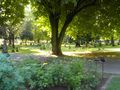
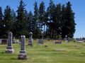
The area around the hashpoint.

Michael5000
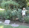
Mrs.5000, looking ghostly
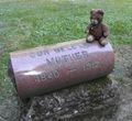
A hashcot, oblivious of cemetery etiquette. He meant no disrespect.
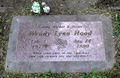
The nearest posthumous geohasher.


A Wheaty start
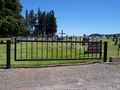
A Graveyard of Washington County
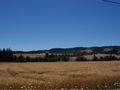
View of the much of it
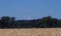
Mount Hood peeking over the horizon
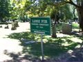
Pioneer Graveyards of Multnomah County
The hashpoint is among the pioneer roses
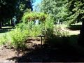
The roses themselves
Some graves have little decorations
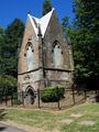
Some are more stately

The GPS got close
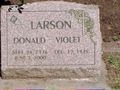
Another nearby coffin potato?
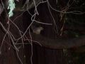
One of our other geohashers would approve of this greeter


Achievements
- Land Geohash
- Coffin Potato