Difference between revisions of "2010-08-10 51 0"
imported>Sourcerer |
imported>Sourcerer (→Image Gallery) |
||
| Line 24: | Line 24: | ||
<gallery perrow="1"> | <gallery perrow="1"> | ||
| − | Image: | + | Image:2010-08-07_51_0_River_Rrouch.jpg|River Crouch. |
| + | Image:2010-08-07_51_0_SSSI.jpg|Site of Special Scientific Interest. | ||
</gallery> | </gallery> | ||
Revision as of 20:20, 10 August 2010
Location
The hash point was located in a recently harvested field near but not on Wallasea Island, Essex, United Kingdom. It was close to a public foot path and as the crops had just been harvested, a small tresspass was possible without causing any damage. The GPS track can be seen at Wikiloc.
| Tue 10 Aug 2010 in East London: 51.6189153, 0.7722010 geohashing.info google osm bing/os kml crox |
Participants
Expedition
This walk documentted at wikiloc has the best views if you go clockwise. The path starts with fine views over the river Crouch vallley. The second leg heads east with the river on the left and a nature reserve on the right. The last leg is less interesting but still pleasant with a short road leg at the end. At the end point there are two pubs and a vilage shop. A couple of the stiles are not in good repair and a little hard to negotiate. The Wikiloc waymark is the geohash location in a stubble field recently harvested.
Image Gallery
- 2010-08-07 51 0 River Rrouch.jpg
River Crouch.
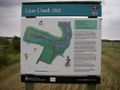
Site of Special Scientific Interest.
