Difference between revisions of "2010-09-12 42 2"
imported>Relet (→Expedition) |
imported>Relet (→Photos) |
||
| Line 44: | Line 44: | ||
{{#vardefine:gaLines|2}} | {{#vardefine:gaLines|2}} | ||
{{Gallery2| | {{Gallery2| | ||
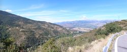
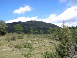
| − | + | {{GalleryItem | File:2010-09-12_42_2_torres.JPG | As seen from the mountain passes }} | |
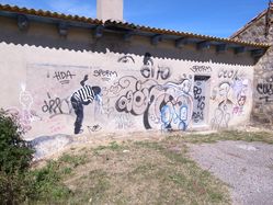
| + | {{GalleryItem | File:2010-09-12_42_2_R1061357.JPG | Street art on the only street around }} | ||
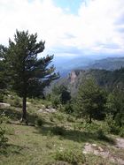
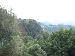
| + | {{GalleryItem | File:2010-09-12_42_2_torres2.JPG | More vistas }} | ||
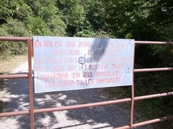
| + | {{GalleryItem | File:2010-09-12_42_2_R1061374.JPG | It's a gate! }} | ||
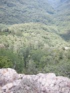
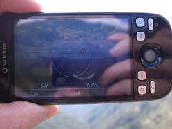
| + | {{GalleryItem | File:2010-09-12_42_2_utsikt.JPG | The view from not quite at the geohash }} | ||
| + | {{GalleryItem | File:2010-09-12_42_2_R1061391.JPG | Still a grin }} | ||
| + | {{GalleryItem | File:2010-09-12_42_2_R1061392.JPG | Looking down }} | ||
| + | {{GalleryItem | File:2010-09-12_42_2_R1061396.JPG | 72m that way }} | ||
| + | {{GalleryItem | File:2010-09-12_42_2_R1061397.JPG | Puig de Comaneyra }} | ||
| + | {{GalleryItem | File:2010-09-12_42_2_R1061398.JPG | Steepness from afar }} | ||
| + | {{GalleryItem | File:2010-09-12_42_2_R1061402.JPG | Steepness from the other side }} | ||
| + | {{GalleryItem | File:2010-09-12_42_2_R1061403.JPG | Not the only madman }} | ||
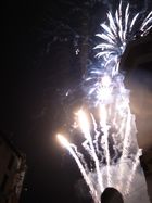
| + | {{GalleryItem | File:2010-09-12_42_2_R1061420.JPG | It's a fiesta! }} | ||
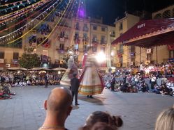
| + | {{GalleryItem | File:2010-09-12_42_2_R1061426.JPG | With dancing giants! }} | ||
}} | }} | ||
Revision as of 19:37, 15 September 2010
| Sun 12 Sep 2010 in 42,2: 42.3299831, 2.5132765 geohashing.info google osm bing/os kml crox |
Location
Just south of the southernmost tip of France.
Participants
Plans
Expedition
Expedition
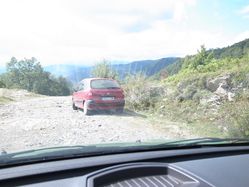
The drive from Seu d'Urgell to here led me over the wonderful high-mountain roads Carretera de Toses and - Torres, and then back up again on a mostly one-lane road in the direction of Beget. From whence, in a road bend, an unmarked rubble track followed on to just south of the Puig del Comanegra, the southernmost point of France, for the remaining 4.1km as the crow would fly at a higher altitude, weather permitting. If I say rubble track, I say the kind of rubble that consists of large, loose rocks which you can navigate in a 4x4. Or in a Ford Fiesta, in the first gear, clenching your teeth every time you can't avoid to drive over one of the larger rocks pointing up. I guess I hit a few, but that's why the cheap cars have plastic fenders making noise before you actually hit something vital.
I passed an improvised refugee camp (or something that looked like it, without the refugees), and later reached a gate, which said (I presume, since it is in Catalán): "Free range cattle, they may damage your vehicle or taunt you. If attacked, stay inside your car." - I assumed that did not translate as "no cars beyond this point" or "private property" but rather the opposite. I opened the gate and proceeded.
At about 22Om to the hash, I passed another Seat something. I obviously wasn't the only one who considered this a road. In the direction of the hash however, there was a perceived grade of about 100%. A few hundred meters further on I encountered an 4x4 driver who gave me a weird look. I smiled and greeted. I parked a bit later, when it was clear that the road wouldn't come much closer to the hash again. To my left, there was the Puig del Comanegra, to the right there was some grassland, which soon enough ended in steepness and some kind of forest.
I grabbed my camera and GPS and trodded on. I soon discovered that there were convenient cow tracks all across the forest. By convenient I mean that they were barely a cow wide and barely a cow high, so that I constantly had to duck under the branches and brambles, while navigating the muddy (and cow-shitty) slope. I scrambled down until a rocky riverbed, only to find the hash being more in the direction of the next hill. I scrambled up again, to find another meadow. I followed the meadow to be rewarded with a wonderful panorama over the mountain range. Which was partly due to the fact that to my feet there was a 70m vertical drop. Estimated distance to the hash: 72m (horizontal).
I could have scrambled back to the riverbed, and tried if that one would lead me to a lower area of the mountains, or investigated the steeper and muddier slopes to the other side. I guess I could have reached the hash with a little more dedication, but I decided that really this was all Mother Nature wanted to show me by placing the hash here, and called it a day.
I scrambled back to the car, drove back on the rocky track, and on to Olot, where I was in time to see the Feste del Tura, the last day of the local fiesta.
Tracklog
...
Photos
..
|
