Difference between revisions of "2010-10-13 -36 174"
From Geohashing
imported>Jiml m (Typos) |
imported>Greenslime m |
||
| Line 27: | Line 27: | ||
<gallery perrow="5"> | <gallery perrow="5"> | ||
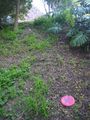
File:2010-10-13 -36 174 GMap.JPG|The hash map, hope i don't 'accidentally' lose my Frisbee in the trees ;) | File:2010-10-13 -36 174 GMap.JPG|The hash map, hope i don't 'accidentally' lose my Frisbee in the trees ;) | ||
| + | File:2010-10-13 -36 174 Frisbee.jpg| | ||
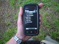
| + | File:2010-10-13 -36 174 GPS.jpg| | ||
| + | File:2010-10-13 -36 174 Me.jpg| | ||
| + | File:2010-10-13 -36 174 View from the hash.jpg| | ||
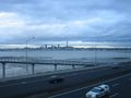
| + | File:2010-10-13 -36 174 Auckland.jpg| | ||
</gallery> | </gallery> | ||
== Achievements == | == Achievements == | ||
{{#vardefine:ribbonwidth|800px}} | {{#vardefine:ribbonwidth|800px}} | ||
| − | |||
| − | |||
| − | |||
| − | |||
| − | |||
| − | |||
[[Category:Expeditions]] | [[Category:Expeditions]] | ||
| − | |||
[[Category:Expeditions with photos]] | [[Category:Expeditions with photos]] | ||
| − | [[Category:Expeditions with videos]] | + | [[Category:Expeditions with videos]] |
| − | |||
| − | |||
| − | |||
[[Category:Coordinates reached]] | [[Category:Coordinates reached]] | ||
| − | |||
| − | |||
| − | |||
| − | |||
| − | |||
| − | |||
| − | |||
| − | |||
| − | |||
| − | |||
Revision as of 07:11, 13 October 2010
| Wed 13 Oct 2010 in -36,174: -36.8075388, 174.7564252 geohashing.info google osm bing/os kml crox |
Location
A backyard, right next to a park, right next to the approach to the Auckland Harbour Bridge
Participants
Plans
On first looking, I thought this had landed on the motorway, thus I would have passed through it on my commute this morning. Not quite, it's in someones bushy back yard right next to a park. I'm going to make more of an effort to get to the actual coordinates, I might try the Frisbee approach. Of course, I'm going to take my kite too, but not for playing near the trees. After work today, it's all on!!!
Expedition
Tracklog
Photos

The hash map, hope i don't 'accidentally' lose my Frisbee in the trees ;)