Difference between revisions of "2011-01-25 60 10"
imported>Relet (yay!) |
imported>Relet |
||
| Line 44: | Line 44: | ||
== Achievements == | == Achievements == | ||
{{#vardefine:ribbonwidth|800px}} | {{#vardefine:ribbonwidth|800px}} | ||
| + | {{Gratuitous ribbon| color = blue | latitude = 60 | longitude = 10 | date = 2011-01-25 | achievement = Ski geohash | description = reaching a geohash exclusively on skis or skates | image = High.PNG }} | ||
[[Category:Expeditions]] | [[Category:Expeditions]] | ||
[[Category:Expeditions with photos]] | [[Category:Expeditions with photos]] | ||
[[Category:Coordinates reached]] | [[Category:Coordinates reached]] | ||
| + | [[Category:Ski geohash]] | ||
Revision as of 18:58, 25 January 2011
| Tue 25 Jan 2011 in 60,10: 60.0835668, 10.2646827 geohashing.info google osm bing/os kml crox |
Location
- In the ski area of Vik.
Participants
Plans
- A quick ski-by after work.
- I should be able to reach the hash about 17:40.. it might be murky to dark by then.
Expedition
I started the expedition at a friend's house, whom I may not have visited, had he not had a geohash in his extended backyard. Is that stretching the rules too much? To me it feels just too perfect an opportunity not to call this a ski geohash. So...
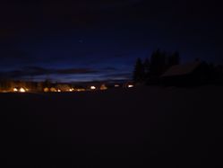
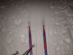
I started the expedition at said friends house, walking for about 200m until where the road network connects to the ski track network. By the time I set out, it was 17:30h and pretty dark, with a hint of light on the horizon. From there, it was about 1.5km to the geohash. The ski runs went as close as 300m, and an auxiliary run had been trampled across the field to about 40m. Even though there was not much light left, I was able to follow the tracks quite nicely.
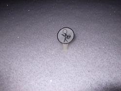
I sat down to prepare the marker (and scribble an URL on the reverse, which I still hadn't managed to do earlier). Then stalked across the field to where I expected the geohash to be. Check? And again a little to the right where I expected the geohash to be. At about 12m to the destination, my GPS got the whoopies and put me 3km further north. But since I was surrounded only by snow, and a few houses lurking in the distance, I claim there to be no relevant obstacle between me and the geohash. I am not going to claim that I have been within the 6km uncertainty range, because then I could almost have stayed at home. Or at least at my friends' place drinking hot and/or alcoholic beverages.
Yay for my first geohashing expedition in 2011. Finally!
Tracklog
Photos
|
Achievements
This user earned the Ski geohash
|


