Difference between revisions of "2011-04-20 51 11"
imported>Reinhard m (→Photos) |
imported>FippeBot m (Location) |
||
| (One intermediate revision by one other user not shown) | |||
| Line 15: | Line 15: | ||
When Reinhard came home from work, he found some pasta in the fridge which should supply him with enough carbohydrates for this hash expedition by bike. It was somehow special, because it would legitimate earning the reverse regional achievement for the 51 11 graticule, where Reinhard had been hashing 15 times before, but never successful in the Saxony-Anhalt part (which is bigger than the Thuringian part, but farther from Jena). | When Reinhard came home from work, he found some pasta in the fridge which should supply him with enough carbohydrates for this hash expedition by bike. It was somehow special, because it would legitimate earning the reverse regional achievement for the 51 11 graticule, where Reinhard had been hashing 15 times before, but never successful in the Saxony-Anhalt part (which is bigger than the Thuringian part, but farther from Jena). | ||
| − | Reinhard started from Jena-Cospeda at 19:45 and explored some unknown roads near Bad Kösen. Between Hassenhausen and Hohndorf he was slowed down by road works, but could continue on the intermittent gravel road. The worse part began, when he left roads after passing through Niedermöllern. Google Earth satellite view planning wasn't perfect and finding the best paths for a road bike at night was tricky. He was already on the right side of a brook (1 to 2 m wide), but it seemed as if there was no path leading closer to the hashpoint and walking was not | + | Reinhard started from Jena-Cospeda at 19:45 and explored some unknown roads near Bad Kösen. Between Hassenhausen and Hohndorf he was slowed down by road works, but could continue on the intermittent gravel road. The worse part began, when he left roads after passing through Niedermöllern. Google Earth satellite view planning wasn't perfect and finding the best paths for a road bike at night was tricky. He was already on the right side of a brook (1 to 2 m wide), but it seemed as if there was no path leading closer to the hashpoint and walking was not yet an option at a distance of 1 km. So he used the way that lead on the other side of the brook and partly walked, partly cycled on until the brook bend to block the remaining 450 m to the hashpoint. The path disappeared at this place and no bridge to the other side was visible. The brook appeared to be at least half a meter deep and the bank was too steep to find a place where jumping across the water was an option. Reinhard already regretted that he started this expedition, but now it was too late. He rode back to where the brook could be crossed on dry tires and suddenly saw a useable track on the right side of the water. That's one of the challenging things about going on hash expeditions by night: The best way to the hashpoint is much harder to find. Reinhard plucked up courage and rode along the tracks as good as he could, but had to recognize that he couldn't get closer than 350 m by using this way. Remember that the last some hundred meters to a hash are always the most exhausting as they are always uphill and always through thicket. This time getting closer could only be done step by step in a literal way. There were six terraces of meadows to cross (of course, Reinhard didn't know before) and all the steps were terribly steep (with a bike on your shoulders in the dark). Reinhard was hating himself for being a geohasher. Less than 100 m from the hashpoint a way got in sight (it was also charted in the topographic map) and from there it was only 50 m into the forest, where Reinhard was very relieved to be successful after an eternity of struggling. |
The way back on paved roads was rather easy, as he could follow the wide gravel roads for 2 km. Meanwhile it was past 10 p.m. and Reinhard got quite hungry, but had to be pleased with 3 or 4 cereal bars for the remaining 40+ km. Getting weak and weaker, he slowly trudged home, where he couldn't make it before midnight. Though it altogether took 4.5 hours, Reinhard only cycled 86 km, walked one km and carried his bike more than he wanted to. | The way back on paved roads was rather easy, as he could follow the wide gravel roads for 2 km. Meanwhile it was past 10 p.m. and Reinhard got quite hungry, but had to be pleased with 3 or 4 cereal bars for the remaining 40+ km. Getting weak and weaker, he slowly trudged home, where he couldn't make it before midnight. Though it altogether took 4.5 hours, Reinhard only cycled 86 km, walked one km and carried his bike more than he wanted to. | ||
| Line 33: | Line 33: | ||
[[Category:Expeditions with photos]] | [[Category:Expeditions with photos]] | ||
[[Category:Coordinates reached]] | [[Category:Coordinates reached]] | ||
| + | {{location|DE|ST|BLK}} | ||
Latest revision as of 06:14, 9 August 2019
| Wed 20 Apr 2011 in 51,11: 51.1720099, 11.7210093 geohashing.info google osm bing/os kml crox |
Location
In a forest in the middle of nowhere, Saxony-Anhalt.
Participants
Expedition
When Reinhard came home from work, he found some pasta in the fridge which should supply him with enough carbohydrates for this hash expedition by bike. It was somehow special, because it would legitimate earning the reverse regional achievement for the 51 11 graticule, where Reinhard had been hashing 15 times before, but never successful in the Saxony-Anhalt part (which is bigger than the Thuringian part, but farther from Jena).
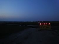
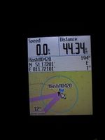
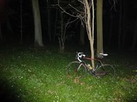
Reinhard started from Jena-Cospeda at 19:45 and explored some unknown roads near Bad Kösen. Between Hassenhausen and Hohndorf he was slowed down by road works, but could continue on the intermittent gravel road. The worse part began, when he left roads after passing through Niedermöllern. Google Earth satellite view planning wasn't perfect and finding the best paths for a road bike at night was tricky. He was already on the right side of a brook (1 to 2 m wide), but it seemed as if there was no path leading closer to the hashpoint and walking was not yet an option at a distance of 1 km. So he used the way that lead on the other side of the brook and partly walked, partly cycled on until the brook bend to block the remaining 450 m to the hashpoint. The path disappeared at this place and no bridge to the other side was visible. The brook appeared to be at least half a meter deep and the bank was too steep to find a place where jumping across the water was an option. Reinhard already regretted that he started this expedition, but now it was too late. He rode back to where the brook could be crossed on dry tires and suddenly saw a useable track on the right side of the water. That's one of the challenging things about going on hash expeditions by night: The best way to the hashpoint is much harder to find. Reinhard plucked up courage and rode along the tracks as good as he could, but had to recognize that he couldn't get closer than 350 m by using this way. Remember that the last some hundred meters to a hash are always the most exhausting as they are always uphill and always through thicket. This time getting closer could only be done step by step in a literal way. There were six terraces of meadows to cross (of course, Reinhard didn't know before) and all the steps were terribly steep (with a bike on your shoulders in the dark). Reinhard was hating himself for being a geohasher. Less than 100 m from the hashpoint a way got in sight (it was also charted in the topographic map) and from there it was only 50 m into the forest, where Reinhard was very relieved to be successful after an eternity of struggling.
The way back on paved roads was rather easy, as he could follow the wide gravel roads for 2 km. Meanwhile it was past 10 p.m. and Reinhard got quite hungry, but had to be pleased with 3 or 4 cereal bars for the remaining 40+ km. Getting weak and weaker, he slowly trudged home, where he couldn't make it before midnight. Though it altogether took 4.5 hours, Reinhard only cycled 86 km, walked one km and carried his bike more than he wanted to.
Photos
|
Achievements
Reinhard earned the Reverse regional achievement
|


