Difference between revisions of "2011-07-23 45 -122"
imported>Michael5000 (Created page with "{{subst:Expedition |lat = 45 |lon = -122 |date = 2011-07-23 }}") |
imported>FippeBot m (Location) |
||
| (8 intermediate revisions by 2 users not shown) | |||
| Line 1: | Line 1: | ||
| − | |||
| − | |||
| − | |||
| − | |||
| − | |||
| − | |||
| − | |||
| − | |||
| − | |||
| − | |||
{{meetup graticule | {{meetup graticule | ||
| lat=45 | | lat=45 | ||
| Line 15: | Line 5: | ||
}} | }} | ||
| − | |||
__NOTOC__ | __NOTOC__ | ||
== Location == | == Location == | ||
| − | + | ||
| + | Off of Springville Road, not far from Skyline Drive. | ||
== Participants == | == Participants == | ||
| − | |||
| − | + | *[[User:Michael5000|Michael5000]] | |
| − | + | *[[User:Mrs.5000|Mrs.5000]] | |
| + | *Jennifer | ||
== Expedition == | == Expedition == | ||
| − | |||
| − | + | With Candida visiting, we 5000s were eager to try for some geohashing glory, and so set off for a hashpoint that, from its aerial image, could have been anything from an accessible grassy slope lined with trails to the kind of impenetrable scrub I've encountered in this area before (see [[2011-05-29_45_-122]]). The first challenge was finding anyplace to park off of Springville Road, a narrow lane with very little in the way of shoulders. That solved, it was obvious that we were looking at way-too-dense undergrowth on a steep downhill slope. Some ways down the hill, an old gate suggested a way in, but Michael5000 found after slithering through that it led only to an old track that rapidly disappeared into the brambles. As the expedition party was wearing shorts, this did not seem like a viable line of attack. | |
| − | + | ||
| + | A secondary approach to the hashpoint was taken from bottom of the slope, but we found there that the way would be not only difficult but subject to the scrutiny of a whole neighborhood of massive, closely built homes. So we went out to eat instead. | ||
| + | |||
| + | Expedition Failure. | ||
| + | |||
== Photos == | == Photos == | ||
| − | |||
| − | |||
| − | |||
<gallery perrow="5"> | <gallery perrow="5"> | ||
| + | File:2011-07-23 45 -122 humans.JPG|Mrs., Michael, Jennifer | ||
| + | File:2011-07-23 45 -122 bear.JPG|And of course The Bear | ||
| + | File:2011-07-23 45 -122 gate.JPG|A gate that hasn't opened in several years | ||
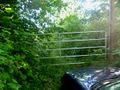
| + | File:2011-07-23 45 -122 fence.JPG|"If the housing market ever picks up, this parcel will be aswarm with bulldozers!" | ||
</gallery> | </gallery> | ||
== Achievements == | == Achievements == | ||
{{#vardefine:ribbonwidth|800px}} | {{#vardefine:ribbonwidth|800px}} | ||
| − | |||
| + | {{drag-along | ||
| + | | latitude = 45 | ||
| + | | longitude = -122 | ||
| + | | date = 2011-07-23 | ||
| + | | partner = Jennifer | ||
| + | | name = Michael5000 | ||
| + | }} | ||
| − | |||
| − | |||
| − | |||
| − | |||
| − | |||
| − | |||
| − | |||
| − | |||
| − | |||
| − | |||
[[Category:Expeditions]] | [[Category:Expeditions]] | ||
| − | |||
[[Category:Expeditions with photos]] | [[Category:Expeditions with photos]] | ||
| − | [[Category: | + | [[Category:Not reached - Mother Nature]] |
| − | [[Category: | + | [[Category:Not reached - No public access]] |
| − | |||
| − | |||
| − | |||
| − | |||
| − | |||
| − | |||
| − | |||
[[Category:Coordinates not reached]] | [[Category:Coordinates not reached]] | ||
| − | + | {{location|US|OR|MU}} | |
| − | |||
| − | |||
| − | |||
| − | |||
| − | |||
Latest revision as of 00:13, 13 August 2019
| Sat 23 Jul 2011 in 45,-122: 45.5636684, -122.8014119 geohashing.info google osm bing/os kml crox |
Location
Off of Springville Road, not far from Skyline Drive.
Participants
- Michael5000
- Mrs.5000
- Jennifer
Expedition
With Candida visiting, we 5000s were eager to try for some geohashing glory, and so set off for a hashpoint that, from its aerial image, could have been anything from an accessible grassy slope lined with trails to the kind of impenetrable scrub I've encountered in this area before (see 2011-05-29_45_-122). The first challenge was finding anyplace to park off of Springville Road, a narrow lane with very little in the way of shoulders. That solved, it was obvious that we were looking at way-too-dense undergrowth on a steep downhill slope. Some ways down the hill, an old gate suggested a way in, but Michael5000 found after slithering through that it led only to an old track that rapidly disappeared into the brambles. As the expedition party was wearing shorts, this did not seem like a viable line of attack.
A secondary approach to the hashpoint was taken from bottom of the slope, but we found there that the way would be not only difficult but subject to the scrutiny of a whole neighborhood of massive, closely built homes. So we went out to eat instead.
Expedition Failure.
Photos

Mrs., Michael, Jennifer
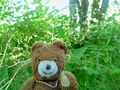
And of course The Bear
A gate that hasn't opened in several years
"If the housing market ever picks up, this parcel will be aswarm with bulldozers!"


Achievements
Michael5000 earned the Drag-along achievement
|