Difference between revisions of "2011-08-29 50 11"
imported>Jens (→Location) |
imported>FippeBot m (Location) |
||
| (9 intermediate revisions by 4 users not shown) | |||
| Line 14: | Line 14: | ||
== Expedition == | == Expedition == | ||
| − | + | Surprise, surprise, we still have August and Jens (it’s me) has once again joined one of Jujas Hashpoint trips, although I already found my August point some days ago. But the point looked easy and so we started after work. The plan was to cycle 18 km to the south, visit the point and then cycle 18 km back to the north again. So we should arrive at 7:30 p.m. at Burgau, just in time to buy something for supper. | |
| + | |||
| + | The plan worked perfectly – for the first 18 km. We cycled to Altenberga, left the street, followed a dirt road between the fields until we reached the wood. Then we placed our bicycles at a tree and walked the last 300 meters through the lovely forest, listening to the singing birds and watching the rabbits bounding from tree to tree and after some minutes we easily reached the point. | ||
| + | |||
| + | STOP. That is how it should have been. And now let’s go back 300 meters and face the reality. We placed our mud-covered bicycles at a tree and walked to the wood. It was jam-packed with trees, bushes and brushwood, all telling "No entry here", "Do not disturb us", "Go home". We ignored what they told us and followed the wood’s margin until we found something we called "path", although it was no path at all. With a speed of 2 meters/minute we created our own path between the plants surrounding us. At a distance of 10 meters to our goal (which meant still 5 minutes to go) I said to Juja a sentence like "Next time you ask me to join a hashpoint trip then please remind me to answer ‘No’ ". But finally we reached the point and even found a slightly easier way back to our bicycles. Then we cycled back the 18 km and at the end I found a supermarket that didn’t close at 8 p.m. | ||
| + | |||
| + | == Photos == | ||
| + | {{gallery|width=200|height=200|lines=2 | ||
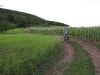
| + | |Image:110829_50_11_1.jpg|The muddy way to the hash (yes, it was steep, too!) | ||
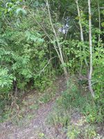
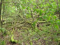
| + | |Image:110829_50_11_2.jpg|This obviously is a path - isn't it? | ||
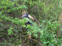
| + | |Image:110829_50_11_3.jpg|Well, maybe not... | ||
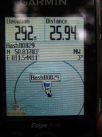
| + | |Image:110829_50_11_4.jpg|...but finally: Coordinates reached! | ||
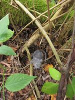
| + | |Image:110829_50_11_5.jpg|Little Benjy found his way a little easier. | ||
| + | |Image:110829_50_11_6.jpg|The lovely Geohash Point of 2011-08-29/50,11. | ||
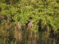
| + | |Image:110829_50_11_7.jpg|Jens made his way out of the thicket again. | ||
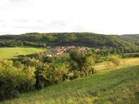
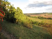
| + | |Image:110829_50_11_8.jpg|Ah - Venice! (Or maybe Altenberga.) | ||
| + | |Image:110829_50_11_9.jpg|Not such a bad place after all... | ||
| + | }} | ||
| + | |||
| + | == Things to add to Geohashing Packing List for next time == | ||
| + | * Drinking bottle (this is actually already on the list, but I need to remember next time) | ||
| + | * '''Machete.''' | ||
[[Category:Expeditions]] | [[Category:Expeditions]] | ||
| + | [[Category:Expeditions with photos]] | ||
[[Category:Coordinates reached]] | [[Category:Coordinates reached]] | ||
| + | {{location|DE|TH|SHK}} | ||
Latest revision as of 00:41, 13 August 2019
| Mon 29 Aug 2011 in 50,11: 50.8370307, 11.5441108 geohashing.info google osm bing/os kml crox |
Location
In a wood near Altenberga (Thuringia).
Participants
Expedition
Surprise, surprise, we still have August and Jens (it’s me) has once again joined one of Jujas Hashpoint trips, although I already found my August point some days ago. But the point looked easy and so we started after work. The plan was to cycle 18 km to the south, visit the point and then cycle 18 km back to the north again. So we should arrive at 7:30 p.m. at Burgau, just in time to buy something for supper.
The plan worked perfectly – for the first 18 km. We cycled to Altenberga, left the street, followed a dirt road between the fields until we reached the wood. Then we placed our bicycles at a tree and walked the last 300 meters through the lovely forest, listening to the singing birds and watching the rabbits bounding from tree to tree and after some minutes we easily reached the point.
STOP. That is how it should have been. And now let’s go back 300 meters and face the reality. We placed our mud-covered bicycles at a tree and walked to the wood. It was jam-packed with trees, bushes and brushwood, all telling "No entry here", "Do not disturb us", "Go home". We ignored what they told us and followed the wood’s margin until we found something we called "path", although it was no path at all. With a speed of 2 meters/minute we created our own path between the plants surrounding us. At a distance of 10 meters to our goal (which meant still 5 minutes to go) I said to Juja a sentence like "Next time you ask me to join a hashpoint trip then please remind me to answer ‘No’ ". But finally we reached the point and even found a slightly easier way back to our bicycles. Then we cycled back the 18 km and at the end I found a supermarket that didn’t close at 8 p.m.
Photos
|
Things to add to Geohashing Packing List for next time
- Drinking bottle (this is actually already on the list, but I need to remember next time)
- Machete.
