Difference between revisions of "2011-10-10 40 -74"
imported>Spindizzy |
imported>Jiml m (Add close gallery tag) |
||
| Line 24: | Line 24: | ||
<gallery> | <gallery> | ||
| − | + | Image:2011-10-10 40 -74 GPS.JPG| GPS | |
| − | + | Image:2011-10-10 40 -74.JPG| The area | |
| + | |||
| + | </gallery> | ||
Revision as of 06:26, 11 October 2011
| Mon 10 Oct 2011 in Newark: 40.7008137, -74.6260021 geohashing.info google osm bing/os kml crox |
Location
Very close to where I live, but it's well inside private property in an expensive area where residents are likely to have surveillance cameras. Update - no cameras but there were "Protected by" signs.
Participants
Plans
Will head there this afternoon.
Expedition Report
As I suspected, Lake Road at Route 202 was closed due to construction and I had to take a very squirilley detour which was a 1.5 car wide lane that used to be a stage coach path. Not very many pics from today's excursion because it was near rush hour and there was no place to stop or even pull over to snap a shot, however, back in 2001 I was a passenger in a car being driven backwards down Pennbrook Road [aka The Detour]. Don't ask. Very hilly. I will collect some photos when traffic is not too dangerous.
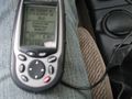
GPS
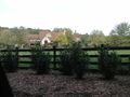
The area

