Difference between revisions of "2012-05-07 52 13"
From Geohashing
imported>Kattapa (→Photos) |
imported>Jiml m (Adjust result codes and fix case) |
||
| Line 1: | Line 1: | ||
| − | |||
<!-- If you did not specify these parameters in the template, please substitute appropriate values for IMAGE, LAT, LON, and DATE (YYYY-MM-DD format) | <!-- If you did not specify these parameters in the template, please substitute appropriate values for IMAGE, LAT, LON, and DATE (YYYY-MM-DD format) | ||
| Line 38: | Line 37: | ||
== Photos == | == Photos == | ||
<gallery perrow="5"> | <gallery perrow="5"> | ||
| − | Image:2012_05_07_52_13_1. | + | Image:2012_05_07_52_13_1.JPG | On the road |
| − | Image:2012_05_07_52_13_2. | + | Image:2012_05_07_52_13_2.JPG | Last bit before the hash, walking an unlit road. |
| − | Image:2012_05_07_52_13_3. | + | Image:2012_05_07_52_13_3.JPG | At the hash! |
| − | Image:2012_05_07_52_13_4. | + | Image:2012_05_07_52_13_4.JPG | On the way back. |
</gallery> | </gallery> | ||
| Line 48: | Line 47: | ||
<!-- Add any achievement ribbons you earned below, or remove this section --> | <!-- Add any achievement ribbons you earned below, or remove this section --> | ||
| + | * Land Geohash | ||
<!-- =============== USEFUL CATEGORIES FOLLOW ================ | <!-- =============== USEFUL CATEGORIES FOLLOW ================ | ||
| Line 53: | Line 53: | ||
[[Category:New report]] | [[Category:New report]] | ||
| − | |||
| − | |||
| − | |||
| − | |||
| − | |||
[[Category:Expeditions]] | [[Category:Expeditions]] | ||
| − | |||
[[Category:Expeditions with photos]] | [[Category:Expeditions with photos]] | ||
| − | |||
| − | |||
| − | |||
| − | + | ||
[[Category:Coordinates reached]] | [[Category:Coordinates reached]] | ||
| − | |||
| − | |||
| − | |||
| − | |||
| − | |||
| − | |||
| − | |||
| − | |||
| − | |||
| − | |||
Revision as of 15:47, 8 May 2012
| Mon 7 May 2012 in 52,13: 52.7065556, 13.1583394 geohashing.info google osm bing/os kml crox |
Location
In a field next to an unlit road near Bärenklau, about 10 km from Oranienburg.
Participants
Plans
The original plan was to follow the map I had drawn and to return home at a reasonable hour.
Expedition
Instead followed roads I hadn't scribbled down and was back home at 2:30.
Other stuff:
Being so happy to finally find a sign for Bärenklau that I ran the last 3 kilometers.
People having sex in a photo booth on my way back.
Photos
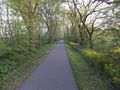
On the road
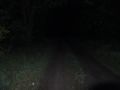
Last bit before the hash, walking an unlit road.

At the hash!
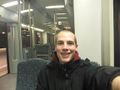
On the way back.


Achievements
- Land Geohash