Difference between revisions of "2012-07-06 45 -122"
From Geohashing
imported>Michael5000 m (→Location) |
imported>Kydlt (→Photos) |
||
| Line 33: | Line 33: | ||
<gallery perrow="5"> | <gallery perrow="5"> | ||
| + | Image:2012-07-06 GPS.jpg|This time I used silver tape as a marker. I couldn't find my chalk. | ||
| + | Image:2012-07-06 me.jpg|I tried to get a photo using the selftimer but my timing was off. | ||
| + | Image:2012-07-06 street signs.jpg|The nearest corner. | ||
</gallery> | </gallery> | ||
Revision as of 05:24, 7 July 2012
| Fri 6 Jul 2012 in 45,-122: 45.6551710, -122.6795101 geohashing.info google osm bing/os kml crox |
Location
On 46th Street in Vancouver.
Participants
- Michael5000
- Molly
Plans
- Kydlt: On the way if I go that way.
- Michael5000: It was a very accessible hashpoint, but didn't look especially interesting. So, I thought maybe a running expedition would be in order. Then, it occurred to me that my running buddy Molly lived along the way. She bought in, and it became a drag-along. She was very sporting when I admitted that it was a geohashing expedition.
Expedition
- Kydlt: Got there, left a marker. I have a lot of trouble posting from iPad so more when I get home.
- Michael5000: We parked not far off the freeway exit by Hazel Dell. Rather than march right up to the hashpoint, we snuck up on it from behind, by running down the Burnt Bridge trail and coming back around on pleasant evening suburban streets. We probably crossed the hashpoint at ~ 8:15 p.m., and commemorated the moment with a little geohash dance. We didn't see any marker, however.
Returned to the truck and the State of Oregon without further incident. 4.25 miles for the run.
Photos
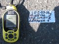
This time I used silver tape as a marker. I couldn't find my chalk.
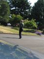
I tried to get a photo using the selftimer but my timing was off.
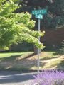
The nearest corner.


Achievements
Michael5000 earned the Drag-along achievement
|