Difference between revisions of "2012-09-16 50 11"
imported>Paintedhell (Created page with "{{meetup graticule | lat=50 | lon=11 | date=2012-09-16 }} __NOTOC__ == Location == In München (the small village in Thuringia), in the area of the old [http://de.wikipedia.org...") |
imported>FippeBot m (Location) |
||
| Line 37: | Line 37: | ||
[[Category:Expeditions with photos]] | [[Category:Expeditions with photos]] | ||
[[Category:Coordinates reached]] | [[Category:Coordinates reached]] | ||
| + | {{location|DE|TH|AP}} | ||
Latest revision as of 06:08, 13 August 2019
| Sun 16 Sep 2012 in 50,11: 50.8753873, 11.2573592 geohashing.info google osm bing/os kml crox |
Location
In München (the small village in Thuringia), in the area of the old Sophienheilstätte which is creepy as fuck.
Participants
- Juja and her Ninja
Expedition
The last expedition was too easy, so to keep the universe in balance, Geohashing returned to the absurd crap it used to be this time: because that old hospital building on the hill gives me the creeps every time I'm there I begged my favorite Ninja to accompany me, which he did. Of course I forgot (again) that Ilmradweg on sunny Sundays is a pain in the a**, so we slowly made our way through the hundreds of cycling families.
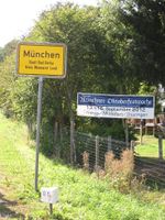
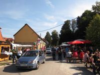
I thought it might be a funny idea to visit the village of München at the Oktoberfest time of the year, but obviously others had thought this too and indeed a tiny "Oktoberfest" also took place right there - a fine prelude to our hash expedition, and I bet the creepy clowns were already waiting right around the corner.
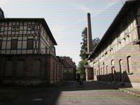
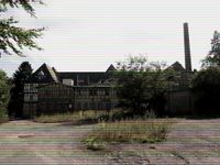
The hash was waiting on the hill of München near Sophienheilstätte, an old hospital (according to Wikipedia it was given up only in 1994 but it looks as if it's been rotting for at least half a century) that would be a perfect setting for horror movies. Though it is located only at a few minutes distance to the village I've never ever seen somebody up there. Bad land, as the Weird Naked Indian would say.
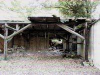
So I already felt scared and insecure near the spine-tangling old buildings when I entered the shrubbery nearby to find the exact coordinates, and then the bad land got me: I stumbled over the thing that looked like a clearing on the satellite picture (I don't know from which century those images are, the trees there were already pretty grown up!), obviously the point was at even further distance, I passed some creepy garages and sheds and behind them (at about 10m distance to the point) I tripped up on what turned out to be an old toilet buried in the loose soil and leaves behind the sheds (and I really don't want to know what else was buried back there). With perfect reflexes I fell right on my hands, which unfortunately carried my camera that was ruined by the crash. Damn. So much for a nice Sunday expedition, no proof today, maybe I'll add the tracklog later but really who cares.
We cycled back home on less frequented roads and arrived for cake and teatime.
Photos
|
(I'm sorry, I couldn't help playing around with those ugly GIMP filters.)
