Difference between revisions of "2013-04-19 50 11"
imported>Paintedhell (Created page with "{{meetup graticule | lat=50 | lon=11 | date=2013-04-19 }} __NOTOC__ == Location == On a field near Dorndorf, Thuringia, not even 100m away from Saaleradweg. == Participants...") |
imported>Paintedhell |
||
| Line 7: | Line 7: | ||
__NOTOC__ | __NOTOC__ | ||
== Location == | == Location == | ||
| − | On a field near Dorndorf, Thuringia, not even | + | On a field near Dorndorf, Thuringia, not even 100 meters away from Saaleradweg (the official cycling route along the river). |
== Participants == | == Participants == | ||
| Line 13: | Line 13: | ||
== Expedition == | == Expedition == | ||
| − | I' | + | I am [[2013-04-13_50_11#Expedition|still]] Hashcot-sitting Hasi (and some others), so this morning he teamed up with my April Hare and they both egged me on to go biking even before work - but they were right: when I went to the bakery in the early morning there was really nice sunny weather and it got worse in the course of the day, so you should probably always follow your hares' advice. |
| + | |||
| + | Anyway I did, and I started right after breakfast (together with both of my long-eared companions that took up all the available space in my tiny backpack) to go for that easy Geohash: not even 10 kms away from my home, I cycled through the sun, found the point without problems, took photos, marked the point (but of course Jens will not go there later, even though it's ''really'' easy!), got back really relaxed, had a shower and went to the office - a nice way to start a workday! | ||
== Photos == | == Photos == | ||
{{gallery|width=200|height=200|lines=2 | {{gallery|width=200|height=200|lines=2 | ||
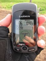
| − | + | |Image:130419_50_11_1.jpg|Proof of location, with mirrored Geohasher. | |
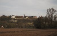
| + | |Image:130419_50_11_2.jpg|Castles of Dornburg, viewed from the Geohash. | ||
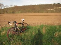
| + | |Image:130419_50_11_3.jpg|Bike and shady Geohasher near the point. | ||
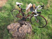
| + | |Image:130419_50_11_4.jpg|My [http://www.liederkiste.com/Osterlieder/Zwischen_BergD.html two hares grazing on the green green grass]. | ||
| + | |Image:130419_50_11_5.jpg|Hashmark with hares ready to ride back home. | ||
}} | }} | ||
[[Category:Expeditions]] | [[Category:Expeditions]] | ||
| − | + | [[Category:Expeditions with photos]] | |
[[Category:Coordinates reached]] | [[Category:Coordinates reached]] | ||
Revision as of 15:32, 19 April 2013
| Fri 19 Apr 2013 in 50,11: 50.9986016, 11.6729531 geohashing.info google osm bing/os kml crox |
Location
On a field near Dorndorf, Thuringia, not even 100 meters away from Saaleradweg (the official cycling route along the river).
Participants
- Juja, Hasi the hare and the April hare
Expedition
I am still Hashcot-sitting Hasi (and some others), so this morning he teamed up with my April Hare and they both egged me on to go biking even before work - but they were right: when I went to the bakery in the early morning there was really nice sunny weather and it got worse in the course of the day, so you should probably always follow your hares' advice.
Anyway I did, and I started right after breakfast (together with both of my long-eared companions that took up all the available space in my tiny backpack) to go for that easy Geohash: not even 10 kms away from my home, I cycled through the sun, found the point without problems, took photos, marked the point (but of course Jens will not go there later, even though it's really easy!), got back really relaxed, had a shower and went to the office - a nice way to start a workday!
Photos
|


