Difference between revisions of "2013-10-26 44 -122"
imported>Frogman (→Achievements) |
imported>FippeBot m (Location) |
||
| (10 intermediate revisions by 3 users not shown) | |||
| Line 15: | Line 15: | ||
}} | }} | ||
| − | + | ||
__NOTOC__ | __NOTOC__ | ||
== Location == | == Location == | ||
<!-- where you've surveyed the hash to be --> | <!-- where you've surveyed the hash to be --> | ||
| + | |||
| + | On a steep hillside in Willamette National Forest. | ||
== Participants == | == Participants == | ||
<!-- who attended: If you link to your wiki user name in this section, your expedition will be picked up by the various statistics generated for geohashing. You may use three tildes ~ as a shortcut to automatically insert the user signature of the account you are editing with. | <!-- who attended: If you link to your wiki user name in this section, your expedition will be picked up by the various statistics generated for geohashing. You may use three tildes ~ as a shortcut to automatically insert the user signature of the account you are editing with. | ||
--> | --> | ||
| + | |||
| + | * [[User:Higgs|Higgs]] | ||
| + | * [[User:Frogman|Frogman]] | ||
| + | * Callie | ||
| + | * Dmitriy | ||
== Plans == | == Plans == | ||
<!-- what were the original plans --> | <!-- what were the original plans --> | ||
| − | [[User:Higgs|Higgs]] and [[User:Frogman|Frogman]] ([[User talk: | + | [[User:Higgs|Higgs]] and [[User:Frogman|Frogman]] might do this one, if we can get a car. |
| + | :Wow! I'm impressed. I don't think I'd try with the apparent slope around there! [[User:Jiml|Jiml]] ([[User talk:Jiml|talk]]) 01:31, 26 October 2013 (EDT) | ||
| + | ::Luckily it was in a good spot and we came at it from the right side, otherwise we might have lost to the steepness. [[User:Higgs|Alec Shields]] ([[User talk:Higgs|talk]]) 21:56, 28 October 2013 (EDT) | ||
== Expedition == | == Expedition == | ||
<!-- how it all turned out. your narrative goes here. --> | <!-- how it all turned out. your narrative goes here. --> | ||
| + | Dmitriy agreed to drive us to the hashpoint under the condition that we pay for gas and take good pictures of him for his Facebook profile. So, after some quick phone calls and hurried preparation, we embarked on our epic journey to the next graticule over. | ||
| + | |||
| + | The day started out gray and dreary but quickly brightened after we passed Sweet Home. We cruised down US Numbered Highway 20, singing along to well-known songs such as Sail by AWOLNATION and Float On by Modest Mouse. At this point, I brought up Google Maps navigation in order to figure out the best route to the hashpoint. | ||
| + | |||
| + | Pro tip: Google Maps doesn't know a whole ton about National Forest roads. We turned onto the main road in that area, NF-15, which was paved for a good way and then not paved for a while after that. Google Map's error was when it told us to turn off of NF-15 and onto a smaller, less-well-traveled road. This would have been a shorted route if the road did indeed go all the way through to the other side. After squeezing the car through bushes and getting out to move fallen trees from the road, we hit a dead end on two separate occasions. Other than the time lost and the stress on Dmitriy as the driver on those difficult roads, these detours were quite nice, as the dead ends all gave us rather impressive views of the Willamette National Forest wilderness, with high hills, deep valleys, and lots and lots of trees. | ||
| + | |||
| + | Luckily, [[User:Higgs|Higgs]] had a standalone GPS that had a very good idea where the roads were. We put the coordinates into the GPS and discovered that staying on NF-15 would have taken us to the hashpoint, albeit less directly. We drove around the hill that the previous roads were on, passing a quarry, a logging site, and a meadow before reaching a trail that was rather close to the hashpoint. From there it was an easy trek to the hashpoint, which was on the side of a rather steep hill near a rotten stump. We had lunch, admired the trees, and left. | ||
| + | |||
| + | Before returning to Corvallis, we stopped at the meadow, which turned out to be not a meadow at all but a beautiful marshy area, and the quarry, which we scaled and admired the view from. From there we left, returning to civilization. | ||
== Tracklog == | == Tracklog == | ||
| Line 39: | Line 57: | ||
--> | --> | ||
<gallery perrow="5"> | <gallery perrow="5"> | ||
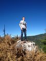
| + | Image:2013-10-26 44 -122 dmitriy1.jpg | Dmitriy on a stump. | ||
| + | Image:2013-10-26 44 -122 rocks.jpg | Some rocks. | ||
| + | Image:2013-10-26 44 -122 dmitriy2.jpg | Dmitriy on a different stump. | ||
| + | Image:2013-10-26 44 -122 dmitriytongue.jpg | I made sure to upload this one because Dmitriy has his tongue out. | ||
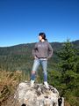
| + | Image:2013-10-26 44 -122 higgs1.jpg | [[User:Higgs|Higgs]] on a different stump! | ||
| + | Image:2013-10-26 44 -122 higgs2.jpg | People sure like standing on stumps to pose for pictures. | ||
| + | Image:2013-10-26 44 -122 callie1.jpg | Callie on a stump. | ||
| + | Image:2013-10-26 44 -122 trees1.jpg | Willamette National Forest is very picturesque! | ||
| + | Image:2013-10-26 44 -122 trees2.jpg | If we hadn't followed Google Maps directions we wouldn't have had this awesome view! | ||
| + | Image:2013-10-26 44 -122 trees3.jpg | Google Maps was convinced that the road continued on this way. | ||
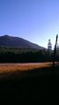
| + | Image:2013-10-26 44 -122 trees4.jpg | Mt. Washington! | ||
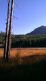
| + | Image:2013-10-26 44 -122 trees5.jpg | There sure are a lot of pretty trees in this forest. | ||
| + | Image:2013-10-26 44 -122 dmitriy3.jpg | Walking to the hashpoint. | ||
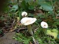
| + | Image:2013-10-26 44 -122 mushrooms.jpg | There's a lot of interesting fungi here! | ||
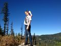
| + | Image:2013-10-26 44 -122 navigating.jpg | [[User:Higgs|Higgs]] checking his GPS. | ||
| + | Image:2013-10-26 44 -122 dmitriyalmostfalls.jpg | Dmitriy almost fell down the hill! | ||
| + | Image:2013-10-26 44 -122 dmitriyisokay.jpg | But he caught himself on a tree. | ||
| + | Image:2013-10-26 44 -122 walkingsafelydownhill.jpg | Callie demonstrating how to not fall down a hill. | ||
| + | Image:2013-10-26 44 -122 dmitriyhashpoint.jpg | Dmitriy on top of the stump we designated as the hashpoint. | ||
| + | Image:2013-10-26 44 -122 grins.jpg | Obligatory goofy grins! | ||
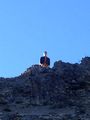
| + | Image:2013-10-26 44 -122 proof.jpg | Proof; well within the margin of error especially as there were trees. | ||
| + | Image:2013-10-26 44 -122 callieeating.jpg | Callie eating. | ||
| + | Image:2013-10-26 44 -122 frogmaneating.jpg | [[User:Frogman|Frogman]] eating. | ||
| + | Image:2013-10-26 44 -122 dmitriyeating.jpg | Dmitriy eating. | ||
| + | Image:2013-10-26 44 -122 higgseating.jpg | [[User:Higgs|Higgs]] eating. | ||
| + | Image:2013-10-26 44 -122 higgs3.jpg | These pictures weren't on a stump. | ||
| + | Image:2013-10-26 44 -122 frogman1.jpg | They were just downhill from the hashpoint. | ||
| + | Image:2013-10-26 44 -122 geotrash1.jpg | Geotrashing! | ||
| + | Image:2013-10-26 44 -122 geotrash2.jpg | For what we assumed was a relatively underused area, there sure was a lot of trash. | ||
| + | Image:2013-10-26 44 -122 marsh1.jpg | A marsh we came across. | ||
| + | Image:2013-10-26 44 -122 marsh2.jpg | The light was nice so we took a lot of pictures. | ||
| + | Image:2013-10-26 44 -122 marsh3.jpg | Callie on a log in the marsh. | ||
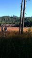
| + | Image:2013-10-26 44 -122 marsh4.jpg | I think this might be Carpenter Mountain, but I'm not entirely sure. | ||
| + | Image:2013-10-26 44 -122 marsh5.jpg | It was a rather large marsh. | ||
| + | Image:2013-10-26 44 -122 marsh6.jpg | Marsh. | ||
| + | Image:2013-10-26 44 -122 marsh7.jpg | More marsh. | ||
| + | Image:2013-10-26 44 -122 marsh8.jpg | [[User:Higgs|Higgs]] in a marsh. | ||
| + | Image:2013-10-26 44 -122 log.jpg | The logs in the marsh were rotting. | ||
| + | Image:2013-10-26 44 -122 marsh9.jpg | More more marsh. | ||
| + | Image:2013-10-26 44 -122 marsh10.jpg | Marsh. | ||
| + | Image:2013-10-26 44 -122 marsh11.jpg | Callie and [[User:Higgs|Higgs]] in a marsh. | ||
| + | Image:2013-10-26 44 -122 marsh12.jpg | Marsh. | ||
| + | Image:2013-10-26 44 -122 littlemushrooms.jpg | There were a lot of these little mushrooms near the marsh. | ||
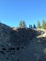
| + | Image:2013-10-26 44 -122 frogman2.jpg | Stopping at a quarry! | ||
| + | Image:2013-10-26 44 -122 dmitriyclimbing.jpg | Dmitriy climbing to the top of the quarry. | ||
| + | Image:2013-10-26 44 -122 higgscontemplative.jpg | [[User:Higgs|Higgs]] agreed to stay down to take pictures. | ||
| + | Image:2013-10-26 44 -122 callieclimbing.jpg | Callie climbing to the top of the quarry. | ||
| + | Image:2013-10-26 44 -122 calliequarry.jpg | Callie at the top! | ||
| + | Image:2013-10-26 44 -122 dmitriyquarry.jpg | Dmitriy at the top! | ||
</gallery> | </gallery> | ||
| Line 45: | Line 112: | ||
<!-- Add any achievement ribbons you earned below, or remove this section --> | <!-- Add any achievement ribbons you earned below, or remove this section --> | ||
| + | {{Picnic_geohash | ||
| + | | latitude = 44 | ||
| + | | longitude = -122 | ||
| + | | date = 2013-10-26 | ||
| + | | name = [[User:Frogman|Frogman]], [[User:Higgs|Higgs]], Callie, Dmitriy | ||
| + | | food = Peanut Butter and Jelly sandwiches | ||
| + | | image = 2013-10-26 44 -122 higgseating.jpg | ||
| + | }} | ||
| − | + | {{Geotrash | |
| − | + | | latitude = 44 | |
| − | [[ | + | | longitude = -122 |
| + | | date = 2013-10-26 | ||
| + | | name = [[User:Frogman|Frogman]], [[User:Higgs|Higgs]], Callie, Dmitriy | ||
| + | | image = 2013-10-26 44 -122 geotrash1.jpg | ||
| + | }} | ||
| − | |||
| − | |||
| − | |||
| − | |||
| − | |||
| − | |||
[[Category:Expeditions]] | [[Category:Expeditions]] | ||
| − | |||
[[Category:Expeditions with photos]] | [[Category:Expeditions with photos]] | ||
| − | |||
| − | |||
| − | |||
| − | |||
[[Category:Coordinates reached]] | [[Category:Coordinates reached]] | ||
| − | + | {{location|US|OR|LN}} | |
| − | |||
| − | |||
| − | |||
| − | |||
| − | |||
| − | |||
| − | |||
| − | |||
| − | |||
| − | |||
| − | |||
| − | |||
| − | |||
| − | |||
| − | |||
| − | |||
| − | |||
Latest revision as of 04:26, 14 August 2019
| Sat 26 Oct 2013 in 44,-122: 44.2990923, -122.1690498 geohashing.info google osm bing/os kml crox |
Location
On a steep hillside in Willamette National Forest.
Participants
Plans
Higgs and Frogman might do this one, if we can get a car.
- Wow! I'm impressed. I don't think I'd try with the apparent slope around there! Jiml (talk) 01:31, 26 October 2013 (EDT)
- Luckily it was in a good spot and we came at it from the right side, otherwise we might have lost to the steepness. Alec Shields (talk) 21:56, 28 October 2013 (EDT)
Expedition
Dmitriy agreed to drive us to the hashpoint under the condition that we pay for gas and take good pictures of him for his Facebook profile. So, after some quick phone calls and hurried preparation, we embarked on our epic journey to the next graticule over.
The day started out gray and dreary but quickly brightened after we passed Sweet Home. We cruised down US Numbered Highway 20, singing along to well-known songs such as Sail by AWOLNATION and Float On by Modest Mouse. At this point, I brought up Google Maps navigation in order to figure out the best route to the hashpoint.
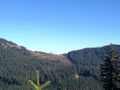
Pro tip: Google Maps doesn't know a whole ton about National Forest roads. We turned onto the main road in that area, NF-15, which was paved for a good way and then not paved for a while after that. Google Map's error was when it told us to turn off of NF-15 and onto a smaller, less-well-traveled road. This would have been a shorted route if the road did indeed go all the way through to the other side. After squeezing the car through bushes and getting out to move fallen trees from the road, we hit a dead end on two separate occasions. Other than the time lost and the stress on Dmitriy as the driver on those difficult roads, these detours were quite nice, as the dead ends all gave us rather impressive views of the Willamette National Forest wilderness, with high hills, deep valleys, and lots and lots of trees.
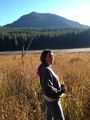
Luckily, Higgs had a standalone GPS that had a very good idea where the roads were. We put the coordinates into the GPS and discovered that staying on NF-15 would have taken us to the hashpoint, albeit less directly. We drove around the hill that the previous roads were on, passing a quarry, a logging site, and a meadow before reaching a trail that was rather close to the hashpoint. From there it was an easy trek to the hashpoint, which was on the side of a rather steep hill near a rotten stump. We had lunch, admired the trees, and left.
Before returning to Corvallis, we stopped at the meadow, which turned out to be not a meadow at all but a beautiful marshy area, and the quarry, which we scaled and admired the view from. From there we left, returning to civilization.
Tracklog
Photos
Dmitriy on a stump.
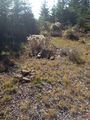
Some rocks.
Dmitriy on a different stump.
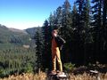
I made sure to upload this one because Dmitriy has his tongue out.
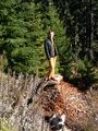
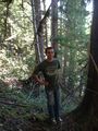
Higgs on a different stump!
People sure like standing on stumps to pose for pictures.
Callie on a stump.
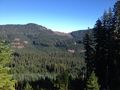
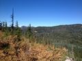
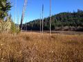
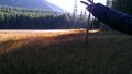
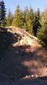
Willamette National Forest is very picturesque!
If we hadn't followed Google Maps directions we wouldn't have had this awesome view!
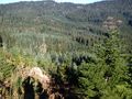
Google Maps was convinced that the road continued on this way.
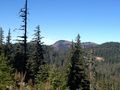
Mt. Washington!
There sure are a lot of pretty trees in this forest.

Walking to the hashpoint.
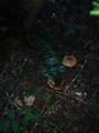
There's a lot of interesting fungi here!
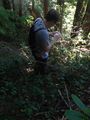
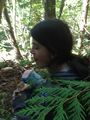
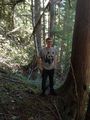
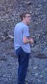
Higgs checking his GPS.
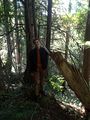
Dmitriy almost fell down the hill!
But he caught himself on a tree.
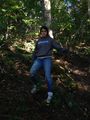
Callie demonstrating how to not fall down a hill.
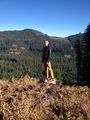
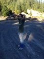
Dmitriy on top of the stump we designated as the hashpoint.
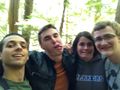
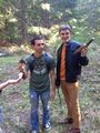
Obligatory goofy grins!
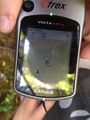
Proof; well within the margin of error especially as there were trees.
Callie eating.
Frogman eating.
Dmitriy eating.
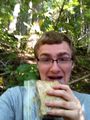
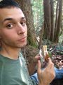
Higgs eating.
These pictures weren't on a stump.
They were just downhill from the hashpoint.
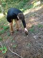
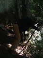
Geotrashing!
For what we assumed was a relatively underused area, there sure was a lot of trash.
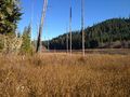
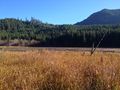
A marsh we came across.

The light was nice so we took a lot of pictures.
Callie on a log in the marsh.
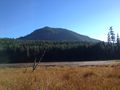
I think this might be Carpenter Mountain, but I'm not entirely sure.
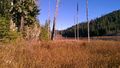
It was a rather large marsh.
Marsh.
More marsh.

Higgs in a marsh.
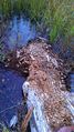
The logs in the marsh were rotting.
More more marsh.
Marsh.
Callie and Higgs in a marsh.
Marsh.
There were a lot of these little mushrooms near the marsh.
Stopping at a quarry!
Dmitriy climbing to the top of the quarry.
Higgs agreed to stay down to take pictures.
Callie climbing to the top of the quarry.
Callie at the top!
Dmitriy at the top!


Achievements
Frogman, Higgs, Callie, Dmitriy earned the Picnic achievement
|
Frogman, Higgs, Callie, Dmitriy earned the GeoTrash Geohash Achievement
|