Difference between revisions of "2014-04-19 50 10"
imported>GeorgDerReisende (expedition report added) |
imported>FippeBot m (Location) |
||
| (3 intermediate revisions by one other user not shown) | |||
| Line 23: | Line 23: | ||
We didn't expect anyone else at this hash and even didn't look up the planned expeditions. | We didn't expect anyone else at this hash and even didn't look up the planned expeditions. | ||
| − | Our plan was simple: We were staying in Schleusingerneundorf and wanted to cycle a bit. The shortest roundtrip on roads to the west of Schleusingerneundorf is 39 km long and does not only lead through [[2012-03-31_50_10|this hashpoint]] we've been to two years ago, but also passes today's point by only 40 m. So we made the trip, starting with tailwind towards Schleusingen and continuing with strong headwind to Suhl, where we had a short rest for reaching the coordinates shortly after 16:15. From there we went on to [http://www.quaeldich.de/paesse/ringbergpass/ Ringberg] and rushed back down to Schleusingerneundorf with fair tailwind again. | + | Our plan was simple: We were staying in Schleusingerneundorf and wanted to cycle a bit. The shortest roundtrip on roads to the west of Schleusingerneundorf is 39 km long and does not only lead through [[2012-03-31_50_10|this hashpoint]] we've been to two years ago, but also passes today's point by only 40 m. So we made the trip, starting with tailwind towards Schleusingen and continuing with strong headwind to Suhl, where we had a short rest for reaching the coordinates shortly after <del>16:15</del> 16:00. From there we went on to [http://www.quaeldich.de/paesse/ringbergpass/ Ringberg] and rushed back down to Schleusingerneundorf with fair tailwind again. |
== Photos Manu and Reinhard == | == Photos Manu and Reinhard == | ||
| Line 36: | Line 36: | ||
'''I didn't see other geohashers there! The metadata of Manu and Reinhard's photos show the same time, but I didn't see them!''' | '''I didn't see other geohashers there! The metadata of Manu and Reinhard's photos show the same time, but I didn't see them!''' | ||
| + | |||
| + | :Reinhard's comment: Indeed, the camera time was (and still is) 11 or 12 minutes fast, so it was approximately 16:06 and 16:09 when the photos were taken. According to the GPS tracklog, we've been in sight of the hashpoint between 16:02 and 16:11. We just had left, when you came around. | ||
== Photos GeorgDerReisende == | == Photos GeorgDerReisende == | ||
| Line 63: | Line 65: | ||
[[Category:Expeditions with photos]] | [[Category:Expeditions with photos]] | ||
[[Category:Coordinates reached]] | [[Category:Coordinates reached]] | ||
| + | {{location|DE|TH|SHL}} | ||
Latest revision as of 06:14, 14 August 2019
| Sat 19 Apr 2014 in 50,10: 50.6125737, 10.7139176 geohashing.info google osm bing/os kml crox |
Location
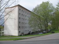
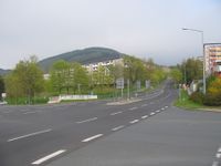
The hash lies in Suhl, near Ilmenauer Straße and Am Himmelreich
Participants
Plans
I (GeorgDerReisende) want hitchhike to Suhl and walk to the hash. This can become a xkcd meetup.
Expedition: Manu and Reinhard
We didn't expect anyone else at this hash and even didn't look up the planned expeditions.
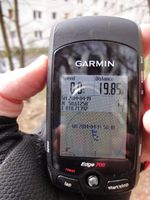
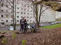
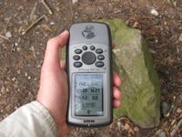
Our plan was simple: We were staying in Schleusingerneundorf and wanted to cycle a bit. The shortest roundtrip on roads to the west of Schleusingerneundorf is 39 km long and does not only lead through this hashpoint we've been to two years ago, but also passes today's point by only 40 m. So we made the trip, starting with tailwind towards Schleusingen and continuing with strong headwind to Suhl, where we had a short rest for reaching the coordinates shortly after 16:15 16:00. From there we went on to Ringberg and rushed back down to Schleusingerneundorf with fair tailwind again.
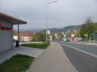
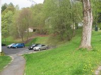
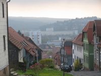
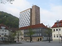
Photos Manu and Reinhard
|
Expedition: GeorgDerReisende
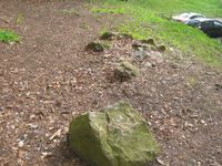
I started at home at 10:30 and with the help of seven cars I arrived near the hash at 16:04 (at the bus stop Martin-Anderson-Nexö-Str.). From there I walked to the hash, where I arrived at 16:15. After a short dance I found the exact spot. I left a mark on the big stone. After that I waited until 16:30, if there are other geohashers, but I didn't see anybody. Then I walked down to the city.
I didn't see other geohashers there! The metadata of Manu and Reinhard's photos show the same time, but I didn't see them!
- Reinhard's comment: Indeed, the camera time was (and still is) 11 or 12 minutes fast, so it was approximately 16:06 and 16:09 when the photos were taken. According to the GPS tracklog, we've been in sight of the hashpoint between 16:02 and 16:11. We just had left, when you came around.
Photos GeorgDerReisende
|
Tracklog
Achievements
GeorgDerReisende earned the Thumbs Up Geohash Achievement
|
GeorgDerReisende earned the xkcd Decurion achievement
|
