Difference between revisions of "2014-05-08 45 -122"
imported>Michael5000 (Created page with "{{subst:Expedition |lat = 45 |lon = -122 |date = 2014-05-08 }}") |
imported>FippeBot m (Location) |
||
| (4 intermediate revisions by 2 users not shown) | |||
| Line 15: | Line 15: | ||
}} | }} | ||
| − | + | ||
__NOTOC__ | __NOTOC__ | ||
== Location == | == Location == | ||
| − | + | ||
| + | In a backyard between Boston and Omaha Avenues in North Portland. | ||
== Participants == | == Participants == | ||
| − | |||
| − | |||
| − | + | * [[user:Michael5000|Michael5000]] | |
| − | + | * [[User:Jiml|Jim]] | |
== Expedition == | == Expedition == | ||
| − | |||
| − | + | With a day off of work and many errands to run, it was pretty easy to justify a loop up into North Portland. The hashpoint was in a backyard, but accessible to within about 10 feet by an alley. Invoking my house rule -- if it's on an in-town residential lot, you can see it, and you are as close as you can get without trespassing, it's a win -- it was an easy expedition indeed. | |
| − | + | ||
| + | This hashpoint is only a few houses down from the home of my buddy MDIC, whom I am passive-aggressively trying to wheedle into taking the short walk after work and sending me a picture to prove it. We'll see how that turns out. | ||
| + | |||
| + | === Jim === | ||
| + | Jim went by, but only on the front side, and gave up when it really seemed to be on private property. | ||
| + | |||
== Photos == | == Photos == | ||
| − | + | ||
| − | |||
| − | |||
<gallery perrow="5"> | <gallery perrow="5"> | ||
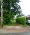
| + | File:2014-05-08 45 -122 alley.JPG|This way to the hashpoint. | ||
| + | File:2014-05-08 45 -122 hashpoint.JPG|The exact hashpoint is right to the left of the Japanese maple. | ||
</gallery> | </gallery> | ||
== Achievements == | == Achievements == | ||
{{#vardefine:ribbonwidth|800px}} | {{#vardefine:ribbonwidth|800px}} | ||
| − | |||
| − | |||
| − | + | * No Trespassing? | |
| − | + | * Land Geohash? | |
| − | |||
| − | |||
| − | |||
| − | |||
| − | |||
| − | |||
| − | |||
| − | |||
[[Category:Expeditions]] | [[Category:Expeditions]] | ||
| − | |||
[[Category:Expeditions with photos]] | [[Category:Expeditions with photos]] | ||
| − | |||
| − | |||
| − | |||
| − | |||
| − | |||
[[Category:Coordinates reached]] | [[Category:Coordinates reached]] | ||
| − | + | {{location|US|OR|MU}} | |
| − | |||
| − | |||
| − | |||
| − | |||
| − | |||
| − | |||
| − | |||
| − | |||
| − | |||
| − | |||
| − | |||
| − | |||
| − | |||
| − | |||
| − | |||
| − | |||
| − | |||
Latest revision as of 06:28, 14 August 2019
| Thu 8 May 2014 in 45,-122: 45.5750941, -122.6909503 geohashing.info google osm bing/os kml crox |
Location
In a backyard between Boston and Omaha Avenues in North Portland.
Participants
Expedition
With a day off of work and many errands to run, it was pretty easy to justify a loop up into North Portland. The hashpoint was in a backyard, but accessible to within about 10 feet by an alley. Invoking my house rule -- if it's on an in-town residential lot, you can see it, and you are as close as you can get without trespassing, it's a win -- it was an easy expedition indeed.
This hashpoint is only a few houses down from the home of my buddy MDIC, whom I am passive-aggressively trying to wheedle into taking the short walk after work and sending me a picture to prove it. We'll see how that turns out.
Jim
Jim went by, but only on the front side, and gave up when it really seemed to be on private property.
Photos
Achievements
- No Trespassing?
- Land Geohash?

