Difference between revisions of "2014-05-23 47 -122"
imported>Thomcat (Its a Hashiversary !) |
imported>FippeBot m (Location) |
||
| (11 intermediate revisions by one other user not shown) | |||
| Line 9: | Line 9: | ||
__NOTOC__ | __NOTOC__ | ||
== Location == | == Location == | ||
| − | + | On a residential street in front of 17810 NE 34th St in Redmond, just west of Lake Sammamish. | |
== Participants == | == Participants == | ||
| − | * [[User:Thomcat|Thomcat]] ([[Hashiversary]]) | + | * [[User:Thomcat|Thomcat]] (6 year [[Hashiversary]]) |
== Plans == | == Plans == | ||
| − | Lunchtime visit, then take the toll bridge back to Seattle. | + | Lunchtime visit, then take the toll bridge back to Seattle (specifically sometime between 10 and 2). |
== Expedition == | == Expedition == | ||
| − | + | Six years ago, I headed east for a [[2008-05-23 47 -117|geohash]]. Today, I headed east again - though not nearly as far. | |
| − | + | Toll rates are at their lowest day rate during the lunchtime block, so I aimed to hit the bridge then. A $2.35 toll each way helps pay for the copious construction evident in the area. Pre-bridge, I of course made a stop at Spud for some local foodstuffs (fish and chips). | |
| − | + | ||
| + | Following the highway 520 around, I ended up at the Microsoft exit, passing a few still on their way in and a few with a very early lunch. Across the highway is Nintendo. | ||
| + | |||
| + | Down the hill, the GPS navigation took me past Idylwood park, a favorite destination for kayakers and the location of at least one Geocache. None close to the hash location today, however. | ||
| + | |||
| + | Reaching the point, I twice tried to drive through the hashpoint, just missing each time. A light rain (standard in Seattle) was falling. Parking, I set the [[Hashiversary]] cake on the exact point and snapped a few photos (below). A marker was also left, and the cake mostly consumed. | ||
| + | |||
| + | The drive home cost another toll but went without incident. | ||
== Photos == | == Photos == | ||
| − | |||
| − | |||
| − | |||
<gallery perrow="5"> | <gallery perrow="5"> | ||
| + | |||
| + | Image:2014-05-23_47_-122_thomcat_1400869656933.jpg | @ Spud [http://www.openstreetmap.org/?lat=47.67847287&lon=-122.32702484&zoom=16&layers=B000FTF @47.6785,-122.3270] | ||
| + | |||
| + | Image:2014-05-23_47_-122_thomcat_1400872099407.jpg | [http://www.openstreetmap.org/?lat=47.66028280&lon=-122.11589480&zoom=16&layers=B000FTF @47.6603,-122.1159] | ||
| + | |||
| + | Image:2014-05-23_47_-122_thomcat_1400872383312.jpg | Someone left the cake out in the rain... [http://www.openstreetmap.org/?lat=47.64029457&lon=-122.10273125&zoom=16&layers=B000FTF @47.6403,-122.1027] | ||
| + | |||
| + | Image:2014-05-23_47_-122_thomcat_1400872498421.jpg | [[Hashiversary]]! [http://www.openstreetmap.org/?lat=47.64029777&lon=-122.10272112&zoom=16&layers=B000FTF @47.6403,-122.1027] | ||
| + | |||
| + | Image:2014-05-23_47_-122_thomcat_1400872691835.jpg | Marker posted [http://www.openstreetmap.org/?lat=47.64027115&lon=-122.10272162&zoom=16&layers=B000FTF @47.6403,-122.1027] | ||
| + | |||
| + | Image:2014-05-23_47_-122_thomcat_1400872828520.jpg | Mmmmmmm [http://www.openstreetmap.org/?lat=47.64031485&lon=-122.10272941&zoom=16&layers=B000FTF @47.6403,-122.1027] | ||
| + | |||
| + | Image:2014-05-23_47_-122_thomcat_1400873212394.jpg | Copilot [http://www.openstreetmap.org/?lat=47.66458943&lon=-122.12704070&zoom=16&layers=B000FTF @47.6646,-122.1270] | ||
</gallery> | </gallery> | ||
== Achievements == | == Achievements == | ||
{{#vardefine:ribbonwidth|800px}} | {{#vardefine:ribbonwidth|800px}} | ||
| − | + | {{Hashiversary | new = 2014-05-23 47 -122 | original = 2008-05-23 47 -117 | ordinal = 6th | name = [[User:Thomcat|Thomcat]] | gender = his | image = 2014-05-23_47_-122_thomcat_1400872691835.jpg }} | |
| − | |||
| − | |||
| − | [[ | ||
| − | |||
[[Category:Expeditions]] | [[Category:Expeditions]] | ||
| − | |||
[[Category:Expeditions with photos]] | [[Category:Expeditions with photos]] | ||
| − | |||
| − | |||
| − | |||
| − | |||
| − | |||
[[Category:Coordinates reached]] | [[Category:Coordinates reached]] | ||
| − | + | {{location|US|WA|KN}} | |
| − | |||
| − | |||
| − | |||
| − | |||
| − | |||
| − | |||
| − | |||
| − | |||
| − | |||
| − | |||
| − | |||
| − | |||
| − | |||
| − | |||
| − | |||
| − | |||
| − | |||
Latest revision as of 06:37, 14 August 2019
| Fri 23 May 2014 in Seattle: 47.6403037, -122.1027419 geohashing.info google osm bing/os kml crox |
Location
On a residential street in front of 17810 NE 34th St in Redmond, just west of Lake Sammamish.
Participants
- Thomcat (6 year Hashiversary)
Plans
Lunchtime visit, then take the toll bridge back to Seattle (specifically sometime between 10 and 2).
Expedition
Six years ago, I headed east for a geohash. Today, I headed east again - though not nearly as far.
Toll rates are at their lowest day rate during the lunchtime block, so I aimed to hit the bridge then. A $2.35 toll each way helps pay for the copious construction evident in the area. Pre-bridge, I of course made a stop at Spud for some local foodstuffs (fish and chips).
Following the highway 520 around, I ended up at the Microsoft exit, passing a few still on their way in and a few with a very early lunch. Across the highway is Nintendo.
Down the hill, the GPS navigation took me past Idylwood park, a favorite destination for kayakers and the location of at least one Geocache. None close to the hash location today, however.
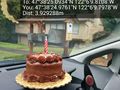
Reaching the point, I twice tried to drive through the hashpoint, just missing each time. A light rain (standard in Seattle) was falling. Parking, I set the Hashiversary cake on the exact point and snapped a few photos (below). A marker was also left, and the cake mostly consumed.
The drive home cost another toll but went without incident.
Photos
@ Spud @47.6785,-122.3270
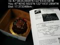
Someone left the cake out in the rain... @47.6403,-122.1027
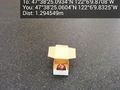
Marker posted @47.6403,-122.1027
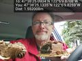
Mmmmmmm @47.6403,-122.1027
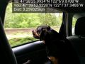
Copilot @47.6646,-122.1270


Achievements
Thomcat earned the 6th Hashiversary achievement
|