Difference between revisions of "2015-03-22 48 17"
imported>B2c (An expedition message sent via Geohash Droid for Android.) |
imported>FippeBot m (Location) |
||
| (11 intermediate revisions by 2 users not shown) | |||
| Line 1: | Line 1: | ||
| − | |||
| − | |||
| − | |||
| − | |||
| − | |||
| − | |||
| − | |||
| − | |||
| − | |||
| − | |||
{{meetup graticule | {{meetup graticule | ||
| lat=48 | | lat=48 | ||
| Line 15: | Line 5: | ||
}} | }} | ||
| − | + | ||
| − | |||
== Location == | == Location == | ||
| − | + | Near the Austrian-Slovakian border in the fields next to a highway ramp. | |
| + | |||
== Participants == | == Participants == | ||
| − | + | * [[User:Micsnare|Micsnare]] | |
| − | + | * [[User:Crankl|Crankl]] | |
| + | * [[User:Datschech|Datschech]] | ||
| + | * [[User:B2c|B2c]] | ||
| + | |||
== Plans == | == Plans == | ||
| − | + | This is the follow-up hash to the [[2015-03-22_48_16]] Vienna expedition. After successfully completing their marathon in the woods they went to pick up 'Datschech' and continue to the next hashpoint at the Austrian-Slovakian border. | |
== Expedition == | == Expedition == | ||
| − | + | After touching base with the Vienna hashpoint they packed up and slowly made their way back to the northern districts of Vienna to pick up their friend and fellow hasher 'Datschech'. Traffic was slow due to lots of people returning from their weekend trip back into the city. As it was getting dark they reached Bisamberg, a sleepy little town on the north-west border of the city. After a little castling of seats in the car they drove off to Bratislava to get to another hashpoint which seemed to be conveniently located next to a highway ramp. The ride went pretty smoothly while they were exchanging jokes about how B2c kept confusing the Czech Republic with Slovakia and other everyday stories. | |
| + | |||
| + | When they where closing in on the Slovakian border the satnav of course had to pull some quirks and steered them off the highway too early, piloting them through the little border town of Kittsee and through some backalleys. When they finally approached the hashpoint near the highway ramp, driving carefully not to miss the hashpoint, they nonetheless missed it as there was no place to park the car. Cursing silently they had to continue onwards to Bratislava where they took the next-best highway exit and were able to u-turn an drive back. This time around they were prepared: on approach B2c parked the car right on top of a restricted area in the middle of the highway ramp intersection and turned on the emergency flashers. They cautiously proceeded to cross the highway, jumped over the guardrail and walked down the slope through some shrubbery towards the hashpoint. Although it was around 8 pm and pretty dark already they managed to make it to the hash in no time, took the mandatory stupid grin selfie and quickly made it back to the car. Not one moment too early, as a police car was passing by them shortly after, whose passengers surely would have been interested in the doings of our happy-go-lucky band of hashers. | ||
| + | |||
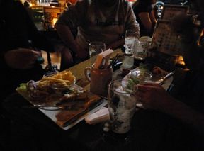
| + | After those exhausting expeditions they found that they deserved themselves some refreshments, so after driving back to Vienna and stashing the car in the hashcave they proceeded to the next pub and ordered themselves some beer and burgers. Cheers! | ||
== Tracklog == | == Tracklog == | ||
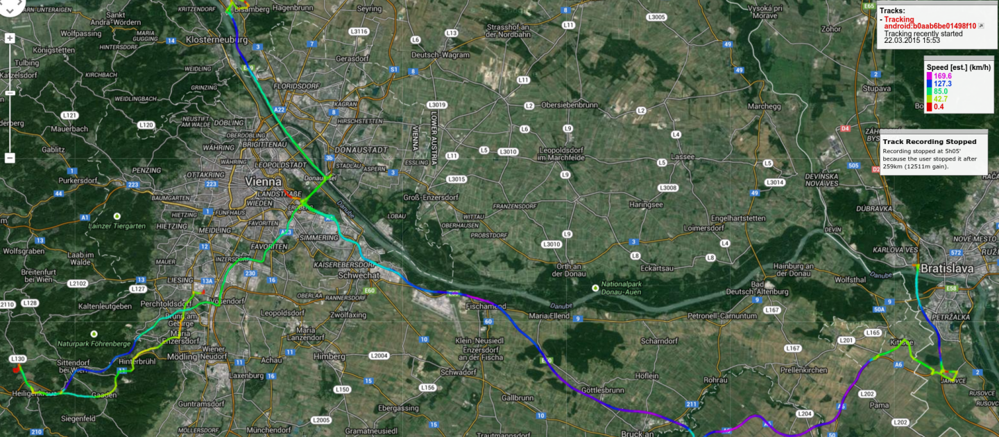
| − | + | (!) This is the tracklog for both the [[2015-03-22_48_16]] and [[2015-03-22_48_17]] hashpoints. | |
| + | |||
| + | [[File:2015-03-22_4817_tracklog2.png]] | ||
| − | == Photos == | + | |
| − | < | + | == Photos == |
| − | Image: | + | <gallery caption="Photo Gallery" widths="320px" heights="213px" perrow="3"> |
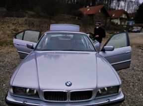
| − | -- | + | Image:20150322 4817 packing up.jpg | Packing up after touching base with the Vienna hashpoint. |
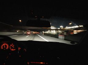
| − | + | Image:20150322 4817 enroute.jpg | En route to Slovakia. | |
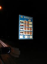
| + | Image:20150322 4817 border.jpg | At the border. | ||
| + | Image:20150322 4817 stupidgrin.jpg | Stupid grin (tm). | ||
| + | Image:2015-03-22_4817_maps.png | Satellite reign. | ||
| + | Image:2015-03-22 4817 hashdroid.png| Proof. | ||
| + | Image:2015-03-22 4817 gps.png | More proof. | ||
| + | Image:20150322 4817 feast.jpg | First hashing, then feasting. | ||
| + | Image:20150322 4817 notamused.jpg | Datschech is not amused. Must be the music. | ||
| + | Image:20150322 4817 cheers.jpg | Micsnare says cheers. | ||
| + | Image:20150322 4817 sleepy.jpg | B2c is very tired. Crankl supports. | ||
</gallery> | </gallery> | ||
| + | |||
| + | |||
| + | == Geohash Droid Post == | ||
| + | *Micsnare, Crankl, b2c and Datschech @ Bratislava -- [[User:B2c|B2c]] ([[User talk:B2c|talk]]) [http://www.openstreetmap.org/?lat=48.07189445&lon=17.10580714&zoom=16&layers=B000FTF @48.0719,17.1058] 20:03, 22 March 2015 (GMT+01:00) | ||
| + | |||
== Achievements == | == Achievements == | ||
| − | {{ | + | {{land geohash |
| − | + | | name = [[User:Datschech|Datschech]] | |
| + | | latitude = 48 | ||
| + | | longitude = 17 | ||
| + | | date = 2015-03-22 | ||
| + | }} | ||
| + | {{Meet-up | ||
| + | | latitude = 48 | ||
| + | | longitude = 17 | ||
| + | | date = 2015-03-22 | ||
| + | | name = [[User:Crankl|Crankl]] | ||
| + | | other = [[User:Datschech|Datschech]] | ||
| + | }} | ||
| − | + | {{Meet-up | |
| − | + | | latitude = 48 | |
| − | [[ | + | | longitude = 17 |
| + | | date = 2015-03-22 | ||
| + | | name = [[User:Datschech|Datschech]] | ||
| + | | other = [[User:Crankl|Crankl]] | ||
| + | }} | ||
| + | |||
| + | {{drag-along | ||
| + | | latitude = 48 | ||
| + | | longitude = 17 | ||
| + | | date = 2015-03-22 | ||
| + | | partner = [[User:Datschech|Datschech]] | ||
| + | | name = [[User:Micsnare|Micsnare]] | ||
| + | }} | ||
| + | |||
| + | {{Multihash2 | ||
| + | | date = 2015-03-22 | ||
| + | | count = 2 | ||
| + | | name = [[User:Micsnare|Micsnare]], [[User:Crankl|Crankl]], [[User:B2c|B2c]] | ||
| + | }} | ||
| + | |||
| + | {{Border geohash achievement | ||
| + | | latitude = 48 | ||
| + | | longitude = 17 | ||
| + | | date = 2015-03-22 | ||
| + | | country1 = Austria | ||
| + | | country2 = Slovakia | ||
| + | | name = [[User:Micsnare|Micsnare]], [[User:Crankl|Crankl]], [[User:Datschech|Datschech]] and [[User:B2c|B2c]] | ||
| + | | image = 20150322 4817 border.jpg | ||
| + | }} | ||
| − | |||
| − | |||
| − | |||
| − | |||
| − | |||
| − | |||
[[Category:Expeditions]] | [[Category:Expeditions]] | ||
| − | |||
[[Category:Expeditions with photos]] | [[Category:Expeditions with photos]] | ||
| − | |||
| − | |||
| − | |||
| − | |||
| − | |||
[[Category:Coordinates reached]] | [[Category:Coordinates reached]] | ||
| − | + | {{location|SK|BL}} | |
| − | |||
| − | |||
| − | |||
| − | |||
| − | |||
| − | |||
| − | |||
| − | |||
| − | |||
| − | |||
| − | |||
| − | |||
| − | |||
| − | |||
| − | |||
| − | |||
| − | |||
Latest revision as of 03:08, 15 August 2019
| Sun 22 Mar 2015 in 48,17: 48.0718751, 17.1057869 geohashing.info google osm bing/os kml crox |
Contents
Location
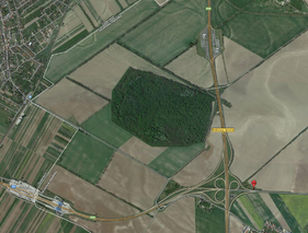
Near the Austrian-Slovakian border in the fields next to a highway ramp.
Participants
Plans
This is the follow-up hash to the 2015-03-22_48_16 Vienna expedition. After successfully completing their marathon in the woods they went to pick up 'Datschech' and continue to the next hashpoint at the Austrian-Slovakian border.
Expedition
After touching base with the Vienna hashpoint they packed up and slowly made their way back to the northern districts of Vienna to pick up their friend and fellow hasher 'Datschech'. Traffic was slow due to lots of people returning from their weekend trip back into the city. As it was getting dark they reached Bisamberg, a sleepy little town on the north-west border of the city. After a little castling of seats in the car they drove off to Bratislava to get to another hashpoint which seemed to be conveniently located next to a highway ramp. The ride went pretty smoothly while they were exchanging jokes about how B2c kept confusing the Czech Republic with Slovakia and other everyday stories.
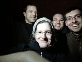
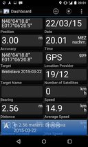
When they where closing in on the Slovakian border the satnav of course had to pull some quirks and steered them off the highway too early, piloting them through the little border town of Kittsee and through some backalleys. When they finally approached the hashpoint near the highway ramp, driving carefully not to miss the hashpoint, they nonetheless missed it as there was no place to park the car. Cursing silently they had to continue onwards to Bratislava where they took the next-best highway exit and were able to u-turn an drive back. This time around they were prepared: on approach B2c parked the car right on top of a restricted area in the middle of the highway ramp intersection and turned on the emergency flashers. They cautiously proceeded to cross the highway, jumped over the guardrail and walked down the slope through some shrubbery towards the hashpoint. Although it was around 8 pm and pretty dark already they managed to make it to the hash in no time, took the mandatory stupid grin selfie and quickly made it back to the car. Not one moment too early, as a police car was passing by them shortly after, whose passengers surely would have been interested in the doings of our happy-go-lucky band of hashers.
After those exhausting expeditions they found that they deserved themselves some refreshments, so after driving back to Vienna and stashing the car in the hashcave they proceeded to the next pub and ordered themselves some beer and burgers. Cheers!
Tracklog
(!) This is the tracklog for both the 2015-03-22_48_16 and 2015-03-22_48_17 hashpoints.
Photos
- Photo Gallery
Geohash Droid Post
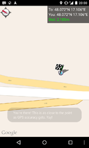
- Micsnare, Crankl, b2c and Datschech @ Bratislava -- B2c (talk) @48.0719,17.1058 20:03, 22 March 2015 (GMT+01:00)
Achievements
Datschech earned the Land geohash achievement
|
Crankl earned the Meet-up achievement
|
Datschech earned the Meet-up achievement
|
Micsnare earned the Drag-along achievement
|
Micsnare, Crankl, B2c earned the Multihash Achievement
|
Micsnare, Crankl, Datschech and B2c earned the Border geohash achievement
|
