Difference between revisions of "2015-07-13 -41 175"
imported>Quaternary |
imported>FippeBot m (Location) |
||
| (2 intermediate revisions by one other user not shown) | |||
| Line 24: | Line 24: | ||
== Plans == | == Plans == | ||
| − | Having a family holiday in Wellington, and great luck - a geohash within striking range. | + | Having a family holiday in Wellington, and great luck - a geohash within striking range. (Although we did have to hire a car especially!) |
== Expedition == | == Expedition == | ||
| Line 49: | Line 49: | ||
<gallery caption="Photo Gallery" widths="320px" heights="213px" perrow="3"> | <gallery caption="Photo Gallery" widths="320px" heights="213px" perrow="3"> | ||
Image:2015_07_13_-41_175_01.jpg | "PRIVATE ROAD, PRIVATE PROPERTY, KEEP OUT" | Image:2015_07_13_-41_175_01.jpg | "PRIVATE ROAD, PRIVATE PROPERTY, KEEP OUT" | ||
| − | Image:2015_07_13_-41_175_02.jpg | What luck, our hash was near the | + | Image:2015_07_13_-41_175_02.jpg | What luck, our hash was near the Cannon Point Walkway |
Image:2015_07_13_-41_175_03.jpg | The walking track took us to a power pylon | Image:2015_07_13_-41_175_03.jpg | The walking track took us to a power pylon | ||
Image:2015_07_13_-41_175_04.jpg | We had to leave the track and go DOWN through the bush ... | Image:2015_07_13_-41_175_04.jpg | We had to leave the track and go DOWN through the bush ... | ||
| Line 62: | Line 62: | ||
[[Category:Expeditions with photos]] | [[Category:Expeditions with photos]] | ||
[[Category:Coordinates reached]] | [[Category:Coordinates reached]] | ||
| + | {{location|NZ|WGN}} | ||
Latest revision as of 04:21, 15 August 2019

| Mon 13 Jul 2015 in -41,175: -41.1072906, 175.0731050 geohashing.info google osm bing/os kml crox |
Location
Totara Park, Upper Hutt, New Zealand
Participants
The Quaternary (talk) family geohashers
Plans
Having a family holiday in Wellington, and great luck - a geohash within striking range. (Although we did have to hire a car especially!)
Expedition
At first our plans looked like they were dashed, as driving along what we thought was a road leading up to the hash was an old, rusty sign reading "PRIVATE ROAD, PRIVATE PROPERTY, KEEP OUT".
However, driving back, somewhat dejected, we came across a park which had a sign for a walking track - right past our geohash! Luck was back on our side.
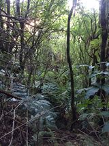
Walking up the track we came to a power pylon which was just a few tens of metres from the hash, but the rest of the trip was going to be traversing down a reasonably steep bank - no major obstacle for a pair of intrepid geohashers! (The rest of the party we left on the track, heels and all).
And soon we were there. And our first North Island hash to our names.
Tracklog


Photos
- Photo Gallery
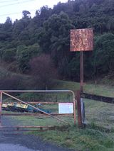
"PRIVATE ROAD, PRIVATE PROPERTY, KEEP OUT"
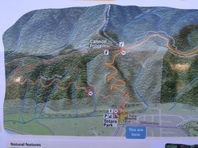
What luck, our hash was near the Cannon Point Walkway
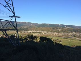
The walking track took us to a power pylon
We had to leave the track and go DOWN through the bush ...
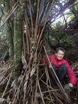
At the hash
View from the hash

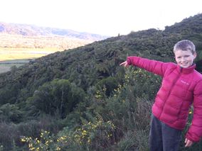
The obligatory selfie
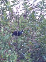
Tui - with its distinctive white wattle
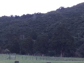
Back at ground level, view up towards the power pylon, and the hash


