Difference between revisions of "2015-12-06 52 1"
From Geohashing
imported>Sourcerer m (→Achievements) |
imported>FippeBot m (Location) |
||
| (2 intermediate revisions by one other user not shown) | |||
| Line 22: | Line 22: | ||
== Expedition == | == Expedition == | ||
| + | *Arrived. -- [[User:Sourcerer|Sourcerer]] ([[User talk:Sourcerer|talk]]) 00:08, 6 December 2015 (GMT) | ||
| + | This was easy enough and under 3 km from home. The walk at the first hashpoint was a little longer than planned so this expedition ran a few minutes late for an exact midnight arrival. A tarmac road led to a point 100 metres away. Then tractor tracks in dry winter wheat led to the destination. It was still very windy. | ||
| − | |||
| − | |||
== Photos == | == Photos == | ||
<gallery> | <gallery> | ||
| − | |||
Image:2015-12-06_52_1_Sourcerer_1449360511276.jpg | Proof. [http://www.openstreetmap.org/?lat=52.43390322&lon=1.43785715&zoom=16&layers=B000FTF @52.4339,1.4379] | Image:2015-12-06_52_1_Sourcerer_1449360511276.jpg | Proof. [http://www.openstreetmap.org/?lat=52.43390322&lon=1.43785715&zoom=16&layers=B000FTF @52.4339,1.4379] | ||
| + | Image:2015-12-06_52_1_Sourcerer.jpg | Google Earth Track | ||
</gallery> | </gallery> | ||
| Line 47: | Line 47: | ||
| next = 2015-12-07 52 0 | | next = 2015-12-07 52 0 | ||
| date = 2015-12-06 | | date = 2015-12-06 | ||
| + | }} | ||
[[Category:Expeditions]] | [[Category:Expeditions]] | ||
[[Category:Expeditions with photos]] | [[Category:Expeditions with photos]] | ||
[[Category:Coordinates reached]] | [[Category:Coordinates reached]] | ||
| + | {{location|GB|ENG|SFK}} | ||
Latest revision as of 06:04, 15 August 2019
| Sun 6 Dec 2015 in Norwich, UK: 52.4338856, 1.4378608 geohashing.info google osm bing/os kml crox |
Location
In a field, south of Bungay, Suffolk, UK.
Participants
Plans
Expedition two of two spanning midnight - 2015-12-05 52 1 - 2015-12-06 52 1 - ETA 00:00.
Expedition
This was easy enough and under 3 km from home. The walk at the first hashpoint was a little longer than planned so this expedition ran a few minutes late for an exact midnight arrival. A tarmac road led to a point 100 metres away. Then tractor tracks in dry winter wheat led to the destination. It was still very windy.
Photos
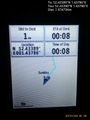
Proof. @52.4339,1.4379
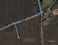
Google Earth Track


Achievements
Sourcerer earned the Midnight Geohash achievement
|
Expeditions and Plans
| 2015-12-06 | ||
|---|---|---|
| Montréal, Québec | Dr Frankenstein | located on the street Chemin des Prairies in Brossard. |
| Zalaegerszeg, Hungary | GeoEdo, GeoIva | On a dirt road next to a small forest between Mackovec and Slemenice in Med... |
| Mannheim, Germany | DODO | A field next to a shelter near Neuhofen. |
| Kassel, Germany | GeorgDerReisende | The hash lay on the (wrong) side of the rivulet Esse near Burguffeln. |
| Norwich, United Kingdom | Sourcerer | In a field, south of Bungay, Suffolk, UK. |
Sourcerer's Expedition Links
2015-12-05 52 1 - 2015-12-06 52 1 - 2015-12-07 52 0 - KML file download of Sourcerer's expeditions for use with Google Earth.