Difference between revisions of "2016-01-30 -34 138"
From Geohashing
imported>Jiml m (Add template) |
imported>Jiml m (Add a few details.) |
||
| Line 1: | Line 1: | ||
| − | |||
| − | |||
| Line 19: | Line 17: | ||
}} | }} | ||
| − | + | ||
__NOTOC__ | __NOTOC__ | ||
== Location == | == Location == | ||
| − | + | ||
| + | A block of units down under | ||
== Participants == | == Participants == | ||
| − | + | ||
| − | + | * [[User:BrendanTWhite|BrendanTWhite]] | |
== Plans == | == Plans == | ||
| − | + | ||
| + | Unknown | ||
== Expedition == | == Expedition == | ||
| − | |||
| − | + | Unknown, but it would appear that they made it. | |
| − | + | ||
| + | |||
| + | [[File:HereIAm.png]] | ||
| + | |||
| + | --[[User:BrendanTWhite|BrendanTWhite]] ([[User talk:BrendanTWhite|talk]]) 19:06, 29 January 2016 (EST) | ||
| + | |||
== Photos == | == Photos == | ||
| − | + | ||
| − | |||
| − | |||
<gallery perrow="5"> | <gallery perrow="5"> | ||
| + | Image:HereIAm.png| Photo uploaded by BrendanTWhite | ||
</gallery> | </gallery> | ||
| Line 49: | Line 52: | ||
<!-- Add any achievement ribbons you earned below, or remove this section --> | <!-- Add any achievement ribbons you earned below, or remove this section --> | ||
| − | + | * Land Geohash?? | |
| − | |||
| − | |||
| − | + | [[Category:Expeditions]] | |
| − | |||
| − | |||
| − | |||
| − | |||
| − | |||
| − | |||
| − | |||
| − | |||
[[Category:Expeditions with photos]] | [[Category:Expeditions with photos]] | ||
| − | |||
| − | |||
| − | |||
| − | |||
| − | |||
[[Category:Coordinates reached]] | [[Category:Coordinates reached]] | ||
| − | |||
| − | |||
| − | |||
| − | |||
| − | |||
| − | |||
| − | |||
| − | |||
| − | |||
| − | |||
| − | |||
| − | |||
| − | |||
| − | |||
| − | |||
| − | |||
| − | |||
| − | |||
Revision as of 23:21, 7 June 2016
| Sat 30 Jan 2016 in -34,138: -34.9269868, 138.5378281 geohashing.info google osm bing/os kml crox |
Location
A block of units down under
Participants
Plans
Unknown
Expedition
Unknown, but it would appear that they made it.

--BrendanTWhite (talk) 19:06, 29 January 2016 (EST)
Photos
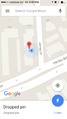
Photo uploaded by BrendanTWhite
Achievements
- Land Geohash??