Difference between revisions of "2016-03-28 49 8"
imported>DODO (Created page with "{{subst:Expedition |lat = 49 |lon = 8 |date = 2016-03-28 }}") |
imported>FippeBot m (Location) |
||
| (23 intermediate revisions by 2 users not shown) | |||
| Line 20: | Line 20: | ||
== Location == | == Location == | ||
<!-- where you've surveyed the hash to be --> | <!-- where you've surveyed the hash to be --> | ||
| + | A field near [[wikipedia:Stockstadt_am_Rhein|Stockstadt am Rhein]]. | ||
== Participants == | == Participants == | ||
| − | + | ||
| − | -- | + | *[[User:DODO|DODO]] |
| + | *[[User:Q-Owla|Q-Owla]] | ||
| + | *[[User:Q-Owl|Q-Owl]] | ||
== Plans == | == Plans == | ||
| − | + | ||
| + | '''DODO:''' Take the train to Worms and walk to the hash. It's almost 28 KM to the hash and I can start in Worms around 10:30, so I think, I'll arrive some minutes after hash o'clock. | ||
| + | |||
| + | '''Q-Owla and Q-Owl''' did not have a look at this page (sorry!) and planned to drive to Stockstadt after lunch. | ||
== Expedition == | == Expedition == | ||
| − | <!-- | + | '''Q-Owla and Q-Owl:''' We drove near Stockstadt and reached the hp at 14:00 h. Cold and very windy here! It was not in the fenced sheep-run, but south of it. :-) |
| + | <br>Later we found about 10 geocaches in and around Stockstadt and [[wikipedia:Riedstadt#Erfelden|Erfelden]]. And we found a wood full of abloom [[wikipedia:Scilla|Scilla]] near Erfelden. :-)) | ||
| + | |||
| + | '''DODO:''' | ||
| + | |||
| + | Number one of this years hash tour. It is continued [[2016-03-29_49_8|here]]. | ||
| + | |||
| + | {| | ||
| + | |- | ||
| + | ! style="width:300px" | !! style="width:300px" | !! style="width:300px" | | ||
| + | |- | ||
| + | | [[Image:2016-03-28 49 8-2.jpg | 300px]] ||[[Image:2016-03-28 49 8-3.jpg | 300px]] || [[Image:2016-03-28 49 8-4.jpg | 300px ]] | ||
| + | |- | ||
| + | | [[Image:2016-03-28 49 8-5.jpg | 300px]] || [[Image:2016-03-28 49 8-6.jpg |300px ]]||I had certain difficulties with the trains. First I had to take a bus in Speyer instead of a train due to construction works on the rails. I had to change to the train in Schifferstadt. Then I left the train at Ludwigshafen main station, but the train I wanted to catch only stopped at Ludwigshafen city center. I hurried to get the next train to Mannheim main station to get an earlier train, but just got the one, that also stopped in Ludwigshafen main station. But finally I reached Worms at 10:37, just 15 minutes later than expected. | ||
| + | |- | ||
| + | |I left the station at the "backdoor" (as you can see on the picture) and walked out of the town. Soon I reached some rails and followed them for a while but sometimes the way runs through some kind of forest and I found my first violets for this year||[[Image:2016-03-28 49 8-8.jpg | 300px]]||[[Image:2016-03-28 49 8-7.jpg | 300px]] | ||
| + | |- | ||
| + | |[[Image:2016-03-28 49 8-9.jpg | 300px]]||After an hour I reached the rhine river and followed it for a while (well almost three hours). The paths lead me through typical alluvial forests. || [[Image:2016-03-28 49 8-13.jpg | 300px]] | ||
| + | |- | ||
| + | |[[Image:2016-03-28 49 8-10.jpg | 300px]]||[[Image:2016-03-28 49 8-15.jpg | 300px]] || I made my first break at this sign to read about the old ferry that was at this place since the 12. century. Later I saw the former nuclear power plant of Biblis on the other side of the river. | ||
| + | |- | ||
| + | |[[Image:2016-03-28 49 8-12.jpg | 300px]]||[[Image:2016-03-28 49 8-11.jpg | 300px]]|| Rheindürkheim was the only village I saw on my way on the left side of the river. And it was very windy. | ||
| + | |- | ||
| + | |[[Image:2016-03-28 49 8-14.jpg | 300px]]||If the hash would have been here, Andres Gorz would have gained a coffin achievement (although I don't think he's really buried here, thats not legal in germany, and anyway not wise, to burry someone so close to a river. He might come back to soon). It was almost 2 pm when I reached the ferry to Gernsheim. Mind the industrial area on the other side. I'll have to cross it soon. ||[[Image:2016-03-28 49 8-16.jpg | 300px]] | ||
| + | |- | ||
| + | |Sometimes the way feels like in prison, but when I came near the hash, the landscape was rural again, and close to the hash was this former mill.||[[Image:2016-03-28 49 8-17.jpg | 300px]]||[[Image:2016-03-28 49 8-18.jpg | 300px]] | ||
| + | |- | ||
| + | |[[Image:2016-03-28 49 8-1.png | 300px]]||[[Image:2016-03-28 49 8-19.jpg | 300px]]||[[Image:2016-03-28 49 8-20.jpg | 300px]] | ||
| + | |- | ||
| + | |[[Image:2016-03-28 49 8-21.jpg | 300px]]||[[Image:2016-03-28 49 8-22.jpg | 300px]]||proof and view to the four directions: the sheep, the town, the mill and the Odenwald | ||
| + | |- | ||
| + | |[[Image:2016-03-28 49 8-23.jpg | 300px]]||Oh, and to the hasher of course. After half an hour break and another hour of walking backwards, I was very happy to reach the Hotel in Biebesheim. Here I found that the Q-Owls had been at the hash just before me. Darn, we missed once again.||[[Image:2016-03-28 49 8-24.jpg | 300px]] | ||
| + | |} | ||
== Tracklog == | == Tracklog == | ||
| Line 38: | Line 76: | ||
Image:2012-##-## ## ## Alpha.jpg | Witty Comment | Image:2012-##-## ## ## Alpha.jpg | Witty Comment | ||
--> | --> | ||
| + | ===Q-Owla and Q-Owl=== | ||
<gallery perrow="5"> | <gallery perrow="5"> | ||
| + | Image:20160328_140052.jpg | Hashpoint behind that sheep-run and the farm in the rear | ||
| + | Image:2016-03-28 49 8 proof.png | Proof 0.766 m | ||
| + | Image:2016-03-28 49 8 e.jpg | View from the hp east | ||
| + | Image:2016-03-28 49 8 n.jpg | View north | ||
| + | Image:2016-03-28 49 8 w.jpg | View west | ||
| + | Image:2016-03-28 49 8 s.jpg | View south | ||
| + | Image:2016-03-28 49 8 g.jpg | Grin² | ||
</gallery> | </gallery> | ||
== Achievements == | == Achievements == | ||
| − | {{#vardefine:ribbonwidth|800px}} | + | {{#vardefine:ribbonwidth|800px}}{{land geohash |
| − | + | | latitude = 49 | |
| + | | longitude = 8 | ||
| + | | date = 2016-03-28 | ||
| + | | name = DODO, Q-Owla, Q-Owl | ||
| + | }} | ||
| + | {{gratuitous ribbon | ||
| + | | icon = Avoid achievement.png | ||
| + | | latitude = 49 | ||
| + | | longitude = 8 | ||
| + | | date = 2016-03-28 | ||
| + | | achievement = Avoid Each Other Achievement | ||
| + | | description = launching two independent expeditions without meeting up at the | ||
| + | | name = DODO, Q-Owla, Q-Owl | ||
| + | }} | ||
| − | |||
| − | |||
| − | |||
| − | |||
| − | |||
| − | |||
| − | |||
| − | + | {{consecutive geohash | |
| + | | count = 2 | ||
| + | | latitude = 49 | ||
| + | | longitude = 8 | ||
| + | | date = 2016-03-28 | ||
| + | | name = DODO | ||
| + | }} | ||
| − | + | {{OpenStreetMap achievement | |
| − | + | | latitude = 49 | |
| − | + | | longitude = 8 | |
| − | + | | date = 2016-03-28 | |
| − | + | | OSMlink = 38459087 | |
| − | + | | name = DODO | |
| − | -- | + | }} |
| − | |||
| − | |||
| − | |||
| + | == Other Geohashing Expeditions and Plans on this Day == | ||
| − | -- | + | {{expedition summaries|2016-03-28}} |
| − | |||
| − | |||
| − | |||
| − | |||
| − | |||
| − | |||
| − | |||
| − | + | [[Category:Expeditions]] | |
| − | [[Category: | + | [[Category:Coordinates reached]] |
| − | + | [[Category:Expeditions with photos]] | |
| − | |||
| − | [[Category: | ||
| − | + | [[Category: Meetup on 2016-03-28]] | |
| + | [[Category: Meetup in 49 8]] | ||
| + | {{location|DE|HE|GG}} | ||
Latest revision as of 00:03, 16 August 2019
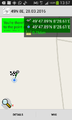
| Mon 28 Mar 2016 in 49,8: 49.7981983, 8.4769133 geohashing.info google osm bing/os kml crox |
Location
A field near Stockstadt am Rhein.
Participants
Plans
DODO: Take the train to Worms and walk to the hash. It's almost 28 KM to the hash and I can start in Worms around 10:30, so I think, I'll arrive some minutes after hash o'clock.
Q-Owla and Q-Owl did not have a look at this page (sorry!) and planned to drive to Stockstadt after lunch.
Expedition
Q-Owla and Q-Owl: We drove near Stockstadt and reached the hp at 14:00 h. Cold and very windy here! It was not in the fenced sheep-run, but south of it. :-)
Later we found about 10 geocaches in and around Stockstadt and Erfelden. And we found a wood full of abloom Scilla near Erfelden. :-))
DODO:
Number one of this years hash tour. It is continued here.
 |
 |

|
 |
 |
I had certain difficulties with the trains. First I had to take a bus in Speyer instead of a train due to construction works on the rails. I had to change to the train in Schifferstadt. Then I left the train at Ludwigshafen main station, but the train I wanted to catch only stopped at Ludwigshafen city center. I hurried to get the next train to Mannheim main station to get an earlier train, but just got the one, that also stopped in Ludwigshafen main station. But finally I reached Worms at 10:37, just 15 minutes later than expected. |
| I left the station at the "backdoor" (as you can see on the picture) and walked out of the town. Soon I reached some rails and followed them for a while but sometimes the way runs through some kind of forest and I found my first violets for this year |  |

|
 |
After an hour I reached the rhine river and followed it for a while (well almost three hours). The paths lead me through typical alluvial forests. | 
|
 |
 |
I made my first break at this sign to read about the old ferry that was at this place since the 12. century. Later I saw the former nuclear power plant of Biblis on the other side of the river. |
 |
 |
Rheindürkheim was the only village I saw on my way on the left side of the river. And it was very windy. |
 |
If the hash would have been here, Andres Gorz would have gained a coffin achievement (although I don't think he's really buried here, thats not legal in germany, and anyway not wise, to burry someone so close to a river. He might come back to soon). It was almost 2 pm when I reached the ferry to Gernsheim. Mind the industrial area on the other side. I'll have to cross it soon. | 
|
| Sometimes the way feels like in prison, but when I came near the hash, the landscape was rural again, and close to the hash was this former mill. |  |

|
 |
 |

|
 |
 |
proof and view to the four directions: the sheep, the town, the mill and the Odenwald |
 |
Oh, and to the hasher of course. After half an hour break and another hour of walking backwards, I was very happy to reach the Hotel in Biebesheim. Here I found that the Q-Owls had been at the hash just before me. Darn, we missed once again. | 
|
Tracklog
Photos
Q-Owla and Q-Owl

Hashpoint behind that sheep-run and the farm in the rear
Proof 0.766 m

View from the hp east

View north

View west

View south

Grin²


Achievements
DODO, Q-Owla, Q-Owl earned the Land geohash achievement
|
DODO, Q-Owla, Q-Owl earned the Avoid Each Other Achievement
|
DODO earned the Consecutive geohash achievement
|
DODO earned the OpenStreetMap achievement
|
Other Geohashing Expeditions and Plans on this Day
Expeditions and Plans
| 2016-03-28 | ||
|---|---|---|
| Mannheim, Germany | DODO, Q-Owla, Q-Owl | A field near Stockstadt am Rhein. |
| Norwich, United Kingdom | ChromeCrusaders, Sourcerer | A patch of public land very close to a patch of private land, East Ruston, ... |