Difference between revisions of "2016-05-13 51 1"
From Geohashing
imported>Sourcerer m ([live picture] Arrival. [http://www.openstreetmap.org/?lat=51.97979987&lon=1.31044686&zoom=16&layers=B000FTF @51.9798,1.3104]) |
imported>Sourcerer m (→Achievements) |
||
| Line 40: | Line 40: | ||
}} | }} | ||
| − | |||
| − | |||
[[Category:Expeditions]] | [[Category:Expeditions]] | ||
[[Category:Expeditions with photos]] | [[Category:Expeditions with photos]] | ||
[[Category:Coordinates reached]] | [[Category:Coordinates reached]] | ||
| − | |||
Revision as of 21:58, 13 May 2016
| Fri 13 May 2016 in Canterbury, UK: 51.9798725, 1.3104482 geohashing.info google osm bing/os kml crox |
Location
A field between the port of Felixtowe and Trimley, Suffolk, UK.
Participants
Plans
One of two spanning midnight - 2016-05-13 51 1 - 2016-05-14 52 1 - ETA 23:00.
Expedition
Photos
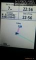
Arrival. @51.9798,1.3104

Achievements
Expeditions and Plans
| 2016-05-13 | ||
|---|---|---|
| Los Angeles, California | Bravissimo594 | Beside a Michigan Ave. sidewalk on the campus of Caltech in Pasadena. |
| Pforzheim, Germany | elimik31 | The hash is in the cemetery of Forchheim, a district of Rheinstetten, about... |
| Canterbury, United Kingdom | Sourcerer | A field between the port of Felixtowe and Trimley, Suffolk, UK. |
Sourcerer's Expedition Links
2016-05-12 52 1 - 2016-05-13 51 1 - 2016-05-14 52 1 - KML file download of Sourcerer's expeditions for use with Google Earth.