Difference between revisions of "2016-05-17 52 1"
From Geohashing
imported>Sourcerer (→Planning) |
imported>FippeBot m (Location) |
||
| (3 intermediate revisions by one other user not shown) | |||
| Line 21: | Line 21: | ||
== Expedition == | == Expedition == | ||
| − | + | Running late after the expedition-one fiasco this was easier. There was no ditch at the parking place. There was legal access via a public footpath. The terrain was dry. Bright moon light shone on the path. Nearer the hashpoint there were wide tractor tracks which also led back to the road. This was a pleasant little walk. | |
== Photos == | == Photos == | ||
<gallery perrow="5"> | <gallery perrow="5"> | ||
| + | Image:2016-05-17_52_1_Sourcerer_1463440117756.jpg | Arrival. [http://www.openstreetmap.org/?lat=52.52974391&lon=1.39949620&zoom=16&layers=B000FTF @52.5297,1.3995] | ||
| + | Image:2016-05-17 52 1 Sourcerer.jpg | Google Earth Track | ||
</gallery> | </gallery> | ||
== Achievements == | == Achievements == | ||
{{#vardefine:ribbonwidth|800px}} | {{#vardefine:ribbonwidth|800px}} | ||
| + | |||
| + | {{Midnight geohash | ||
| + | | latitude = 52 | ||
| + | | longitude = 1 | ||
| + | | date = 2016-05-17 | ||
| + | | name = Sourcerer | ||
| + | }} | ||
{{Sourcerer_links | {{Sourcerer_links | ||
| prev = 2016-05-16 52 1 | | prev = 2016-05-16 52 1 | ||
| curr = 2016-05-17 52 1 | | curr = 2016-05-17 52 1 | ||
| − | | next = 2016-05- | + | | next = 2016-05-21 52 0 |
| date = 2016-05-17 | | date = 2016-05-17 | ||
}} | }} | ||
| − | |||
| − | |||
[[Category:Expeditions]] | [[Category:Expeditions]] | ||
[[Category:Expeditions with photos]] | [[Category:Expeditions with photos]] | ||
[[Category:Coordinates reached]] | [[Category:Coordinates reached]] | ||
| − | + | {{location|GB|ENG|NFK}} | |
Latest revision as of 00:32, 16 August 2019
| Tue 17 May 2016 in Norwich, UK: 52.5297466, 1.3995347 geohashing.info google osm bing/os kml crox |
Location
A field between Kirstead Green and Seething, Norfolk, UK.
Participants
Plans
Two of two spanning midnight - 2016-05-16 52 1 - 2016-05-17 52 1 - ETA 00:00.
Expedition
Running late after the expedition-one fiasco this was easier. There was no ditch at the parking place. There was legal access via a public footpath. The terrain was dry. Bright moon light shone on the path. Nearer the hashpoint there were wide tractor tracks which also led back to the road. This was a pleasant little walk.
Photos
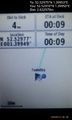
Arrival. @52.5297,1.3995
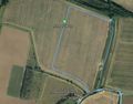
Google Earth Track


Achievements
Sourcerer earned the Midnight Geohash achievement
|
Expeditions and Plans
| 2016-05-17 | ||
|---|---|---|
| Norwich, United Kingdom | Sourcerer | A field between Kirstead Green and Seething, Norfolk, UK. |
Sourcerer's Expedition Links
2016-05-16 52 1 - 2016-05-17 52 1 - 2016-05-21 52 0 - KML file download of Sourcerer's expeditions for use with Google Earth.