Difference between revisions of "2016-08-02 52 1"
From Geohashing
imported>Sourcerer m (→New expedition) |
imported>FippeBot m (Location) |
||
| (One intermediate revision by one other user not shown) | |||
| Line 21: | Line 21: | ||
== Expedition == | == Expedition == | ||
| − | In damp steamy conditions, this was easy. There were easily followed tractor tracks through the harvested | + | In damp steamy conditions, this was easy. There were easily followed tractor tracks through the harvested potatoes. A diesel water pump could be heard in the distance. The 400kV power lines were not making much noise at all. |
== Photos == | == Photos == | ||
| Line 42: | Line 42: | ||
[[Category:Expeditions with photos]] | [[Category:Expeditions with photos]] | ||
[[Category:Coordinates reached]] | [[Category:Coordinates reached]] | ||
| + | {{location|GB|ENG|SFK}} | ||
Latest revision as of 01:08, 16 August 2019
| Tue 2 Aug 2016 in Norwich, UK: 52.1579934, 1.4241637 geohashing.info google osm bing/os kml crox |
Location
A field between Campsea Ashe and Blaxhall, Suffolk, UK.
Participants
Plans
One of two spanning midnight - 2016-08-02 52 1 - 2016-08-03 52 1 - ETA 23:15.
Expedition
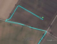
In damp steamy conditions, this was easy. There were easily followed tractor tracks through the harvested potatoes. A diesel water pump could be heard in the distance. The 400kV power lines were not making much noise at all.
Photos
- Photo Gallery
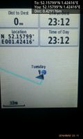
Arrived. @52.1580,1.4242
Achievements
Expeditions and Plans
| 2016-08-02 | ||
|---|---|---|
| Düsseldorf, Germany | pah, NB's mom | On a dog playing lawn in Rheydt. |
| Norwich, United Kingdom | Sourcerer | A field between Campsea Ashe and Blaxhall, Suffolk, UK. |
Sourcerer's Expedition Links
2016-07-31 52 1 - 2016-08-02 52 1 - 2016-08-03 52 1 - KML file download of Sourcerer's expeditions for use with Google Earth.

