Difference between revisions of "2017-11-27 47 -122"
imported>Thomcat (An expedition message sent via Geohash Droid for Android.) |
imported>FippeBot m (Location) |
||
| (5 intermediate revisions by one other user not shown) | |||
| Line 1: | Line 1: | ||
| − | |||
| − | |||
| − | |||
| − | |||
| − | |||
| − | |||
| − | |||
| − | |||
| − | |||
| − | |||
{{meetup graticule | {{meetup graticule | ||
| lat=47 | | lat=47 | ||
| lon=-122 | | lon=-122 | ||
| date=2017-11-27 | | date=2017-11-27 | ||
| + | | graticule_name=Seattle | ||
| + | | graticule_link=Seattle, Washington | ||
}} | }} | ||
| Line 19: | Line 11: | ||
== Location == | == Location == | ||
| − | + | In the middle of a grassy area in Genesee Park and Playfield. | |
== Participants == | == Participants == | ||
| − | + | * [[User:Thomcat|Thomcat]] | |
| − | |||
== Plans == | == Plans == | ||
| − | + | Visit after work. | |
== Expedition == | == Expedition == | ||
| − | + | Posted this easily reached point this morning, no takers. I've been examining the output of the Seattle graticule [http://geohashing-shotgun.appspot.com/showmap?radsearch=0&globhash=0&lat=47&lon=-122&YL=0&YLh=-90&YH=.999&YHh=90&XL=0&XLh=-180&XH=.9993&XHh=180&yearmask=****&monthmask=**&daymask=**&startdate=2008-05-23&enddate=2017-11-27&View=View shotgun] and figuring which flags were visited and which not, at least for the Seattle city limits. | |
| + | |||
| + | In doing so, I came across an expedition I was sure I went on, [[2009-09-04 47 -122]]. I've been backing up old photos and files anyhow, so it was an easy thing to find my 2009 folder and the specific pictures - yes, there it was, a chalked success. Why hadn't I uploaded these? | ||
| + | |||
| + | After doing that, I figured I would revisit to see the current view - well, the current dark view at night. After that - well, nobody took me up on my offer, and it *was* rather easy to reach - I drove 20 minutes to the current day hashpoint. | ||
| + | |||
| + | The field was quite dark - sliver moon behind clouds and no streetlights - but I reached the point easily and without soaking my shoes. I snapped a picture in the car with light so I would have *something* to upload, but the picture I took facing west looked okay at the time. | ||
| − | + | On the way home, I drove north to visit the boat ramp before the park closed at 11. No fences, probably no enforcement. A short drive home followed, where I contemplated which sub pages my 8 year old would screw up. | |
| − | |||
== Photos == | == Photos == | ||
| Line 39: | Line 35: | ||
--> | --> | ||
<gallery perrow="5"> | <gallery perrow="5"> | ||
| + | |||
| + | Image:2017-11-27_47_-122_thomcat_1511851926173.jpg|Geohasher in car [http://www.openstreetmap.org/?lat=47.56609360&lon=-122.27826780&zoom=16&layers=B000FTF @47.5661,-122.2783] | ||
| + | |||
| + | Image:2017-11-27_47_-122_thomcat_1511852000749.jpg|view west [http://www.openstreetmap.org/?lat=47.56608890&lon=-122.27826100&zoom=16&layers=B000FTF @47.5661,-122.2783] | ||
| + | |||
| + | Image:2017-11-27_47_-122_thomcat_1511852135459.jpg|Shelter SE [http://www.openstreetmap.org/?lat=47.56606380&lon=-122.27822010&zoom=16&layers=B000FTF @47.5661,-122.2782] | ||
| + | |||
| + | Image:2017-11-27_47_-122_thomcat_1511852460635.jpg|Nearby [http://www.openstreetmap.org/?lat=47.57067840&lon=-122.27708130&zoom=16&layers=B000FTF @47.5707,-122.2771] | ||
</gallery> | </gallery> | ||
| Line 45: | Line 49: | ||
<!-- Add any achievement ribbons you earned below, or remove this section --> | <!-- Add any achievement ribbons you earned below, or remove this section --> | ||
| − | |||
| − | |||
| − | |||
| − | |||
| − | |||
| − | |||
| − | |||
| − | |||
| − | |||
| − | |||
| − | |||
| − | |||
| − | |||
| − | |||
[[Category:Expeditions]] | [[Category:Expeditions]] | ||
| − | |||
[[Category:Expeditions with photos]] | [[Category:Expeditions with photos]] | ||
| − | |||
| − | |||
| − | |||
| − | |||
| − | |||
[[Category:Coordinates reached]] | [[Category:Coordinates reached]] | ||
| − | + | {{location|US|WA|KN}} | |
| − | |||
| − | |||
| − | |||
| − | |||
| − | |||
| − | |||
| − | |||
| − | |||
| − | |||
| − | |||
| − | |||
| − | |||
| − | |||
| − | |||
| − | |||
| − | |||
| − | |||
Latest revision as of 03:10, 16 August 2019
| Mon 27 Nov 2017 in Seattle: 47.5660844, -122.2782711 geohashing.info google osm bing/os kml crox |
Location
In the middle of a grassy area in Genesee Park and Playfield.
Participants
Plans
Visit after work.
Expedition
Posted this easily reached point this morning, no takers. I've been examining the output of the Seattle graticule shotgun and figuring which flags were visited and which not, at least for the Seattle city limits.
In doing so, I came across an expedition I was sure I went on, 2009-09-04 47 -122. I've been backing up old photos and files anyhow, so it was an easy thing to find my 2009 folder and the specific pictures - yes, there it was, a chalked success. Why hadn't I uploaded these?
After doing that, I figured I would revisit to see the current view - well, the current dark view at night. After that - well, nobody took me up on my offer, and it *was* rather easy to reach - I drove 20 minutes to the current day hashpoint.
The field was quite dark - sliver moon behind clouds and no streetlights - but I reached the point easily and without soaking my shoes. I snapped a picture in the car with light so I would have *something* to upload, but the picture I took facing west looked okay at the time.
On the way home, I drove north to visit the boat ramp before the park closed at 11. No fences, probably no enforcement. A short drive home followed, where I contemplated which sub pages my 8 year old would screw up.
Photos

Geohasher in car @47.5661,-122.2783
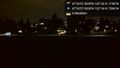
view west @47.5661,-122.2783
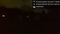
Shelter SE @47.5661,-122.2782
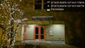
Nearby @47.5707,-122.2771


