Difference between revisions of "2008-06-15"
From Geohashing
imported>Tjtrumpet2323 m |
imported>Aperfectring |
||
| (34 intermediate revisions by 17 users not shown) | |||
| Line 1: | Line 1: | ||
| − | {{date navigation}} | + | <noinclude>{{date navigation}}</noinclude> |
| − | + | === Coordinates === | |
| − | |||
| − | |||
| − | == Coordinates | ||
<pre> | <pre> | ||
| − | + | All locations: 0.475380817774, 0.761276686309 | |
| − | |||
</pre> | </pre> | ||
| − | == Photo Gallery == | + | === Expeditions === |
| − | {{Expedition Images | + | |
| + | * [[2008-06-15 45, -75|2008-06-15 Ottawa, ON]]: The location is on the fairway of the 18th hole of the Hautes Plaines golf club in Gatineau, QC. Definitely accessible, but flying golf balls may present a hazard. [[user:Laszlok|Laszlo]] plans on being there. | ||
| + | * [[2008-06-15 -43 172|2008-06-15 Christchurch, New Zealand]]: The actual hash is about 3 km off the coast in the Pacific Ocean. [[User:Evil Monkey|Evil Monkey]] got to the beach nearest just before 1 pm. | ||
| + | * [[2008-06-15 -41 174|2008-06-15 Wellington, New Zealand]]: The hash is ~14km off the south coast of the North Island, in the Cook Straight. [[User:nzsteak|nzsteak]] was going to have a beach picnic at the closest beach, but was delayed and only ended up with photos. | ||
| + | * [[2008-06-15 58 15|2008-06-15 Linköping, Sweden]]: Hash is on a field off a small local road north of Linghem. [[User:Floffe|Floffe]] was there. | ||
| + | * [[2008-06-15 39 -119|2008-06-15 Reno, Nevada]]: Hash is within Reno city limits, but about 30 feet up a cliff face from the nearest reachable flat area. [[User:Fo0bar|fo0bar]] was there. | ||
| + | * [[2008-06-15 47 -121|2008-06-15 Snoqualmie, Washington]]: Just off Insterstate 90, but unfortunately on private and inaccessible property. [[User:Thomcat|Thomcat]] got as close as possible. | ||
| + | * [[2008-06-15 37 -121|2008-06-15 San Jose, California]]: Other side of Calaveras. Everyone got as far down Marsh road as the "San Francisco Water District" restricted property locked gates. | ||
| + | * [[2008-06-15 43 -80|2008-06-15 Waterloo, ON]]:Right in the middle of the community center/baseball diamond/arena in the small town of Wellesley. | ||
| + | |||
| + | === Photo Gallery === | ||
| + | {{Expedition Images|2008-06-15}} | ||
| + | <noinclude>{{expedition summaries|2008-06-15}}</noinclude> | ||
Latest revision as of 12:38, 10 July 2009
Expedition Archives from June 2008
Saturday 14 June 2008 | Sunday 15 June 2008 | Monday 16 June 2008
See also: Category:Meetup on 2008-06-15
Coordinates
All locations: 0.475380817774, 0.761276686309
Expeditions
- 2008-06-15 Ottawa, ON: The location is on the fairway of the 18th hole of the Hautes Plaines golf club in Gatineau, QC. Definitely accessible, but flying golf balls may present a hazard. Laszlo plans on being there.
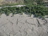
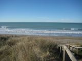
- 2008-06-15 Christchurch, New Zealand: The actual hash is about 3 km off the coast in the Pacific Ocean. Evil Monkey got to the beach nearest just before 1 pm.
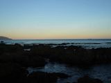
- 2008-06-15 Wellington, New Zealand: The hash is ~14km off the south coast of the North Island, in the Cook Straight. nzsteak was going to have a beach picnic at the closest beach, but was delayed and only ended up with photos.
- 2008-06-15 Linköping, Sweden: Hash is on a field off a small local road north of Linghem. Floffe was there.
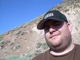
- 2008-06-15 Reno, Nevada: Hash is within Reno city limits, but about 30 feet up a cliff face from the nearest reachable flat area. fo0bar was there.
- 2008-06-15 Snoqualmie, Washington: Just off Insterstate 90, but unfortunately on private and inaccessible property. Thomcat got as close as possible.
- 2008-06-15 San Jose, California: Other side of Calaveras. Everyone got as far down Marsh road as the "San Francisco Water District" restricted property locked gates.
- 2008-06-15 Waterloo, ON:Right in the middle of the community center/baseball diamond/arena in the small town of Wellesley.
Photo Gallery
Add your own photo for Sunday 15 June
Expeditions and Plans
| 2008-06-15 | ||
|---|---|---|
| Wollongong, Australia | Mrchips0 | This one falls in a paddock off Smith Lane in Wongawilli. It is a small, ru... |
| Wellington, New Zealand | nzsteak | was ~14km in the ocean in the Cook Straight between New Zealand's North and... |
| Christchurch, New Zealand | Evil Monkey | Somewhere |
| San Jose, California | Youhas | Somewhere |
| Reno, Nevada | fo0bar | Somewhere |
| Boston, Massachusetts | Someone went | 42.475380N, 71.761277W This geohash is located in the Boston, Massachusetts graticule in Sterli... |
| Waterloo, Ontario | Codesmith | was in the middle of the parking lot/access roads around the Wellesley Comm... |
| Ottawa, Ontario | Someone went | just behind a house on Avenue de la Citadelle. The area looks to be part of... |
| Snoqualmie, Washington | Thomcat | Satellite wasn't that useful, so I scouted it myself. Turns out to be down ... |
| Seattle, Washington | Someone went | Litho and family will try to meet at the clearing a half mile south of the ... |
| Nürnberg, Germany | dawidi | Somewhere |
| Praha, Czech Republic | Redguy | These coordinates are located near Bela pod Bezdezem with nice view to the ... |
| Berlin, Germany | Thilo | Somewhere |
| Linköping, Sweden | Floffe, Effbot | Near the boundary of a harvested and a wheat field 5km north of Linghem, 10... |
| Seward, Alaska | Someone went | Sounds like it didn't actually happen. |
